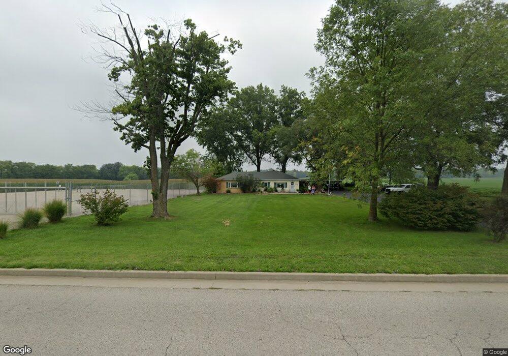
5501 Concordia Church Rd Belleville, IL 62226
Estimated Value: $148,000 - $195,000
--
Bed
--
Bath
1,378
Sq Ft
$125/Sq Ft
Est. Value
About This Home
This home is located at 5501 Concordia Church Rd, Belleville, IL 62226 and is currently estimated at $172,267, approximately $125 per square foot. 5501 Concordia Church Rd is a home located in St. Clair County with nearby schools including Roosevelt Elementary School, Central Jr High School, and Governor French Academy.
Ownership History
Date
Name
Owned For
Owner Type
Purchase Details
Closed on
Oct 25, 2005
Sold by
Kistner Kristina L
Bought by
Lobstein Douglas E and Lobstein Jackie R Gremel
Current Estimated Value
Home Financials for this Owner
Home Financials are based on the most recent Mortgage that was taken out on this home.
Original Mortgage
$106,400
Outstanding Balance
$57,440
Interest Rate
5.8%
Mortgage Type
Fannie Mae Freddie Mac
Estimated Equity
$114,827
Create a Home Valuation Report for This Property
The Home Valuation Report is an in-depth analysis detailing your home's value as well as a comparison with similar homes in the area
Home Values in the Area
Average Home Value in this Area
Purchase History
| Date | Buyer | Sale Price | Title Company |
|---|---|---|---|
| Lobstein Douglas E | $133,000 | Benchmark Title Company |
Source: Public Records
Mortgage History
| Date | Status | Borrower | Loan Amount |
|---|---|---|---|
| Open | Lobstein Douglas E | $106,400 |
Source: Public Records
Tax History Compared to Growth
Tax History
| Year | Tax Paid | Tax Assessment Tax Assessment Total Assessment is a certain percentage of the fair market value that is determined by local assessors to be the total taxable value of land and additions on the property. | Land | Improvement |
|---|---|---|---|---|
| 2024 | $2,139 | $39,751 | $7,072 | $32,679 |
| 2023 | $2,101 | $37,642 | $6,974 | $30,668 |
| 2022 | $1,883 | $34,283 | $6,352 | $27,931 |
| 2021 | $1,824 | $32,876 | $6,091 | $26,785 |
| 2020 | $1,729 | $30,617 | $5,672 | $24,945 |
| 2019 | $2,073 | $35,504 | $5,788 | $29,716 |
| 2018 | $2,015 | $34,597 | $5,640 | $28,957 |
| 2017 | $1,958 | $33,677 | $5,490 | $28,187 |
| 2016 | $1,960 | $32,516 | $5,301 | $27,215 |
| 2014 | $1,501 | $29,911 | $2,841 | $27,070 |
| 2013 | $2,086 | $29,911 | $2,841 | $27,070 |
Source: Public Records
Map
Nearby Homes
- 1909 Menard Dr
- 1824 Menard Dr
- 6009 Rolling Hills Ln
- 45 Fenwood Dr
- 1374 Rocky Creek Ct
- 324 Lake Forest Dr
- 1366 Radden Ct
- 800 Springwood Dr
- 633 Springwood Dr
- 245 Summers Trace
- 178 Wyndrose Estates Dr
- 1800 Roosevelt Ave
- 636 S 19th St
- 7168 Mine Haul Rd
- 404 S 16th St
- 421 S 20th St
- 1316 Raab Ave
- 318 S 20th St
- 402 S 21st St
- 301 S 15th St
- 5601 Concordia Rd
- 5325 Concordia Church Rd
- 5301 Concordia Rd
- 4704 Frank Scott Pkwy W
- 5800 Concordia Rd
- 4692 Frank Scott Pkwy W
- 5801 Concordia Rd
- 4696 Frank Scott Pkwy W
- 4700 Frank Scott Pkwy W
- 5108 Concordia Rd
- 4734 Frank Scott Pkwy W
- 4710 Frank Scott Pkwy W
- 0 Concordia Church Rd Unit 16052544
- 0 Concordia Church Rd Unit 16052541
- 0 Concordia Church Rd Unit 17008184
- 4616 Frank Scott Pkwy W
- 4534 Frank Scott Pkwy W
- 4649 Frank Scott Pkwy W
- 4530 Frank Scott Pkwy W
- 2600 Centreville Ave