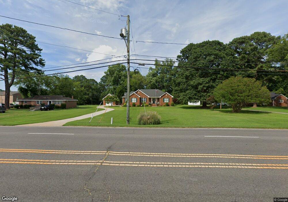
5504 High St W Portsmouth, VA 23703
Churchland NeighborhoodEstimated Value: $375,000 - $625,000
4
Beds
2
Baths
2,739
Sq Ft
$186/Sq Ft
Est. Value
About This Home
This home is located at 5504 High St W, Portsmouth, VA 23703 and is currently estimated at $510,632, approximately $186 per square foot. 5504 High St W is a home located in Portsmouth City with nearby schools including Churchland Elementary School, Churchland Academy Elementary School, and Churchland Middle School.
Ownership History
Date
Name
Owned For
Owner Type
Purchase Details
Closed on
Oct 17, 2006
Sold by
Murphy Michael S
Bought by
Albright James A
Current Estimated Value
Purchase Details
Closed on
Nov 11, 2005
Sold by
Boyd Carol L
Bought by
Murphy Michael L
Home Financials for this Owner
Home Financials are based on the most recent Mortgage that was taken out on this home.
Original Mortgage
$104,500
Interest Rate
6.06%
Mortgage Type
New Conventional
Create a Home Valuation Report for This Property
The Home Valuation Report is an in-depth analysis detailing your home's value as well as a comparison with similar homes in the area
Home Values in the Area
Average Home Value in this Area
Purchase History
| Date | Buyer | Sale Price | Title Company |
|---|---|---|---|
| Albright James A | $169,900 | -- | |
| Murphy Michael L | $104,500 | -- |
Source: Public Records
Mortgage History
| Date | Status | Borrower | Loan Amount |
|---|---|---|---|
| Previous Owner | Murphy Michael L | $104,500 |
Source: Public Records
Tax History Compared to Growth
Tax History
| Year | Tax Paid | Tax Assessment Tax Assessment Total Assessment is a certain percentage of the fair market value that is determined by local assessors to be the total taxable value of land and additions on the property. | Land | Improvement |
|---|---|---|---|---|
| 2025 | $6,194 | $497,620 | $113,630 | $383,990 |
| 2024 | $6,194 | $489,650 | $113,630 | $376,020 |
| 2023 | $5,524 | $441,890 | $113,630 | $328,260 |
| 2022 | $5,291 | $407,020 | $94,690 | $312,330 |
| 2021 | $4,918 | $378,320 | $89,870 | $288,450 |
| 2020 | $4,725 | $363,430 | $85,590 | $277,840 |
| 2019 | $4,552 | $350,160 | $85,590 | $264,570 |
| 2018 | $4,412 | $339,370 | $64,190 | $275,180 |
| 2017 | $4,412 | $339,370 | $64,190 | $275,180 |
| 2016 | $4,412 | $339,370 | $64,190 | $275,180 |
| 2015 | $4,411 | $339,330 | $64,190 | $275,140 |
| 2014 | $4,309 | $339,330 | $64,190 | $275,140 |
Source: Public Records
Map
Nearby Homes
- 3101 Laurel Ln
- 3110 Sterling Way Unit 62
- 5304 High St W
- 3432 Carter Rd
- 5302 High St W
- 5221 High St W
- 1004 Christiana Cir
- 3315 Camellia Dr
- 1047 Christiana Cir Unit 40
- 5516 Bingham Dr
- 5220 Clover Hill Dr
- 3205 Clover Hill Dr
- 3233 Clover Hill Dr
- 5111 Sweetbriar Cir
- 3509 Spence Rd
- 3000 Ferguson Dr
- 3209 Tyre Neck Rd
- 4011 Reese Dr S
- 3425 Cedar Ln
- 3408 Kenley Ct
- 5600 High St W
- 5658 High St W
- 5406 High St W
- 3210 Lilac Dr
- 3208 Lilac Dr
- 3206 Lilac Dr
- 3212 Lilac Dr
- 3120 Garland Dr
- 5404 High St W
- 3204 Lilac Dr
- 3125 Garland Dr
- 3101 Sterling Way
- 5501 High St W
- 3103 Sterling Way
- 3103 Sterling Way Unit 2
- 3214 Lilac Dr
- 3116 Garland Dr
- 3105 Sterling Way
- 3105 Sterling Way Unit 3
- 3107 Sterling Way