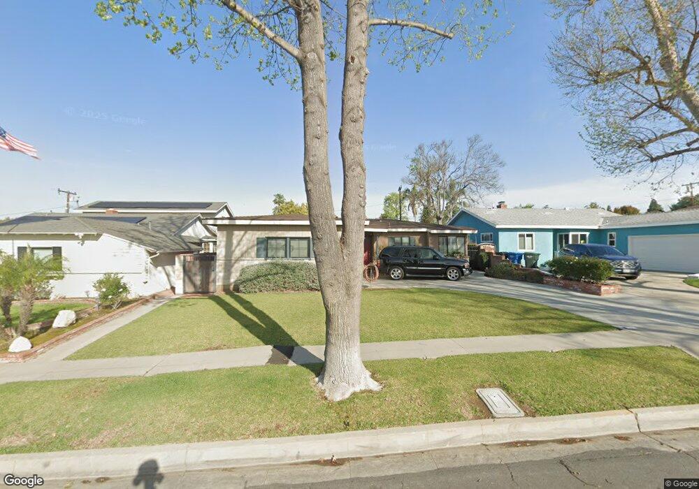
5507 Rockne Ave Whittier, CA 90601
West Whittier NeighborhoodEstimated Value: $781,000 - $918,000
3
Beds
2
Baths
1,522
Sq Ft
$553/Sq Ft
Est. Value
About This Home
This home is located at 5507 Rockne Ave, Whittier, CA 90601 and is currently estimated at $841,573, approximately $552 per square foot. 5507 Rockne Ave is a home located in Los Angeles County with nearby schools including Orange Grove Elementary School, Walter F. Dexter Middle School, and Whittier High School.
Ownership History
Date
Name
Owned For
Owner Type
Purchase Details
Closed on
Feb 15, 2024
Sold by
Bermudez Sergio and Bermudez Shirley A
Bought by
S And S Bermudez Family Trust and Bermudez
Current Estimated Value
Purchase Details
Closed on
Apr 12, 1999
Sold by
Dieterich Oneil D and Dieterich Nan
Bought by
Bermudez Sergio
Home Financials for this Owner
Home Financials are based on the most recent Mortgage that was taken out on this home.
Original Mortgage
$171,353
Interest Rate
6.9%
Mortgage Type
FHA
Purchase Details
Closed on
Nov 20, 1998
Sold by
St Post Duane C Tr Duane And Mary Pos
Bought by
Post Duane Clason and The Duane & Mary Post Family Trust
Create a Home Valuation Report for This Property
The Home Valuation Report is an in-depth analysis detailing your home's value as well as a comparison with similar homes in the area
Home Values in the Area
Average Home Value in this Area
Purchase History
| Date | Buyer | Sale Price | Title Company |
|---|---|---|---|
| S And S Bermudez Family Trust | -- | None Listed On Document | |
| Bermudez Sergio | $172,500 | First American Title Co | |
| Post Duane Clason | -- | -- |
Source: Public Records
Mortgage History
| Date | Status | Borrower | Loan Amount |
|---|---|---|---|
| Previous Owner | Bermudez Sergio | $171,353 |
Source: Public Records
Tax History Compared to Growth
Tax History
| Year | Tax Paid | Tax Assessment Tax Assessment Total Assessment is a certain percentage of the fair market value that is determined by local assessors to be the total taxable value of land and additions on the property. | Land | Improvement |
|---|---|---|---|---|
| 2025 | $3,604 | $270,409 | $163,032 | $107,377 |
| 2024 | $3,604 | $265,108 | $159,836 | $105,272 |
| 2023 | $3,662 | $259,910 | $156,702 | $103,208 |
| 2022 | $3,573 | $254,815 | $153,630 | $101,185 |
| 2021 | $3,422 | $249,819 | $150,618 | $99,201 |
| 2019 | $3,402 | $242,410 | $146,151 | $96,259 |
| 2018 | $3,251 | $237,658 | $143,286 | $94,372 |
| 2016 | $3,206 | $228,431 | $137,723 | $90,708 |
| 2015 | $3,126 | $225,001 | $135,655 | $89,346 |
| 2014 | $3,069 | $220,594 | $132,998 | $87,596 |
Source: Public Records
Map
Nearby Homes
- 5518 Norwalk Blvd
- 5315 Bihr Ct
- 5307 Woodward Ln
- 10605 Cordoba Ct
- 11302 Maple St
- 11511 Beverly Dr
- 5115 Castelotte Ct
- 5593 Pioneer Blvd Unit 18
- 5577 Pioneer Blvd Unit 5
- 5107 Vista Verde Way
- 5903 Redman Ave
- 10050 Obregon St
- 10013 Obregon St
- 5729 Juarez Ave
- 11759 S Circle Dr
- 11273 Dorland Dr
- 11232 Dorland Dr
- 10825 Loch Avon Dr
- 11447 Broadway Ave
- 11905 Mendenhall Ln
- 5513 Rockne Ave
- 5503 Rockne Ave
- 5519 Rockne Ave
- 5461 Rockne Ave
- 5508 Mavis Ave
- 5512 Mavis Ave
- 5502 Mavis Ave
- 5457 Rockne Ave
- 5525 Rockne Ave
- 5518 Mavis Ave
- 5460 Mavis Ave
- 5508 Rockne Ave
- 5522 Mavis Ave
- 5514 Rockne Ave
- 5502 Rockne Ave
- 5451 Rockne Ave
- 5456 Mavis Ave
- 5531 Rockne Ave
- 5460 Rockne Ave
- 5518 Rockne Ave