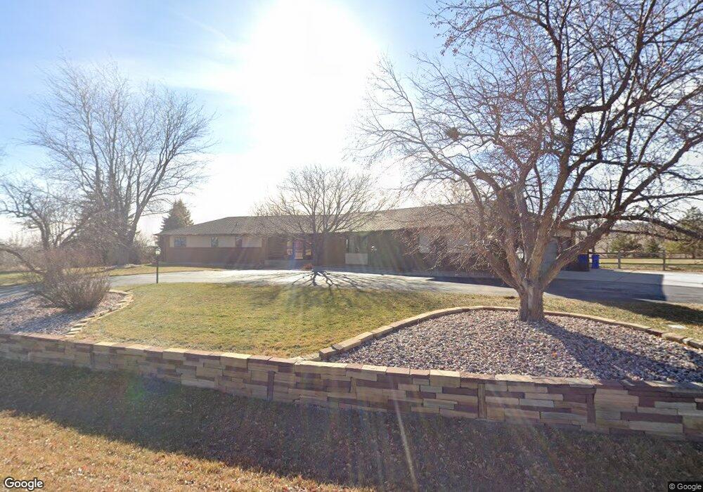
5518 Jordan Dr Loveland, CO 80537
Estimated Value: $924,803 - $1,338,000
5
Beds
3
Baths
2,048
Sq Ft
$569/Sq Ft
Est. Value
About This Home
This home is located at 5518 Jordan Dr, Loveland, CO 80537 and is currently estimated at $1,164,701, approximately $568 per square foot. 5518 Jordan Dr is a home located in Larimer County with nearby schools including Carrie Martin Elementary School, Walt Clark Middle School, and Thompson Valley High School.
Ownership History
Date
Name
Owned For
Owner Type
Purchase Details
Closed on
Dec 7, 1999
Sold by
Baker William Edward Bonnie J
Bought by
Warren Robert W and Warren Rhonda R
Current Estimated Value
Home Financials for this Owner
Home Financials are based on the most recent Mortgage that was taken out on this home.
Original Mortgage
$310,300
Outstanding Balance
$88,068
Interest Rate
6.62%
Estimated Equity
$1,076,633
Purchase Details
Closed on
Jul 1, 1986
Bought by
Baker William Edward
Create a Home Valuation Report for This Property
The Home Valuation Report is an in-depth analysis detailing your home's value as well as a comparison with similar homes in the area
Home Values in the Area
Average Home Value in this Area
Purchase History
| Date | Buyer | Sale Price | Title Company |
|---|---|---|---|
| Warren Robert W | $387,900 | -- | |
| Baker William Edward | $45,000 | -- |
Source: Public Records
Mortgage History
| Date | Status | Borrower | Loan Amount |
|---|---|---|---|
| Open | Warren Robert W | $310,300 |
Source: Public Records
Tax History Compared to Growth
Tax History
| Year | Tax Paid | Tax Assessment Tax Assessment Total Assessment is a certain percentage of the fair market value that is determined by local assessors to be the total taxable value of land and additions on the property. | Land | Improvement |
|---|---|---|---|---|
| 2025 | $6,071 | $69,948 | $11,055 | $58,893 |
| 2024 | $6,108 | $69,948 | $11,055 | $58,893 |
| 2022 | $4,724 | $51,118 | $11,468 | $39,650 |
| 2021 | $4,745 | $52,589 | $11,798 | $40,791 |
| 2020 | $4,435 | $49,150 | $11,798 | $37,352 |
| 2019 | $4,369 | $49,150 | $11,798 | $37,352 |
| 2018 | $4,067 | $43,704 | $11,880 | $31,824 |
| 2017 | $3,570 | $43,704 | $11,880 | $31,824 |
| 2016 | $3,545 | $42,148 | $13,134 | $29,014 |
| 2015 | $3,603 | $42,140 | $13,130 | $29,010 |
| 2014 | $3,354 | $38,140 | $7,160 | $30,980 |
Source: Public Records
Map
Nearby Homes
- 3020 Blue Mountain Ct
- 2909 Pronghorn Ct
- 5714 Bluff Ln
- 4260 S County Road 23
- 6819 W County Road 18
- 2272 Golden Valley Rd
- 4707 Lonetree Dr
- 4616 Lonetree Dr
- 1016 Meadowridge Ct
- 4121 Silene Place
- 6950 W County Road 18
- 2712 S County Road 29
- 3805 Panther Dr
- 613 Cove Dr
- 0 Tbd Unit RECIR1004964
- 5794 Jackdaw Dr
- 459 Cape Dory Dr
- 5360 Lighthouse Point Ct
- 270 Meadowsweet Cir
- 2366 Shoreside Dr
- 5517 Jordan Dr
- 5530 Jordan Dr
- 5529 Jordan Dr
- 5405 Jordan Dr
- 5507 Wild Plum Dr
- 5519 Wild Plum Dr
- 5606 Jordan Dr
- 5605 Jordan Dr
- 5407 Wild Plum Dr
- 5508 Wild Plum Dr
- 5618 Jordan Dr
- 5618 Jordan Dr
- 5620 Wild Plum Dr
- 5631 Wild Plum Dr
- 3220 S County Road 23
- 5708 Wild Plum Dr
- 5706 Jordan Dr
- 3210 S County Road 23
- 5703 Wild Plum Dr
- 5705 Jordan Dr