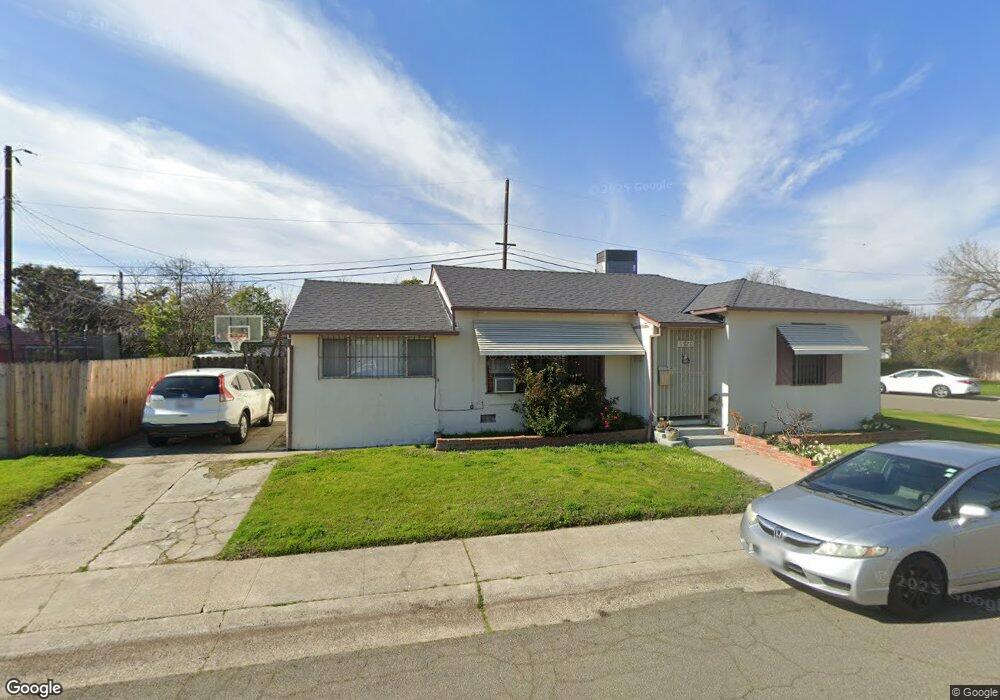
5520 Ashland Way Sacramento, CA 95822
South Land Park NeighborhoodEstimated Value: $422,000 - $456,408
2
Beds
1
Bath
1,142
Sq Ft
$389/Sq Ft
Est. Value
About This Home
This home is located at 5520 Ashland Way, Sacramento, CA 95822 and is currently estimated at $444,102, approximately $388 per square foot. 5520 Ashland Way is a home located in Sacramento County with nearby schools including Sutterville Elementary School, California Middle, and C. K. McClatchy High.
Ownership History
Date
Name
Owned For
Owner Type
Purchase Details
Closed on
Sep 22, 2022
Sold by
Kam-Yuen Tsang
Bought by
Tsang Ivan Shak Yung
Current Estimated Value
Purchase Details
Closed on
Jun 12, 2018
Sold by
Tsang Kam Yuen
Bought by
Tsang Kam Yuen and Tsang Ivan Shak Yung
Purchase Details
Closed on
Feb 28, 2012
Sold by
Tsang Anna On Nor
Bought by
Tsang Anna On Nor and Tsang Kam Yuen
Purchase Details
Closed on
Mar 15, 2011
Sold by
Chin Mary
Bought by
Chin Mary and Tsang Anna On Nor
Create a Home Valuation Report for This Property
The Home Valuation Report is an in-depth analysis detailing your home's value as well as a comparison with similar homes in the area
Home Values in the Area
Average Home Value in this Area
Purchase History
| Date | Buyer | Sale Price | Title Company |
|---|---|---|---|
| Tsang Ivan Shak Yung | -- | -- | |
| Tsang Kam Yuen | -- | None Available | |
| Tsang Anna On Nor | -- | None Available | |
| Chin Mary | -- | None Available |
Source: Public Records
Tax History Compared to Growth
Tax History
| Year | Tax Paid | Tax Assessment Tax Assessment Total Assessment is a certain percentage of the fair market value that is determined by local assessors to be the total taxable value of land and additions on the property. | Land | Improvement |
|---|---|---|---|---|
| 2025 | $6,189 | $525,402 | $145,656 | $379,746 |
| 2024 | $6,189 | $515,100 | $142,800 | $372,300 |
| 2023 | $6,043 | $505,000 | $140,000 | $365,000 |
| 2022 | $2,125 | $163,329 | $91,961 | $71,368 |
| 2021 | $2,028 | $160,127 | $90,158 | $69,969 |
| 2020 | $2,041 | $158,486 | $89,234 | $69,252 |
| 2019 | $1,999 | $155,380 | $87,485 | $67,895 |
| 2018 | $1,948 | $152,334 | $85,770 | $66,564 |
| 2017 | $1,920 | $149,348 | $84,089 | $65,259 |
| 2016 | $1,852 | $146,421 | $82,441 | $63,980 |
| 2015 | $1,824 | $144,222 | $81,203 | $63,019 |
| 2014 | $1,778 | $141,398 | $79,613 | $61,785 |
Source: Public Records
Map
Nearby Homes
- 1621 Fruitridge Rd
- 5531 Michael Way
- 1810 Opper Ave
- 1433 32nd Ave
- 1432 Oregon Dr
- 1428 Tradewinds Ave
- 1548 London St
- 2117 Fruitridge Rd
- 1436 Sterling St
- 4989 Virginia Way
- 5200 Pleasant Dr
- 2225 Irvin Way
- 5440 Pleasant Dr
- 5604 Johns Dr
- 1224 Nevis Ct
- 1220 Lucio Ln
- 4500 Crestwood Way
- 5779 Gloria Dr
- 4913 23rd St
- 4400 Capri Way
- 1710 Shirley Dr
- 5540 Ashland Way
- 5531 Ashland Way
- 1711 Fruitridge Rd
- 1700 Shirley Dr
- 5521 Ashland Way
- 5500 Ashland Way
- 1721 Shirley Dr
- 5511 Ashland Way
- 5541 Ashland Way
- 1701 Fruitridge Rd
- 1711 Shirley Dr
- 1640 Shirley Dr
- 5501 Ashland Way
- 1701 Shirley Dr
- 1641 Fruitridge Rd
- 5530 Michael Way
- 5540 Michael Way
- 5520 Michael Way
- 5441 Ashland Way