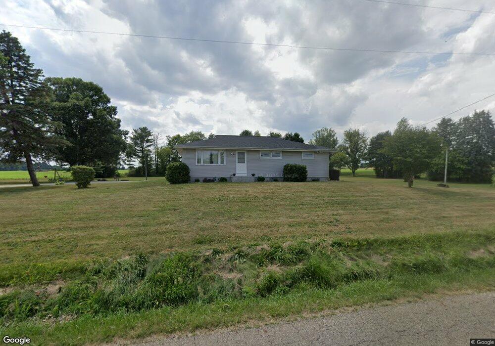
5569 Schilling Ave Louisville, OH 44641
Estimated Value: $203,000 - $227,000
3
Beds
2
Baths
1,232
Sq Ft
$175/Sq Ft
Est. Value
About This Home
This home is located at 5569 Schilling Ave, Louisville, OH 44641 and is currently estimated at $216,088, approximately $175 per square foot. 5569 Schilling Ave is a home located in Stark County with nearby schools including Louisville High School and St. Thomas Aquinas High School & Middle School.
Ownership History
Date
Name
Owned For
Owner Type
Purchase Details
Closed on
Jun 23, 2021
Sold by
Neff Charles E
Bought by
Wurzbach Russell M and Wurzbach Courtney E
Current Estimated Value
Home Financials for this Owner
Home Financials are based on the most recent Mortgage that was taken out on this home.
Original Mortgage
$139,680
Outstanding Balance
$126,463
Interest Rate
2.9%
Mortgage Type
New Conventional
Estimated Equity
$89,625
Purchase Details
Closed on
Apr 23, 2019
Sold by
Eleanor E Neff Revocable Trust
Bought by
Neff Charles E
Purchase Details
Closed on
Jan 7, 2015
Sold by
Neff Eleanor E
Bought by
Neff Eleanor N and The Eleanor E Neff Revocable Trust
Purchase Details
Closed on
Oct 20, 1992
Create a Home Valuation Report for This Property
The Home Valuation Report is an in-depth analysis detailing your home's value as well as a comparison with similar homes in the area
Home Values in the Area
Average Home Value in this Area
Purchase History
| Date | Buyer | Sale Price | Title Company |
|---|---|---|---|
| Wurzbach Russell M | $144,000 | None Available | |
| Neff Charles E | $130,000 | None Available | |
| Neff Eleanor N | -- | None Available | |
| -- | -- | -- |
Source: Public Records
Mortgage History
| Date | Status | Borrower | Loan Amount |
|---|---|---|---|
| Open | Wurzbach Russell M | $139,680 |
Source: Public Records
Tax History Compared to Growth
Tax History
| Year | Tax Paid | Tax Assessment Tax Assessment Total Assessment is a certain percentage of the fair market value that is determined by local assessors to be the total taxable value of land and additions on the property. | Land | Improvement |
|---|---|---|---|---|
| 2025 | -- | $60,480 | $18,410 | $42,070 |
| 2024 | -- | $60,480 | $18,410 | $42,070 |
| 2023 | $2,487 | $50,970 | $16,210 | $34,760 |
| 2022 | $2,493 | $50,970 | $16,210 | $34,760 |
| 2021 | $2,550 | $50,970 | $16,210 | $34,760 |
| 2020 | $2,116 | $44,560 | $14,600 | $29,960 |
| 2019 | $2,126 | $46,880 | $14,600 | $32,280 |
| 2018 | $1,775 | $46,880 | $14,600 | $32,280 |
| 2017 | $1,698 | $43,550 | $13,690 | $29,860 |
| 2016 | $1,409 | $38,230 | $13,690 | $24,540 |
| 2015 | $1,413 | $38,230 | $13,690 | $24,540 |
| 2014 | $1,276 | $33,360 | $11,940 | $21,420 |
| 2013 | $641 | $33,360 | $11,940 | $21,420 |
Source: Public Records
Map
Nearby Homes
- 6052 N Nickelplate St
- 5495 Meese Rd NE
- 910 Crosswyck Cir
- 1170 Winding Ridge Ave
- 2015 E Main St
- 316 E Reno Dr
- 0 Michigan Blvd
- 5474 Ravenna Ave
- 203 Brookfield St
- 428 Honeycrisp Dr NE
- 3047 Mcintosh Dr NE
- 432 Honeycrisp Dr NE
- 2962 Mcintosh Dr NE
- 2963 Mcintosh Dr NE
- 430 Honeycrisp Dr NE
- 2957 Mcintosh Dr NE
- 325 Lincoln Ave
- 524 Glenbar St
- 1812 E Broad St
- 308 Superior St
- 5627 Schilling Ave
- 5472 N Nickelplate St
- 5469 N Nickelplate St
- 5550 N Nickelplate St
- 5460 N Nickelplate St
- 5552 N Nickelplate St
- 5568 N Nickelplate St
- 5425 N Nickelplate St
- 5584 N Nickelplate St
- 5845 Schilling Ave
- 5389 N Nickelplate St
- 5797 N Nickelplate St
- 5399 N Nickelplate St
- 5876 Schilling Ave
- 5397 N Nickelplate St
- 5381 N Nickelplate St
- 5904 Schilling Ave
- 5294 N Nickelplate St
- 5395 N Nickelplate St
- 5265 Meese Rd NE