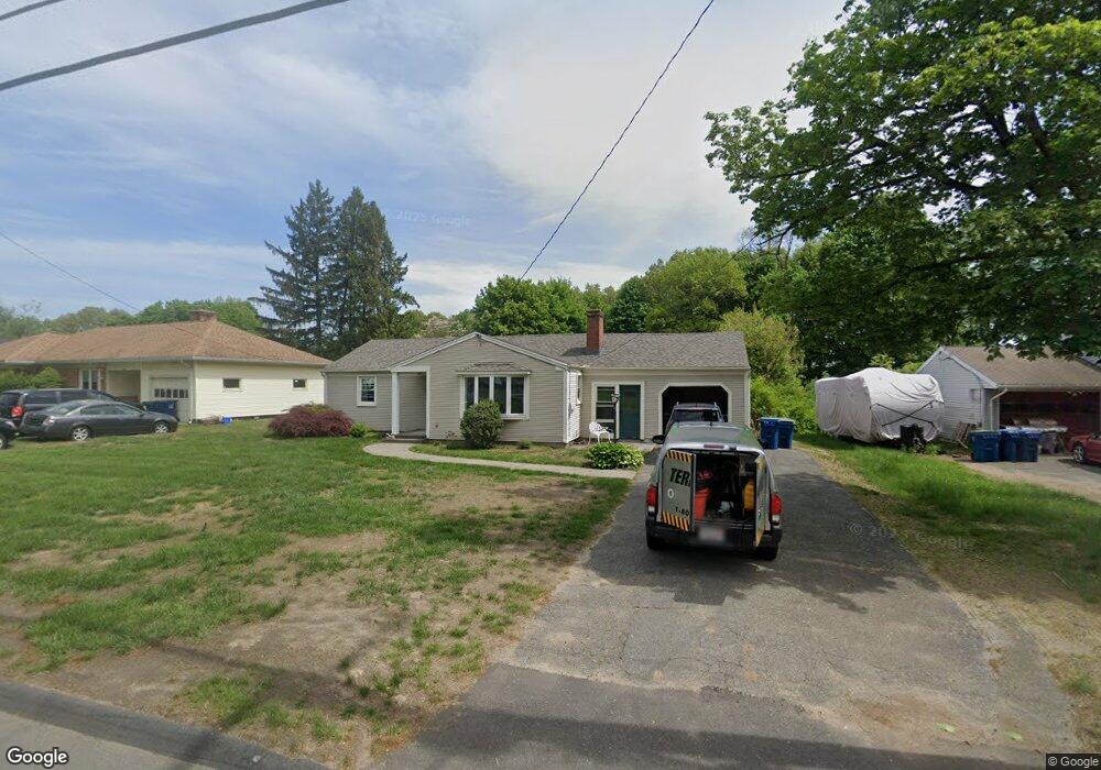
558 Amostown Rd West Springfield, MA 01089
Estimated Value: $338,000 - $385,000
3
Beds
1
Bath
1,456
Sq Ft
$246/Sq Ft
Est. Value
About This Home
This home is located at 558 Amostown Rd, West Springfield, MA 01089 and is currently estimated at $357,600, approximately $245 per square foot. 558 Amostown Rd is a home located in Hampden County with nearby schools including St Thomas The Apostle School.
Ownership History
Date
Name
Owned For
Owner Type
Purchase Details
Closed on
May 7, 2004
Sold by
Lapalme Lucille M
Bought by
Byrne Christine A
Current Estimated Value
Home Financials for this Owner
Home Financials are based on the most recent Mortgage that was taken out on this home.
Original Mortgage
$70,000
Outstanding Balance
$32,566
Interest Rate
5.39%
Mortgage Type
Purchase Money Mortgage
Estimated Equity
$325,034
Create a Home Valuation Report for This Property
The Home Valuation Report is an in-depth analysis detailing your home's value as well as a comparison with similar homes in the area
Home Values in the Area
Average Home Value in this Area
Purchase History
| Date | Buyer | Sale Price | Title Company |
|---|---|---|---|
| Byrne Christine A | $169,900 | -- |
Source: Public Records
Mortgage History
| Date | Status | Borrower | Loan Amount |
|---|---|---|---|
| Open | Byrne Christine A | $70,000 |
Source: Public Records
Tax History Compared to Growth
Tax History
| Year | Tax Paid | Tax Assessment Tax Assessment Total Assessment is a certain percentage of the fair market value that is determined by local assessors to be the total taxable value of land and additions on the property. | Land | Improvement |
|---|---|---|---|---|
| 2025 | $4,308 | $289,700 | $118,600 | $171,100 |
| 2024 | $4,250 | $287,000 | $118,600 | $168,400 |
| 2023 | $4,059 | $261,200 | $118,600 | $142,600 |
| 2022 | $3,666 | $232,600 | $107,600 | $125,000 |
| 2021 | $3,437 | $203,400 | $86,900 | $116,500 |
| 2020 | $3,452 | $203,200 | $86,900 | $116,300 |
| 2019 | $3,446 | $203,200 | $86,900 | $116,300 |
| 2018 | $3,442 | $201,900 | $86,900 | $115,000 |
| 2017 | $3,442 | $201,900 | $86,900 | $115,000 |
| 2016 | $3,366 | $198,100 | $81,600 | $116,500 |
| 2015 | $3,298 | $194,100 | $79,800 | $114,300 |
| 2014 | $800 | $194,100 | $79,800 | $114,300 |
Source: Public Records
Map
Nearby Homes
- 17 Laurence Dr
- 81 Laurence Dr
- 61 Clarence St
- 147 Grandview Ave
- 19 Cora St
- 142 Morton St
- 65 Verdugo St
- 36 Shady Brook
- 42 Janet St
- 43 Wishing Well Way
- 16 North St
- 32 Windpath E
- 42 Gregory Ln
- 74 Maple Terrace
- 1304 Elm St Unit 4C
- 36 Maple Terrace
- 917 Elm St
- 86 Birnie Ave
- 283 Forest Glen
- 64 Apple Ridge Rd
- 566 Amostown Rd
- 550 Amostown Rd
- 538 Amostown Rd
- 582 Amostown Rd
- 553 Amostown Rd
- 561 Amostown Rd
- 543 Amostown Rd
- 569 Amostown Rd
- 535 Amostown Rd
- 592 Amostown Rd
- 597 Amostown Rd
- 602 Amostown Rd
- 440 Massachusetts Ave
- 432 Massachusetts Ave
- 446 Massachusetts Ave
- 490 Massachusetts Ave
- 452 Massachusetts Ave
- 452 Massachusetts Ave
- 460 Massachusetts Ave
- 612 Amostown Rd