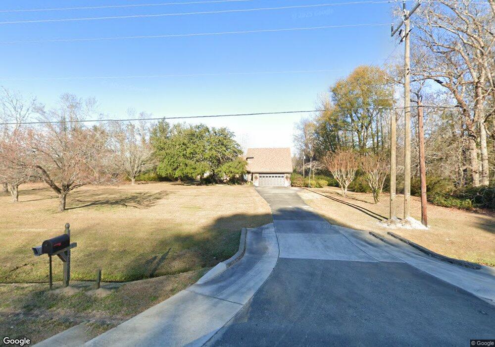
5596 Highway 70 Newport, NC 28570
Estimated Value: $352,000 - $414,000
4
Beds
2
Baths
1,991
Sq Ft
$188/Sq Ft
Est. Value
About This Home
This home is located at 5596 Highway 70, Newport, NC 28570 and is currently estimated at $375,108, approximately $188 per square foot. 5596 Highway 70 is a home located in Carteret County with nearby schools including Newport Elementary School, Newport Middle School, and West Carteret High School.
Ownership History
Date
Name
Owned For
Owner Type
Purchase Details
Closed on
Feb 15, 2007
Sold by
Hinson Earl M and Hinson Betsy G
Bought by
Hinson Earl M and Hinson Betsy G
Current Estimated Value
Purchase Details
Closed on
Feb 8, 2007
Sold by
Hinson Earl M and Hinson Betsy G
Bought by
Alpert Tracy D and Earl M & Betsy G Hinson Irrevocable Tr
Purchase Details
Closed on
Jan 23, 2007
Sold by
Hinson Earl M and Hinson Betsy G
Bought by
Hinson Earl M and Hinson Betsy G
Purchase Details
Closed on
Aug 30, 2004
Create a Home Valuation Report for This Property
The Home Valuation Report is an in-depth analysis detailing your home's value as well as a comparison with similar homes in the area
Home Values in the Area
Average Home Value in this Area
Purchase History
| Date | Buyer | Sale Price | Title Company |
|---|---|---|---|
| Hinson Earl M | -- | None Available | |
| Alpert Tracy D | -- | None Available | |
| Hinson Earl M | -- | None Available | |
| -- | -- | -- |
Source: Public Records
Tax History Compared to Growth
Tax History
| Year | Tax Paid | Tax Assessment Tax Assessment Total Assessment is a certain percentage of the fair market value that is determined by local assessors to be the total taxable value of land and additions on the property. | Land | Improvement |
|---|---|---|---|---|
| 2025 | $1,168 | $324,160 | $73,779 | $250,381 |
| 2024 | $1,090 | $206,677 | $66,314 | $140,363 |
| 2023 | $1,123 | $206,677 | $66,314 | $140,363 |
| 2022 | $1,102 | $206,677 | $66,314 | $140,363 |
| 2021 | $0 | $206,677 | $66,314 | $140,363 |
| 2020 | $1,069 | $206,677 | $66,314 | $140,363 |
| 2019 | $1,018 | $209,562 | $66,314 | $143,248 |
| 2017 | $976 | $209,562 | $66,314 | $143,248 |
| 2016 | $976 | $209,562 | $66,314 | $143,248 |
| 2015 | $935 | $204,036 | $60,788 | $143,248 |
| 2014 | $960 | $210,728 | $57,748 | $152,980 |
Source: Public Records
Map
Nearby Homes
- 415 Hillcrest Dr
- 404 Hillcrest Dr
- 806 Lord Granville Dr
- 357 Mccabe Rd
- 311 Lord Granville Dr
- 904 Lord Granville Dr
- 341 Mccabe Rd
- 304 Lord Granville Dr
- 126 Hatcher Dr
- 302 Lord Granville Dr
- 212 Lord Granville Dr
- 215 Oak Dr
- 105 Fairway Dr W
- 113 Fairway Dr W
- 6650 Highway 70 W
- 414 W Branch Dr
- 200 Tree Fern Dr
- 206 Lazy Ln
- 5320 Highway 70 W
- 306 Rattan St
- 5568 Highway 70
- 5568 Highway 70
- 158 Sam Garner Rd
- 5674 Highway 70
- 5674 Highway 70
- 5621 U S 70
- 173 Sam Garner Rd
- 140 Mccabe Rd
- 198 Sam Garner Rd
- 197 Sam Garner Rd
- 146 Mccabe Rd
- 159 Mccabe Rd
- 173 Mccabe Rd
- 170 Mccabe Rd
- 226 Sam Garner Rd
- 211 Sam Garner Rd
- 5514 Hwy 70 W
- 5514 Highway 70 W
- 176 Mccabe Rd
- 133 Wildwood Rd