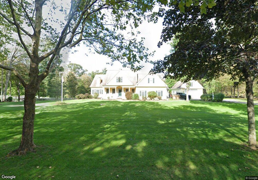
56 Davis Rd Storrs Mansfield, CT 06268
Estimated Value: $575,000 - $824,530
3
Beds
3
Baths
3,652
Sq Ft
$193/Sq Ft
Est. Value
About This Home
This home is located at 56 Davis Rd, Storrs Mansfield, CT 06268 and is currently estimated at $704,133, approximately $192 per square foot. 56 Davis Rd is a home located in Tolland County with nearby schools including Mansfield Elementary School, Annie E. Vinton School, and Mansfield Middle School.
Ownership History
Date
Name
Owned For
Owner Type
Purchase Details
Closed on
Jan 23, 2012
Sold by
Beebe Ronald C
Bought by
Beebe Lexie A and Beebe Ronald C
Current Estimated Value
Home Financials for this Owner
Home Financials are based on the most recent Mortgage that was taken out on this home.
Original Mortgage
$358,000
Interest Rate
3.98%
Mortgage Type
New Conventional
Purchase Details
Closed on
Dec 28, 1994
Sold by
Clifford Wright and Clifford Thelma
Bought by
Beebe Ronald
Create a Home Valuation Report for This Property
The Home Valuation Report is an in-depth analysis detailing your home's value as well as a comparison with similar homes in the area
Home Values in the Area
Average Home Value in this Area
Purchase History
| Date | Buyer | Sale Price | Title Company |
|---|---|---|---|
| Beebe Lexie A | -- | -- | |
| Beebe Lexie A | -- | -- | |
| Beebe Ronald | $75,000 | -- | |
| Beebe Ronald | $75,000 | -- |
Source: Public Records
Mortgage History
| Date | Status | Borrower | Loan Amount |
|---|---|---|---|
| Closed | Beebe Ronald | $358,000 | |
| Previous Owner | Beebe Ronald | $175,000 |
Source: Public Records
Tax History Compared to Growth
Tax History
| Year | Tax Paid | Tax Assessment Tax Assessment Total Assessment is a certain percentage of the fair market value that is determined by local assessors to be the total taxable value of land and additions on the property. | Land | Improvement |
|---|---|---|---|---|
| 2025 | $9,344 | $467,200 | $72,500 | $394,700 |
| 2024 | $9,095 | $298,000 | $66,200 | $231,800 |
| 2023 | $9,393 | $298,000 | $66,200 | $231,800 |
| 2022 | $9,053 | $298,000 | $66,200 | $231,800 |
| 2021 | $9,351 | $298,000 | $66,200 | $231,800 |
| 2020 | $9,351 | $298,000 | $66,200 | $231,800 |
| 2019 | $9,602 | $306,000 | $68,700 | $237,300 |
| 2018 | $9,449 | $306,000 | $68,700 | $237,300 |
| 2017 | $9,373 | $306,000 | $68,700 | $237,300 |
| 2016 | $9,140 | $306,000 | $68,700 | $237,300 |
| 2015 | $9,140 | $306,000 | $68,700 | $237,300 |
| 2014 | $9,268 | $331,590 | $80,780 | $250,810 |
Source: Public Records
Map
Nearby Homes
- 124 Spring Hill Rd
- 48 Monticello Ln
- 18 Spring Hill Rd
- 985 Storrs Rd
- 934 Storrs Rd
- 21 Silo Rd W Unit 21
- 30 Wyllys Farm Rd
- 29 Wyllys Farm Rd
- 37 Wyllys Farm Rd
- 43 Wyllys Farm Rd
- 31 Wyllys Farm Rd
- 67 Mulberry Rd
- 35 Wyllys Farm Rd
- 91 Chaffeeville Rd Unit TRLR 19
- 0 Mansfield City Rd Unit LOT 2
- 113 Hillyndale Rd
- 00 Sheffield Dr
- 241 Wormwood Hill Rd
- 457 Stafford Rd
- 329 N Eagleville Rd