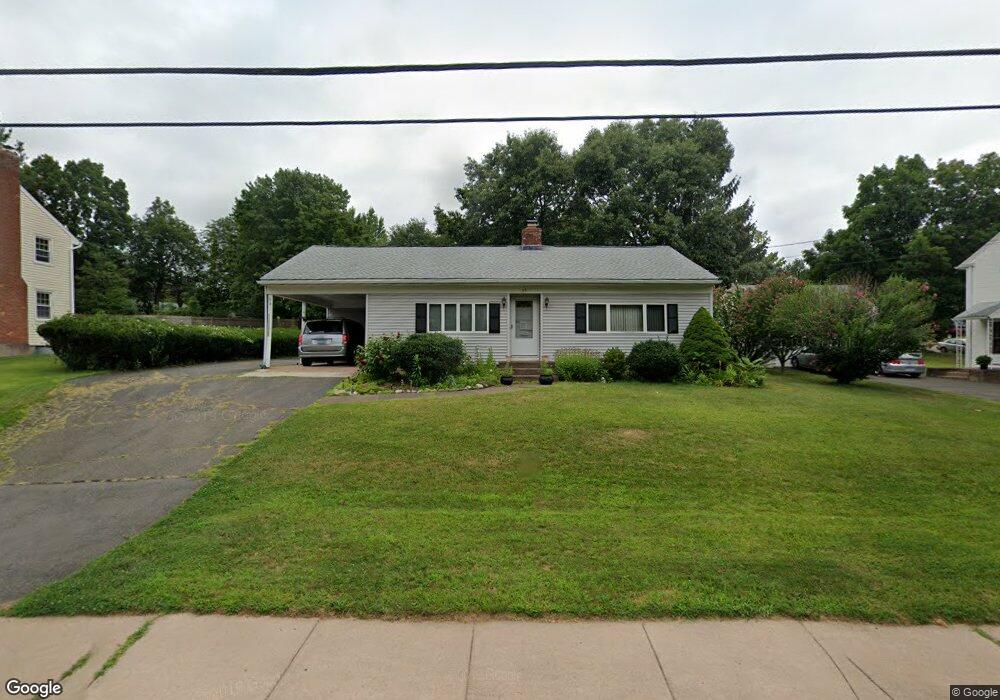
56 Duval St Manchester, CT 06042
Waddell NeighborhoodEstimated Value: $298,328 - $322,000
3
Beds
2
Baths
1,144
Sq Ft
$274/Sq Ft
Est. Value
About This Home
This home is located at 56 Duval St, Manchester, CT 06042 and is currently estimated at $313,082, approximately $273 per square foot. 56 Duval St is a home located in Hartford County with nearby schools including Illing Middle School, Elisabeth M. Bennet Academy, and Manchester High School.
Ownership History
Date
Name
Owned For
Owner Type
Purchase Details
Closed on
Oct 5, 1995
Sold by
Downing Charles and Downing Ruth
Bought by
Carr Thomas and Carr Jusith
Current Estimated Value
Purchase Details
Closed on
Aug 30, 1994
Sold by
Perri David and Perri Denise M
Bought by
Downing Charles C and Downing Ruth E
Purchase Details
Closed on
May 2, 1988
Sold by
Stahelski David H
Bought by
Perri David
Create a Home Valuation Report for This Property
The Home Valuation Report is an in-depth analysis detailing your home's value as well as a comparison with similar homes in the area
Home Values in the Area
Average Home Value in this Area
Purchase History
| Date | Buyer | Sale Price | Title Company |
|---|---|---|---|
| Carr Thomas | $100,000 | -- | |
| Carr Thomas | $100,000 | -- | |
| Downing Charles C | $115,500 | -- | |
| Downing Charles C | $115,500 | -- | |
| Perri David | $139,000 | -- |
Source: Public Records
Mortgage History
| Date | Status | Borrower | Loan Amount |
|---|---|---|---|
| Open | Perri David | $35,000 | |
| Closed | Perri David | $25,000 |
Source: Public Records
Tax History Compared to Growth
Tax History
| Year | Tax Paid | Tax Assessment Tax Assessment Total Assessment is a certain percentage of the fair market value that is determined by local assessors to be the total taxable value of land and additions on the property. | Land | Improvement |
|---|---|---|---|---|
| 2025 | $5,252 | $131,900 | $39,100 | $92,800 |
| 2024 | $5,102 | $131,900 | $39,100 | $92,800 |
| 2023 | $4,907 | $131,900 | $39,100 | $92,800 |
| 2022 | $4,810 | $131,900 | $39,100 | $92,800 |
| 2021 | $4,017 | $110,000 | $33,600 | $76,400 |
| 2020 | $4,017 | $110,000 | $33,600 | $76,400 |
| 2019 | $4,017 | $110,000 | $33,600 | $76,400 |
| 2018 | $3,939 | $110,000 | $33,600 | $76,400 |
| 2017 | $3,834 | $110,000 | $33,600 | $76,400 |
| 2016 | $3,994 | $114,600 | $42,700 | $71,900 |
| 2015 | $3,974 | $114,600 | $42,700 | $71,900 |
| 2014 | $3,896 | $114,600 | $42,700 | $71,900 |
Source: Public Records
Map
Nearby Homes
- 12 Butler Rd
- 14 Evergreen Rd
- 708 Hilliard St
- 424 Middle Turnpike W Unit 5
- 47 Crestwood Dr
- 60 Deerfield Dr
- 9 Deepwood Dr
- 113 Deepwood Dr
- 41 Windemere St
- 43 Salem Rd
- 149 Deepwood Dr
- 565 Adams St
- 28 Devon Dr
- 186 Irving St
- 21 Saint John St
- 15 Saint John St
- 63 Irving St
- 633 Center St Unit E
- 633 Center St Unit A
- 126 Falknor Dr