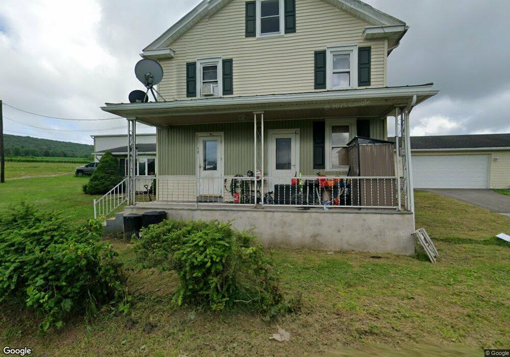
56 Swamp Rd Tamaqua, PA 18252
Estimated Value: $238,373 - $375,000
4
Beds
2
Baths
2,792
Sq Ft
$108/Sq Ft
Est. Value
About This Home
This home is located at 56 Swamp Rd, Tamaqua, PA 18252 and is currently estimated at $300,843, approximately $107 per square foot. 56 Swamp Rd is a home located in Schuylkill County with nearby schools including Tamaqua Area Senior High School.
Ownership History
Date
Name
Owned For
Owner Type
Purchase Details
Closed on
Mar 1, 2023
Sold by
Reed Brenda J
Bought by
Reed Jonathan Robert
Current Estimated Value
Purchase Details
Closed on
Aug 30, 2022
Sold by
Heisler Leroy J and Heisler Revoc J
Bought by
Reed Brenda J
Purchase Details
Closed on
Jun 4, 2011
Sold by
Heisler Leroy and Heisler Leroy J
Bought by
The Leroy T Heisler And J Jane Heisler R
Purchase Details
Closed on
Aug 26, 2009
Sold by
Heisler Leroy and Jane Heisler J
Bought by
Heisler Leroy and Jane Heisler J
Create a Home Valuation Report for This Property
The Home Valuation Report is an in-depth analysis detailing your home's value as well as a comparison with similar homes in the area
Home Values in the Area
Average Home Value in this Area
Purchase History
| Date | Buyer | Sale Price | Title Company |
|---|---|---|---|
| Reed Jonathan Robert | -- | -- | |
| Reed Brenda J | -- | Bohmueller Law Offices Pc | |
| The Leroy T Heisler And J Jane Heisler R | -- | None Available | |
| Heisler Leroy | -- | None Available |
Source: Public Records
Tax History Compared to Growth
Tax History
| Year | Tax Paid | Tax Assessment Tax Assessment Total Assessment is a certain percentage of the fair market value that is determined by local assessors to be the total taxable value of land and additions on the property. | Land | Improvement |
|---|---|---|---|---|
| 2025 | $2,775 | $39,725 | $10,515 | $29,210 |
| 2024 | $2,520 | $39,725 | $10,515 | $29,210 |
| 2023 | $2,520 | $39,725 | $10,515 | $29,210 |
| 2022 | $2,444 | $39,725 | $10,515 | $29,210 |
| 2021 | $2,468 | $39,725 | $10,515 | $29,210 |
| 2020 | $2,383 | $39,725 | $10,515 | $29,210 |
| 2018 | $2,308 | $39,725 | $10,515 | $29,210 |
| 2017 | $2,221 | $39,725 | $10,515 | $29,210 |
| 2015 | -- | $39,725 | $10,515 | $29,210 |
| 2011 | -- | $39,725 | $0 | $0 |
Source: Public Records
Map
Nearby Homes
- 1319 Shady Ln
- 609 Catawissa Rd
- 93 Washington St
- 28 Main St
- 26 Main St
- 22 Hughes St
- 303 Mulberry St
- 409 Coal St
- 0 Whitetail Crossing Rd Unit 743729
- 0 Whitetail Crossing Rd
- 0 Overlook Dr Unit PM-137226
- 212 Pine St
- 17 Main St
- 1032 Clamtown Rd
- 4 Federal St
- 235 Valley St
- 0 Wild Turkey Ln Unit PASK2023694
- 15 Alliance St
- 675 Arrow Rd
- 26 Chain Cir
- 0 N Shady Ln Unit 1008026512
- 0 N Shady Ln Unit 1007514314
- 0 N Shady Ln Unit 1007468624
- 0 N Shady Ln Unit 6925079
- 0 N Shady Ln Unit 6718529
- 0 N Shady Ln Unit 16-2591
- 0 N Shady Ln Unit PM-35489
- 0 N Shady Ln Unit 520204
- 0 N Shady Ln Unit 534805
- 16 Shady Ln
- 1160 Shady Ln
- 1131 Shady Ln
- 1121 Shady Ln
- 1253 Shady Ln
- 91 Pebble Ln
- 1120 Shady Ln
- 1108 Shady Ln
- 10 Pebble Ln
- 1180 Shady Ln
- 721 Catawissa Rd