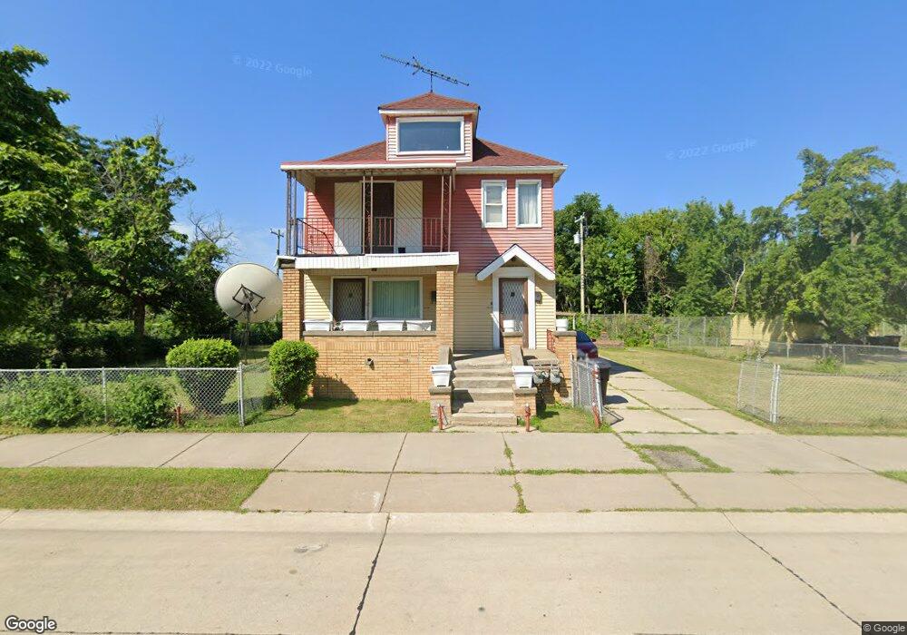
561 Meadowbrook St Detroit, MI 48214
Marina District NeighborhoodEstimated Value: $108,000 - $169,000
4
Beds
2
Baths
1,968
Sq Ft
$71/Sq Ft
Est. Value
About This Home
This home is located at 561 Meadowbrook St, Detroit, MI 48214 and is currently estimated at $140,313, approximately $71 per square foot. 561 Meadowbrook St is a home located in Wayne County with nearby schools including Hutchinson Elementary-Middle School, Edward 'Duke' Ellington Conservatory of Music and Art, and Charles L. Spain Elementary-Middle School.
Ownership History
Date
Name
Owned For
Owner Type
Purchase Details
Closed on
May 3, 2024
Sold by
Weatherly Addie M
Bought by
Addie M Weatherly Trust and Weatherly
Current Estimated Value
Purchase Details
Closed on
Apr 3, 2024
Sold by
Weatherly Jeremiah and Weatherly Addie M
Bought by
Weatherly Addie M
Purchase Details
Closed on
Oct 15, 2015
Sold by
The Detroit Land Bank Authority
Bought by
The Neighborhood Development Corporation
Create a Home Valuation Report for This Property
The Home Valuation Report is an in-depth analysis detailing your home's value as well as a comparison with similar homes in the area
Home Values in the Area
Average Home Value in this Area
Purchase History
| Date | Buyer | Sale Price | Title Company |
|---|---|---|---|
| Addie M Weatherly Trust | -- | None Listed On Document | |
| Weatherly Addie M | -- | None Listed On Document | |
| The Neighborhood Development Corporation | -- | Attorney |
Source: Public Records
Tax History Compared to Growth
Tax History
| Year | Tax Paid | Tax Assessment Tax Assessment Total Assessment is a certain percentage of the fair market value that is determined by local assessors to be the total taxable value of land and additions on the property. | Land | Improvement |
|---|---|---|---|---|
| 2025 | -- | $33,100 | $0 | $0 |
| 2024 | $100 | $0 | $0 | $0 |
| 2023 | $340 | $0 | $0 | $0 |
| 2022 | $340 | $0 | $0 | $0 |
| 2021 | $460 | $0 | $0 | $0 |
| 2020 | $711 | $0 | $0 | $0 |
| 2019 | $340 | $0 | $0 | $0 |
| 2018 | $340 | $0 | $0 | $0 |
| 2017 | $250 | $0 | $0 | $0 |
| 2016 | $340 | $0 | $0 | $0 |
| 2015 | $250 | $0 | $0 | $0 |
| 2013 | $250 | $2,503 | $0 | $0 |
| 2010 | -- | $3,670 | $321 | $3,349 |
Source: Public Records
Map
Nearby Homes
- 701 Montclair St
- 661 Lemay St
- 681 Lillibridge St
- 11015 E Jefferson Ave
- 1497 Harding St
- 1486 Montclair St
- 1534 Saint Clair St
- 1535 Garland St
- 1539 Garland St
- 176 Sea Breeze Dr Unit 4
- 176 Sea Breeze Dr Unit 5
- 188 Sea Breeze Dr Unit 13
- 188 Sea Breeze Dr Unit 15
- 188 Sea Breeze Dr Unit 10
- 1679 Lemay St
- 1586 Bewick St
- 200 Sea Breeze Dr Unit 18
- 200 Sea Breeze Dr Unit 23
- 200 Sea Breeze Dr Unit 20
- 200 Sea Breeze Dr
- 583 Meadowbrook St
- 535 Meadowbrook St
- 591 Meadowbrook St
- 552 Harding St
- 538 Harding St
- 597 Meadowbrook St
- 609 Harding St
- 509 Harding St
- 558 Saint Clair St
- 564 Saint Clair St
- 550 Saint Clair St
- 621 Harding St
- 542 Saint Clair St
- 576 Saint Clair St
- 501 Harding St
- 530 Saint Clair St
- 623 Montclair St
- 592 Saint Clair St
- 629 Harding St
- 493 Harding St