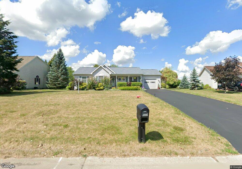
5615 Angela Dr Lockport, NY 14094
South Lockport NeighborhoodEstimated Value: $263,000 - $299,000
3
Beds
2
Baths
1,136
Sq Ft
$251/Sq Ft
Est. Value
About This Home
This home is located at 5615 Angela Dr, Lockport, NY 14094 and is currently estimated at $284,724, approximately $250 per square foot. 5615 Angela Dr is a home located in Niagara County with nearby schools including Aaron Mossell Junior High School, Lockport High School, and Henrietta G Lewis Campus School.
Ownership History
Date
Name
Owned For
Owner Type
Purchase Details
Closed on
Apr 8, 2021
Sold by
Hawkes Carter M and Hawkes Lisa M
Bought by
Sapia Nancey L
Current Estimated Value
Home Financials for this Owner
Home Financials are based on the most recent Mortgage that was taken out on this home.
Original Mortgage
$121,250
Outstanding Balance
$109,474
Interest Rate
3%
Mortgage Type
New Conventional
Estimated Equity
$175,250
Purchase Details
Closed on
Mar 16, 2017
Sold by
Murphy Charles K
Bought by
Hawkes Christian and Mattiuzzo Hannah
Purchase Details
Closed on
Oct 25, 2010
Sold by
Secrist Sandra
Bought by
Hawkes Carter M and Hawkes Lisa M
Home Financials for this Owner
Home Financials are based on the most recent Mortgage that was taken out on this home.
Original Mortgage
$125,312
Interest Rate
4.5%
Mortgage Type
FHA
Purchase Details
Closed on
Dec 21, 2001
Sold by
Yanport Warehouse Corpora Tion
Bought by
Secrist Sandra
Create a Home Valuation Report for This Property
The Home Valuation Report is an in-depth analysis detailing your home's value as well as a comparison with similar homes in the area
Home Values in the Area
Average Home Value in this Area
Purchase History
| Date | Buyer | Sale Price | Title Company |
|---|---|---|---|
| Sapia Nancey L | $125,000 | Stewart Title | |
| Hawkes Christian | $144,000 | None Available | |
| Hawkes Carter M | $127,000 | None Available | |
| Secrist Sandra | $132,500 | David Natemeier |
Source: Public Records
Mortgage History
| Date | Status | Borrower | Loan Amount |
|---|---|---|---|
| Open | Sapia Nancey L | $121,250 | |
| Previous Owner | Hawkes Carter M | $125,312 |
Source: Public Records
Tax History Compared to Growth
Tax History
| Year | Tax Paid | Tax Assessment Tax Assessment Total Assessment is a certain percentage of the fair market value that is determined by local assessors to be the total taxable value of land and additions on the property. | Land | Improvement |
|---|---|---|---|---|
| 2024 | $6,488 | $240,000 | $25,000 | $215,000 |
| 2023 | $6,222 | $223,000 | $25,000 | $198,000 |
| 2022 | $6,144 | $212,000 | $25,000 | $187,000 |
| 2021 | $5,954 | $161,800 | $30,000 | $131,800 |
| 2020 | $4,825 | $161,800 | $30,000 | $131,800 |
| 2019 | $2,413 | $143,000 | $30,000 | $113,000 |
| 2018 | $4,257 | $130,000 | $30,000 | $100,000 |
| 2017 | $4,337 | $130,000 | $30,000 | $100,000 |
| 2016 | $4,370 | $130,000 | $30,000 | $100,000 |
| 2015 | -- | $130,000 | $30,000 | $100,000 |
| 2014 | -- | $121,700 | $25,000 | $96,700 |
Source: Public Records
Map
Nearby Homes
- 6598 Parkwood Dr
- 6588 Royal Pkwy S
- 6558 Royal Pkwy S
- 6667 Curtis Ct
- Patio A Plan at Lockhaven Estates
- Patio B Plan at Lockhaven Estates
- Patio D Plan at Lockhaven Estates
- 6673 Curtis Ct
- Patio C Plan at Lockhaven Estates
- 6632 Royal Pkwy N
- 6429 Hamm Rd
- 1100 Beattie Ave
- 6685 Curtis Ct
- 6640 Royal Pkwy S
- 6409 Buell Dr
- 6364 Oconnor Dr
- 6354 Oconnor Dr
- 5916 Collins Dr
- 869 Lincoln Ave
- 44 Coolidge Ave
- 5613 Angela Dr
- 5617 Angela Dr
- 5611 Angela Dr
- 5631 Jeffrey Dr
- 5633 Jeffrey Dr
- 5619 Angela Dr
- 5635 Jeffrey Dr
- 5629 Jeffrey Dr
- 5616 Angela Dr
- 5612 Angela Dr
- 5609 Angela Dr
- 6525 Amy Ln
- 5610 Angela Dr
- 5621 Angela Dr
- 5637 Jeffrey Dr
- 5608 Angela Dr
- 5627 Jeffrey Dr
- 5623 Angela Dr
- 5630 Jeffrey Dr
- 5626 Angela Dr