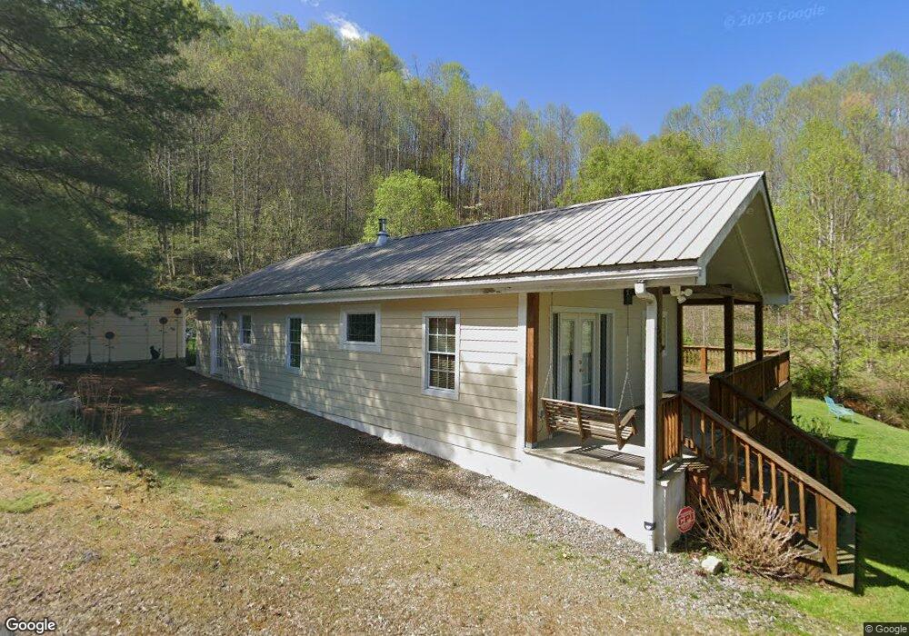
562 Sampson Mountain Rd Burnsville, NC 28714
Estimated Value: $223,000 - $348,000
2
Beds
1
Bath
1,056
Sq Ft
$285/Sq Ft
Est. Value
About This Home
This home is located at 562 Sampson Mountain Rd, Burnsville, NC 28714 and is currently estimated at $300,575, approximately $284 per square foot. 562 Sampson Mountain Rd is a home with nearby schools including Mountain Heritage High School.
Ownership History
Date
Name
Owned For
Owner Type
Purchase Details
Closed on
Aug 26, 2025
Sold by
Sampson Mtn Llc
Bought by
Wilde Stephen J
Current Estimated Value
Purchase Details
Closed on
Sep 28, 2011
Bought by
Sampson Mtn Llc
Purchase Details
Closed on
Aug 29, 2005
Sold by
Pitts Robert M and Gordon Reed Roberts
Bought by
Wilde Stephen J
Create a Home Valuation Report for This Property
The Home Valuation Report is an in-depth analysis detailing your home's value as well as a comparison with similar homes in the area
Home Values in the Area
Average Home Value in this Area
Purchase History
| Date | Buyer | Sale Price | Title Company |
|---|---|---|---|
| Wilde Stephen J | -- | None Listed On Document | |
| Sampson Mtn Llc | -- | -- | |
| Wilde Stephen J | $2,000 | None Available |
Source: Public Records
Tax History Compared to Growth
Tax History
| Year | Tax Paid | Tax Assessment Tax Assessment Total Assessment is a certain percentage of the fair market value that is determined by local assessors to be the total taxable value of land and additions on the property. | Land | Improvement |
|---|---|---|---|---|
| 2025 | $1,410 | $247,300 | $91,700 | $155,600 |
| 2024 | $1,410 | $247,300 | $91,700 | $155,600 |
| 2023 | $721 | $110,910 | $50,400 | $60,510 |
| 2022 | $707 | $110,910 | $50,400 | $60,510 |
| 2021 | $721 | $110,910 | $50,400 | $60,510 |
| 2020 | $721 | $110,910 | $50,400 | $60,510 |
| 2019 | $721 | $110,910 | $50,400 | $60,510 |
| 2018 | $721 | $110,910 | $50,400 | $60,510 |
| 2017 | $833 | $128,210 | $67,700 | $60,510 |
| 2016 | $833 | $128,210 | $67,700 | $60,510 |
| 2015 | $501 | $91,170 | $39,600 | $51,570 |
| 2014 | $501 | $91,170 | $39,600 | $51,570 |
Source: Public Records
Map
Nearby Homes
- 128 Hadleigh Way
- 000 Pearl Way Unit 12
- Lot 11 Settlement Way
- Lot 8 Settlement Way
- Lot 6 Settlement Way
- 141 Locust Ramp Dr
- 1099 Silas Branch Rd
- Lot 27 Black Bear Run
- Lot 42 Black Bear Run
- Lot 28 Black Bear Run
- 1201 Simms Fork Rd
- Lot 38 Black Bear Run
- 197 Cherry Knob Dr
- 000 Weaver Ln Unit 182
- 0 Weaver Ln Unit 202
- 15 +/- Acres Riddle Branch Rd
- 2812 Bald Mountain Rd
- 17 Mountain Gait Dr Unit 17
- 1617 Mountain Gait Dr Unit 16 & 17
- Lot 9 Mountain Gait Dr
- 463 Sampson Mountain Rd
- 651 Sampson Mountain Rd
- Lot 12 Locust Rough Mountain Rd
- Lot 11 Locust Rough Mountain Rd
- Lot 8 Locust Rough Mountain Rd
- Lot 7 Locust Rough Mountain Rd
- Lot 6 Locust Rough Mountain Rd
- Lot 5 Locust Rough Mountain Rd
- 249 Sampson Mountain Rd
- 213 Green Leaf Rd
- 9999 Green Leaf Rd Unit Tract A
- TBD Green Leaf Rd
- 5087 Bald Mountain Rd
- 54 Green Leaf Rd
- 245 Green Leaf Rd
- 5039 Bald Mountain Rd
- 4 Boo Scamp Mountain Rd
- 260 Green Leaf Rd
- 000 Green Leaf Rd
- 0 Green Leaf Rd Unit NCM420886