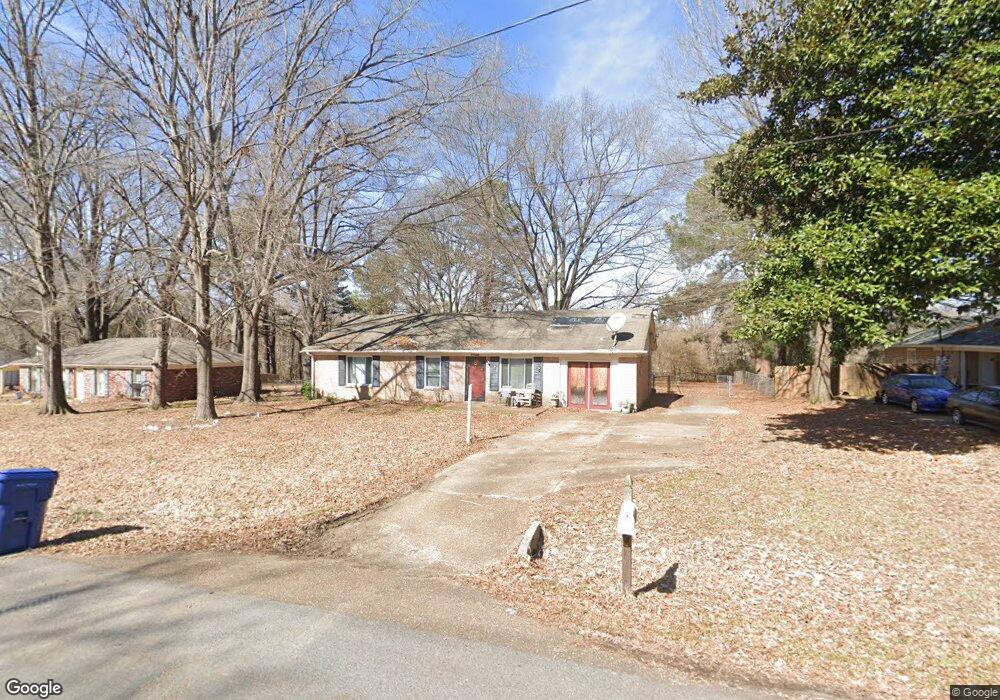
5626 Ashford Dr Horn Lake, MS 38637
Estimated Value: $169,000 - $185,000
4
Beds
2
Baths
1,358
Sq Ft
$128/Sq Ft
Est. Value
About This Home
This home is located at 5626 Ashford Dr, Horn Lake, MS 38637 and is currently estimated at $173,672, approximately $127 per square foot. 5626 Ashford Dr is a home located in DeSoto County with nearby schools including Lake Cormorant Elementary School, Horn Lake Intermediate School, and Horn Lake Middle School.
Ownership History
Date
Name
Owned For
Owner Type
Purchase Details
Closed on
Nov 18, 2009
Sold by
Hylander Rebecca A and Alizadegan Connie B
Bought by
Flynn Ondraetta
Current Estimated Value
Home Financials for this Owner
Home Financials are based on the most recent Mortgage that was taken out on this home.
Original Mortgage
$79,591
Outstanding Balance
$51,757
Interest Rate
4.92%
Mortgage Type
New Conventional
Estimated Equity
$121,915
Create a Home Valuation Report for This Property
The Home Valuation Report is an in-depth analysis detailing your home's value as well as a comparison with similar homes in the area
Home Values in the Area
Average Home Value in this Area
Purchase History
| Date | Buyer | Sale Price | Title Company |
|---|---|---|---|
| Flynn Ondraetta | -- | Select Title & Escrow Llc |
Source: Public Records
Mortgage History
| Date | Status | Borrower | Loan Amount |
|---|---|---|---|
| Open | Flynn Ondraetta | $79,591 |
Source: Public Records
Tax History Compared to Growth
Tax History
| Year | Tax Paid | Tax Assessment Tax Assessment Total Assessment is a certain percentage of the fair market value that is determined by local assessors to be the total taxable value of land and additions on the property. | Land | Improvement |
|---|---|---|---|---|
| 2024 | $962 | $6,454 | $1,000 | $5,454 |
| 2023 | $962 | $6,454 | $0 | $0 |
| 2022 | $962 | $6,454 | $1,000 | $5,454 |
| 2021 | $962 | $6,454 | $1,000 | $5,454 |
| 2020 | $896 | $6,017 | $1,000 | $5,017 |
| 2019 | $896 | $6,017 | $1,000 | $5,017 |
| 2017 | $919 | $11,280 | $6,140 | $5,140 |
| 2016 | $895 | $6,140 | $1,000 | $5,140 |
| 2015 | $895 | $11,280 | $6,140 | $5,140 |
| 2014 | $649 | $6,140 | $0 | $0 |
| 2013 | $870 | $6,140 | $0 | $0 |
Source: Public Records
Map
Nearby Homes
- 5562 Caroline Dr
- 5409 Smallwood Cove
- 5736 Natchez Dr
- 5843 Ashford Dr
- 5743 Iroquois Dr
- 5770 Chickasaw Dr
- 5348 Haynes Dr
- 5805 Fleetwood Dr
- 5135 Woody Dr
- 0 Nail Rd Unit 4104586
- 4901 Port Stacy Cove
- 0 Mississippi 301
- 5515 Jordan Dr
- 6251 Clover Ct
- 4971 Church Rd
- 6175 Tucker Ridge Rd
- 6026 Daffodil Ln
- 6348 Jameson Cove
- 6364 Jameson Cove
- 0 Church Rd Unit 4087501
- 5606 Ashford Dr
- 5666 Ashford Dr
- 5584 Ashford Dr
- 5680 Ashford Dr
- 5625 Ashford Dr
- 5665 Ashford Dr
- 5605 Ashford Dr
- 5625 Ashford Dr
- 5679 Ashford Dr
- 5564 Ashford Dr
- 5679 Ashford Dr
- 5682 Ashford Dr
- 5583 Ashford Dr
- 5681 Ashford Dr
- 5563 Ashford Dr
- 5605 Ashford Dr
- 5696 Ashford Dr
- 5602 Caroline Dr
- 5602 Caroline Dr
- 5642 Caroline Dr