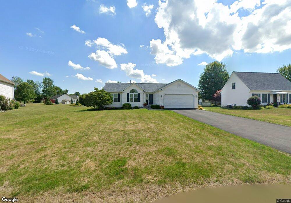
5631 Jeffrey Dr Lockport, NY 14094
South Lockport NeighborhoodEstimated Value: $232,000 - $330,000
3
Beds
2
Baths
1,058
Sq Ft
$275/Sq Ft
Est. Value
About This Home
This home is located at 5631 Jeffrey Dr, Lockport, NY 14094 and is currently estimated at $291,234, approximately $275 per square foot. 5631 Jeffrey Dr is a home located in Niagara County with nearby schools including Aaron Mossell Junior High School, Lockport High School, and Henrietta G Lewis Campus School.
Ownership History
Date
Name
Owned For
Owner Type
Purchase Details
Closed on
Nov 25, 2022
Sold by
Ranney Brian C
Bought by
Firpo Xavier Rodriguez and Ramos Betzaida Cruz
Current Estimated Value
Home Financials for this Owner
Home Financials are based on the most recent Mortgage that was taken out on this home.
Original Mortgage
$192,000
Outstanding Balance
$186,375
Interest Rate
7.08%
Mortgage Type
New Conventional
Estimated Equity
$104,859
Purchase Details
Closed on
Jun 20, 1996
Sold by
Antholzner Deanne
Bought by
Ranney Michael J
Create a Home Valuation Report for This Property
The Home Valuation Report is an in-depth analysis detailing your home's value as well as a comparison with similar homes in the area
Home Values in the Area
Average Home Value in this Area
Purchase History
| Date | Buyer | Sale Price | Title Company |
|---|---|---|---|
| Firpo Xavier Rodriguez | $240,000 | -- | |
| Ranney Michael J | $109,000 | -- |
Source: Public Records
Mortgage History
| Date | Status | Borrower | Loan Amount |
|---|---|---|---|
| Open | Firpo Xavier Rodriguez | $192,000 |
Source: Public Records
Tax History Compared to Growth
Tax History
| Year | Tax Paid | Tax Assessment Tax Assessment Total Assessment is a certain percentage of the fair market value that is determined by local assessors to be the total taxable value of land and additions on the property. | Land | Improvement |
|---|---|---|---|---|
| 2024 | $5,969 | $220,100 | $25,000 | $195,100 |
| 2023 | $5,361 | $191,000 | $25,000 | $166,000 |
| 2022 | $5,487 | $182,000 | $25,000 | $157,000 |
| 2021 | $5,642 | $153,000 | $30,000 | $123,000 |
| 2020 | $3,638 | $153,000 | $30,000 | $123,000 |
| 2019 | $1,484 | $133,000 | $30,000 | $103,000 |
| 2018 | $3,291 | $127,100 | $30,000 | $97,100 |
| 2017 | $3,387 | $127,100 | $30,000 | $97,100 |
| 2016 | $3,215 | $121,600 | $30,000 | $91,600 |
| 2015 | -- | $121,600 | $30,000 | $91,600 |
| 2014 | -- | $105,600 | $25,000 | $80,600 |
Source: Public Records
Map
Nearby Homes
- 6598 Parkwood Dr
- 6558 Royal Pkwy S
- 6667 Curtis Ct
- 6588 Royal Pkwy S
- Patio A Plan at Lockhaven Estates
- Patio B Plan at Lockhaven Estates
- Patio D Plan at Lockhaven Estates
- 6673 Curtis Ct
- Patio C Plan at Lockhaven Estates
- 1100 Beattie Ave
- 6429 Hamm Rd
- 6685 Curtis Ct
- 6632 Royal Pkwy N
- 6409 Buell Dr
- 6364 Oconnor Dr
- 6354 Oconnor Dr
- 6640 Royal Pkwy S
- 5916 Collins Dr
- 869 Lincoln Ave
- 44 Coolidge Ave
- 5633 Jeffrey Dr
- 5629 Jeffrey Dr
- 5635 Jeffrey Dr
- 5615 Angela Dr
- 5617 Angela Dr
- 5613 Angela Dr
- 5627 Jeffrey Dr
- 5630 Jeffrey Dr
- 5626 Jeffrey Dr
- 5611 Angela Dr
- 5634 Jeffrey Dr
- 5637 Jeffrey Dr
- 6525 Amy Ln
- 5619 Angela Dr
- 5625 Jeffrey Dr
- 5609 Angela Dr
- 6517 Amy Ln
- 5623 Jeffrey Dr
- 5616 Angela Dr
- 5621 Angela Dr