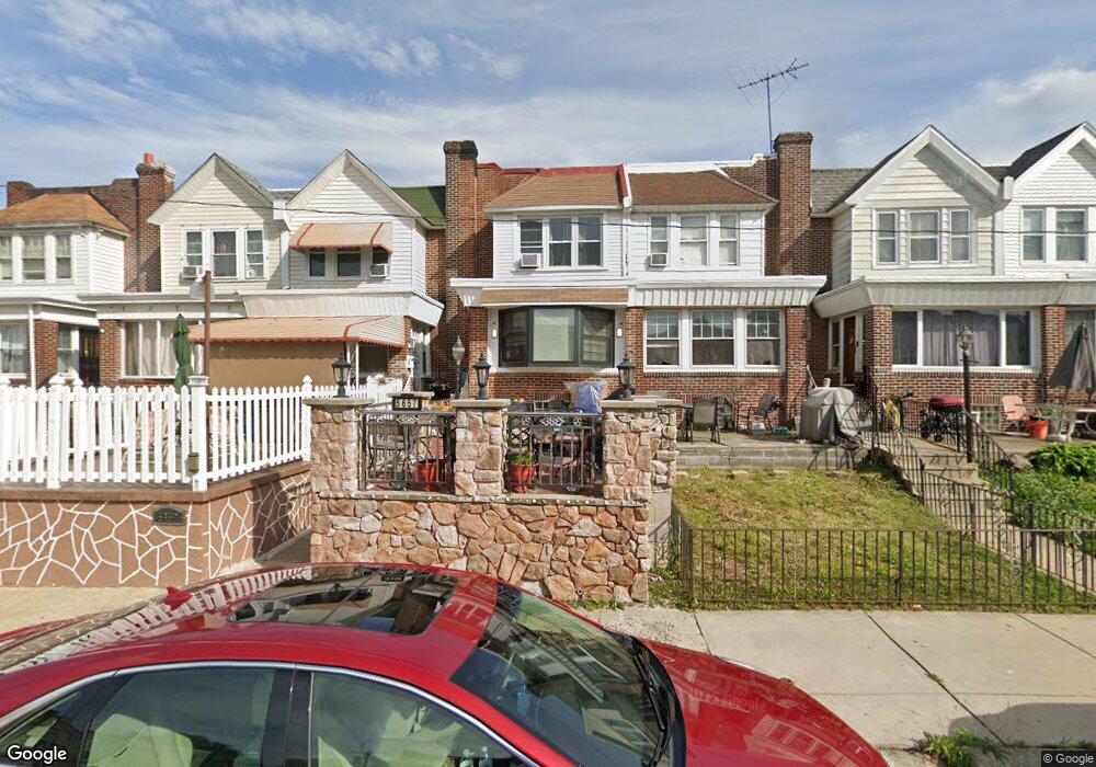
5657 Miriam Rd Philadelphia, PA 19124
Lawncrest NeighborhoodEstimated Value: $209,000 - $235,000
3
Beds
1
Bath
1,500
Sq Ft
$149/Sq Ft
Est. Value
About This Home
This home is located at 5657 Miriam Rd, Philadelphia, PA 19124 and is currently estimated at $223,148, approximately $148 per square foot. 5657 Miriam Rd is a home located in Philadelphia County with nearby schools including Laura H Carnell School, Harding Warren G Middle School, and Samuel Fels High School.
Ownership History
Date
Name
Owned For
Owner Type
Purchase Details
Closed on
Aug 19, 2003
Sold by
Hud
Bought by
Borgella Paule
Current Estimated Value
Home Financials for this Owner
Home Financials are based on the most recent Mortgage that was taken out on this home.
Original Mortgage
$63,451
Outstanding Balance
$29,157
Interest Rate
6.22%
Mortgage Type
Purchase Money Mortgage
Estimated Equity
$193,991
Purchase Details
Closed on
Apr 8, 2002
Sold by
Watson Darryl E and Northwest Mtg Inc
Bought by
Hud
Purchase Details
Closed on
Jul 24, 1998
Sold by
Overend Anthony P and Overend Patricia A
Bought by
Watson Darryl E
Create a Home Valuation Report for This Property
The Home Valuation Report is an in-depth analysis detailing your home's value as well as a comparison with similar homes in the area
Home Values in the Area
Average Home Value in this Area
Purchase History
| Date | Buyer | Sale Price | Title Company |
|---|---|---|---|
| Borgella Paule | $70,501 | Fidelity Natl Title Ins Co O | |
| Hud | $9,400 | -- | |
| Watson Darryl E | $64,400 | Lawyers Title Insurance Co |
Source: Public Records
Mortgage History
| Date | Status | Borrower | Loan Amount |
|---|---|---|---|
| Open | Borgella Paule | $63,451 |
Source: Public Records
Tax History Compared to Growth
Tax History
| Year | Tax Paid | Tax Assessment Tax Assessment Total Assessment is a certain percentage of the fair market value that is determined by local assessors to be the total taxable value of land and additions on the property. | Land | Improvement |
|---|---|---|---|---|
| 2025 | $2,115 | $191,600 | $38,320 | $153,280 |
| 2024 | $2,115 | $191,600 | $38,320 | $153,280 |
| 2023 | $2,115 | $151,100 | $30,220 | $120,880 |
| 2022 | $829 | $106,100 | $30,220 | $75,880 |
| 2021 | $1,459 | $0 | $0 | $0 |
| 2020 | $1,459 | $0 | $0 | $0 |
| 2019 | $1,400 | $0 | $0 | $0 |
| 2018 | $974 | $0 | $0 | $0 |
| 2017 | $1,394 | $0 | $0 | $0 |
| 2016 | $974 | $0 | $0 | $0 |
| 2015 | $933 | $0 | $0 | $0 |
| 2014 | -- | $99,600 | $17,835 | $81,765 |
| 2012 | -- | $14,944 | $2,106 | $12,838 |
Source: Public Records
Map
Nearby Homes
- 5659 Miriam Rd
- 5661 Miriam Rd
- 5640 Miriam Rd
- 991 Carver St
- 996 Anchor St
- 972 Bridge St
- 934 Brill St
- 1225 E Cheltenham Ave
- 1211 E Cheltenham Ave
- 925 E Sanger St
- 1048 Bridge St
- 929 1/2 Anchor St
- 912 Anchor St
- 1127 E Cheltenham Ave
- 5505 Loretto Ave
- 894 E Sanger St
- 5900 Loretto Ave
- 883 Brill St
- 889 Anchor St
- 1121 Alcott St
- 5655 Miriam Rd
- 5653 Miriam Rd
- 5651 Miriam Rd
- 5663 Miriam Rd
- 5649 Miriam Rd
- 5647 Miriam Rd
- 5645 Miriam Rd
- 5352 Roosevelt Blvd
- 5350 Roosevelt Blvd
- 5348 Roosevelt Blvd
- 5354 Roosevelt Blvd
- 5346 Roosevelt Blvd
- 5344 Roosevelt Blvd
- 5643 Miriam Rd
- 5342 Roosevelt Blvd
- 5356 Roosevelt Blvd
- 5340 Roosevelt Blvd
- 5338 Roosevelt Blvd
- 5641 Miriam Rd
- 5662 Miriam Rd