Estimated Value: $293,000 - $437,000
4
Beds
3
Baths
3,086
Sq Ft
$122/Sq Ft
Est. Value
About This Home
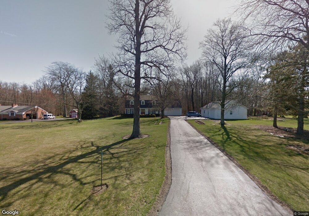
This home is located at 5664 County Road 35, Ada, OH 45810 and is currently estimated at $376,530, approximately $122 per square foot. 5664 County Road 35 is a home located in Hardin County with nearby schools including Ada Elementary School and Ada High School.
Ownership History
Date
Name
Owned For
Owner Type
Purchase Details
Closed on
Mar 16, 2006
Sold by
Hunt Dennis D and Hunt Linda H
Bought by
Graham Stewart A and Jean Daniel W
Current Estimated Value
Home Financials for this Owner
Home Financials are based on the most recent Mortgage that was taken out on this home.
Original Mortgage
$216,000
Interest Rate
6.33%
Mortgage Type
New Conventional
Purchase Details
Closed on
Sep 28, 2005
Sold by
Burton Bruce E and Burton Elizabeth J
Bought by
Hunt Dennis D and Hunt Linda H
Home Financials for this Owner
Home Financials are based on the most recent Mortgage that was taken out on this home.
Original Mortgage
$54,000
Interest Rate
5.93%
Mortgage Type
Credit Line Revolving
Purchase Details
Closed on
Sep 21, 1995
Bought by
Burton Bruce E Living Tr
Create a Home Valuation Report for This Property
The Home Valuation Report is an in-depth analysis detailing your home's value as well as a comparison with similar homes in the area
Home Values in the Area
Average Home Value in this Area
Purchase History
| Date | Buyer | Sale Price | Title Company |
|---|---|---|---|
| Graham Stewart A | $275,000 | None Available | |
| Hunt Dennis D | -- | None Available | |
| Burton Bruce E Living Tr | -- | -- |
Source: Public Records
Mortgage History
| Date | Status | Borrower | Loan Amount |
|---|---|---|---|
| Previous Owner | Graham Stewart A | $216,000 | |
| Previous Owner | Hunt Dennis D | $54,000 | |
| Previous Owner | Hunt Dennis D | $216,000 |
Source: Public Records
Tax History Compared to Growth
Tax History
| Year | Tax Paid | Tax Assessment Tax Assessment Total Assessment is a certain percentage of the fair market value that is determined by local assessors to be the total taxable value of land and additions on the property. | Land | Improvement |
|---|---|---|---|---|
| 2024 | $3,718 | $110,310 | $11,060 | $99,250 |
| 2023 | $3,718 | $110,310 | $11,060 | $99,250 |
| 2022 | $3,843 | $99,090 | $5,800 | $93,290 |
| 2021 | $4,233 | $99,090 | $5,800 | $93,290 |
| 2020 | $4,292 | $99,090 | $5,800 | $93,290 |
| 2019 | $3,691 | $87,410 | $5,590 | $81,820 |
| 2018 | $3,607 | $87,410 | $5,590 | $81,820 |
| 2017 | $1,772 | $87,410 | $5,590 | $81,820 |
| 2016 | $2,875 | $76,530 | $5,060 | $71,470 |
| 2015 | $3,195 | $76,530 | $5,060 | $71,470 |
| 2014 | $1,420 | $76,530 | $5,060 | $71,470 |
| 2013 | $1,512 | $77,080 | $5,060 | $72,020 |
Source: Public Records
Map
Nearby Homes
- 2864 Ohio 309
- 4071 Township Road 35
- 900 N Front St
- 623 S Gilbert St
- 710 S Main St
- 617 S Gilbert St
- 613 S Gilbert St
- 6782 County Road 15
- 3931 County Road 80
- 301 S Main St
- 203 Belmont St
- 314 E University Ave
- 308-310 S Simon St
- 211 W Buckeye Ave Unit 211 1/2
- 118 W Buckeye Ave
- 210 N Gilbert St
- 211 S Main St
- 212 N Simon St
- 442 Edwards St
- 444 Edwards St Unit A, B
- 5628 County Road 35
- 5710 County Road 35
- 5594 County Road 35
- 5635 County Road 35
- 5550 County Road 35
- 5827 County Road 35
- 5808 County Road 35
- 5480 County Road 35
- 5494 County Road 35
- 5871 Cr
- 5871 County Road 35
- 5460 County Road 35
- 5915 County Road 35
- 1991 State Route
- 5338 County Road 35
- 1991 Ohio 309
- 1991 State Route 309
- 5317 Cr
- 1968 State Route 309