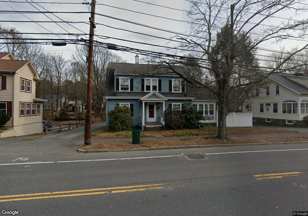
569 Lexington St Waltham, MA 02452
Piety Corner NeighborhoodEstimated Value: $909,000 - $933,997
2
Beds
3
Baths
1,951
Sq Ft
$474/Sq Ft
Est. Value
About This Home
This home is located at 569 Lexington St, Waltham, MA 02452 and is currently estimated at $925,249, approximately $474 per square foot. 569 Lexington St is a home located in Middlesex County with nearby schools including Thomas R Plympton Elementary School, John F Kennedy Middle School, and Waltham Sr High School.
Ownership History
Date
Name
Owned For
Owner Type
Purchase Details
Closed on
Dec 5, 2023
Sold by
Powers Diane S
Bought by
Diane S Day 2023 T S and Diane Day
Current Estimated Value
Purchase Details
Closed on
Dec 27, 1995
Sold by
Hubertus Marold
Bought by
Powers Diane S and Day Colin A
Home Financials for this Owner
Home Financials are based on the most recent Mortgage that was taken out on this home.
Original Mortgage
$142,400
Interest Rate
7.33%
Mortgage Type
Purchase Money Mortgage
Purchase Details
Closed on
Apr 2, 1993
Sold by
Homeowners Sb and Resolution Tr Corp
Bought by
Marold Hubertus
Purchase Details
Closed on
Mar 31, 1992
Sold by
Bourque Raoul
Bought by
Homeowners Sb
Create a Home Valuation Report for This Property
The Home Valuation Report is an in-depth analysis detailing your home's value as well as a comparison with similar homes in the area
Home Values in the Area
Average Home Value in this Area
Purchase History
| Date | Buyer | Sale Price | Title Company |
|---|---|---|---|
| Diane S Day 2023 T S | -- | None Available | |
| Powers Diane S | $178,000 | -- | |
| Marold Hubertus | $161,000 | -- | |
| Homeowners Sb | $157,250 | -- |
Source: Public Records
Mortgage History
| Date | Status | Borrower | Loan Amount |
|---|---|---|---|
| Previous Owner | Homeowners Sb | $142,400 | |
| Previous Owner | Homeowners Sb | $168,000 |
Source: Public Records
Tax History Compared to Growth
Tax History
| Year | Tax Paid | Tax Assessment Tax Assessment Total Assessment is a certain percentage of the fair market value that is determined by local assessors to be the total taxable value of land and additions on the property. | Land | Improvement |
|---|---|---|---|---|
| 2025 | $7,726 | $786,800 | $438,300 | $348,500 |
| 2024 | $7,555 | $783,700 | $438,300 | $345,400 |
| 2023 | $7,471 | $723,900 | $399,200 | $324,700 |
| 2022 | $7,509 | $674,100 | $364,500 | $309,600 |
| 2021 | $7,475 | $660,300 | $364,500 | $295,800 |
| 2020 | $7,209 | $603,300 | $329,800 | $273,500 |
| 2019 | $4,548 | $551,500 | $323,400 | $228,100 |
| 2018 | $5,508 | $504,800 | $299,400 | $205,400 |
| 2017 | $6,014 | $478,800 | $273,400 | $205,400 |
| 2016 | $5,648 | $461,400 | $256,000 | $205,400 |
| 2015 | $5,694 | $433,700 | $243,000 | $190,700 |
Source: Public Records
Map
Nearby Homes
- 511 Lexington St
- 49 Lincoln St
- 28 College Farm Rd Unit 2
- 44 Sachem St
- 16 Winter St Unit 26C
- 14 Piedmont Ave
- 65 Montclair Ave
- 326 Bacon St
- 28 Hillcrest St
- 129 Lake St
- 30 Wampum Ave
- 15 Cedarcroft Ln
- 234 Lake St
- 14 Claremont St
- 249 Lake St
- 70 Rosewood Dr
- 92 Milner St
- 463 Lincoln St
- 116 Raffaele Dr
- 30 Jacqueline Rd Unit C
- 575 Lexington St
- 563 Lexington St
- 579 Lexington St
- 561 Lexington St
- 12 Stanley Rd
- 36 Chester Brook Rd
- 583 Lexington St
- 561 Lexington St(stanley Rd Drive)
- 40 Chester Brook Rd
- 26 Chester Brook Rd
- 587 Lexington St
- 574 Lexington St
- 562 Lexington St
- 3 Chest Brook Rd
- 18 Chester Brook Rd
- 564 Lexington St Unit 1
- 564 Lexington St
- 50 Chester Brook Rd
- 549 Lexington St
- 578 Lexington St