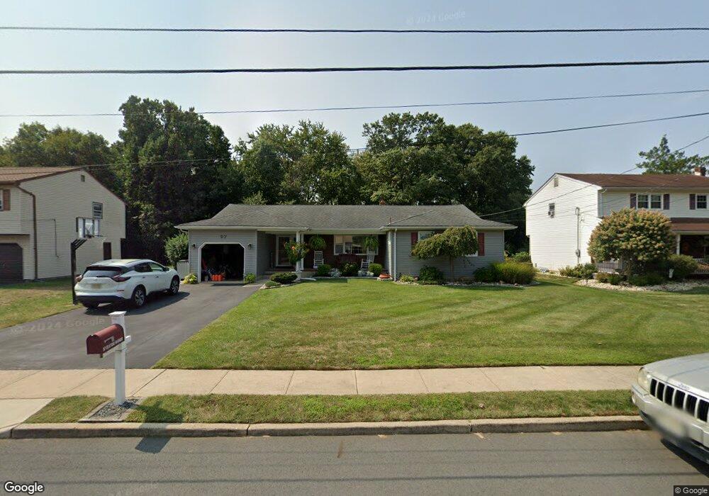
57 Elkton Ave Trenton, NJ 08619
Estimated Value: $518,000 - $580,000
4
Beds
2
Baths
2,096
Sq Ft
$263/Sq Ft
Est. Value
About This Home
This home is located at 57 Elkton Ave, Trenton, NJ 08619 and is currently estimated at $550,473, approximately $262 per square foot. 57 Elkton Ave is a home located in Mercer County with nearby schools including Kuser Elementary School, Emily C. Reynolds Middle School, and Steinert - Hamilton High East.
Ownership History
Date
Name
Owned For
Owner Type
Purchase Details
Closed on
May 13, 2010
Sold by
Ellmer Kenneth R and Ellmer Linda R
Bought by
Urbanski Amanda and Dzwilewski Christopher
Current Estimated Value
Home Financials for this Owner
Home Financials are based on the most recent Mortgage that was taken out on this home.
Original Mortgage
$305,250
Outstanding Balance
$206,392
Interest Rate
5.23%
Mortgage Type
FHA
Estimated Equity
$344,081
Create a Home Valuation Report for This Property
The Home Valuation Report is an in-depth analysis detailing your home's value as well as a comparison with similar homes in the area
Home Values in the Area
Average Home Value in this Area
Purchase History
| Date | Buyer | Sale Price | Title Company |
|---|---|---|---|
| Urbanski Amanda | $317,500 | Multiple |
Source: Public Records
Mortgage History
| Date | Status | Borrower | Loan Amount |
|---|---|---|---|
| Open | Urbanski Amanda | $305,250 |
Source: Public Records
Tax History Compared to Growth
Tax History
| Year | Tax Paid | Tax Assessment Tax Assessment Total Assessment is a certain percentage of the fair market value that is determined by local assessors to be the total taxable value of land and additions on the property. | Land | Improvement |
|---|---|---|---|---|
| 2025 | $10,699 | $303,600 | $83,200 | $220,400 |
| 2024 | $10,028 | $303,600 | $83,200 | $220,400 |
| 2023 | $10,028 | $303,600 | $83,200 | $220,400 |
| 2022 | $9,870 | $303,600 | $83,200 | $220,400 |
| 2021 | $11,333 | $303,600 | $83,200 | $220,400 |
| 2020 | $10,240 | $303,600 | $83,200 | $220,400 |
| 2019 | $9,973 | $303,600 | $83,200 | $220,400 |
| 2018 | $9,861 | $303,600 | $83,200 | $220,400 |
| 2017 | $9,357 | $303,600 | $83,200 | $220,400 |
| 2016 | $8,209 | $303,600 | $83,200 | $220,400 |
| 2015 | $8,630 | $177,600 | $53,800 | $123,800 |
| 2014 | $8,491 | $177,600 | $53,800 | $123,800 |
Source: Public Records
Map
Nearby Homes
- 14 Chester Ave
- 176 Pope Ave
- 319 Cypress Ln
- L:25 Mandl St
- 61 Leuckel Ave
- 25 Brook Ln
- 20 Leuckel Ave
- 90 Sundance Dr
- 125 Sundance Dr
- 16 Merovan Ave
- 1523 Cornell Ave
- 226 Saybrook Ave
- 121 Dickinson Ave
- 235 Darcy Ave
- 1427 Hamilton Ave
- 144 Beal St
- 448 Lynwood Ave
- 51 Charlotte Ave
- 20 Charlotte Ave
- 618 Atlantic Ave