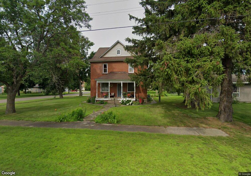
57 Fir Ave SW Richmond, MN 56368
Estimated Value: $211,679 - $281,000
4
Beds
2
Baths
1,464
Sq Ft
$165/Sq Ft
Est. Value
About This Home
This home is located at 57 Fir Ave SW, Richmond, MN 56368 and is currently estimated at $241,920, approximately $165 per square foot. 57 Fir Ave SW is a home located in Stearns County with nearby schools including Rocori Senior High School.
Ownership History
Date
Name
Owned For
Owner Type
Purchase Details
Closed on
Mar 14, 2017
Sold by
Holthaus Jonathon E
Bought by
Heinen Anne
Current Estimated Value
Purchase Details
Closed on
Jul 10, 2008
Sold by
Binsfeld Thomas A and Binsfeld Kris L
Bought by
Holthaus Jonathan E
Purchase Details
Closed on
Jul 9, 2004
Sold by
Kascht Melvin
Bought by
Binsfeld Thomas Etal
Create a Home Valuation Report for This Property
The Home Valuation Report is an in-depth analysis detailing your home's value as well as a comparison with similar homes in the area
Home Values in the Area
Average Home Value in this Area
Purchase History
| Date | Buyer | Sale Price | Title Company |
|---|---|---|---|
| Heinen Anne | $138,000 | First American Title Company | |
| Holthaus Jonathan E | $140,000 | -- | |
| Binsfeld Thomas Etal | $175,000 | -- |
Source: Public Records
Tax History Compared to Growth
Tax History
| Year | Tax Paid | Tax Assessment Tax Assessment Total Assessment is a certain percentage of the fair market value that is determined by local assessors to be the total taxable value of land and additions on the property. | Land | Improvement |
|---|---|---|---|---|
| 2025 | $1,588 | $162,700 | $27,400 | $135,300 |
| 2024 | $1,588 | $150,300 | $27,400 | $122,900 |
| 2023 | $1,410 | $137,100 | $25,200 | $111,900 |
| 2022 | $1,346 | $114,200 | $23,000 | $91,200 |
| 2021 | $1,352 | $114,200 | $23,000 | $91,200 |
| 2020 | $1,410 | $113,200 | $23,000 | $90,200 |
| 2019 | $1,956 | $112,800 | $21,200 | $91,600 |
| 2018 | $1,254 | $99,700 | $19,800 | $79,900 |
| 2017 | $1,560 | $93,200 | $19,800 | $73,400 |
| 2016 | $1,546 | $0 | $0 | $0 |
| 2015 | $1,478 | $0 | $0 | $0 |
| 2014 | -- | $0 | $0 | $0 |
Source: Public Records
Map
Nearby Homes
- 261 Main St W
- 205 Grant Ave SW
- 148 Main St W
- 577 Main St W
- 153 Central Ave S
- 232 Main St E
- 101 Barry Loop NW
- 22296 Hall Ave SW
- 448 1st St NE
- 464 Main St E
- XXX Eastfield Dr
- 21107 State Highway 23
- 22579 Fordham Rd
- 20734 Black Cherry Dr
- 21312 State Highway 22 #4
- 21312 State Highway 22 Unit 20
- 21312 State Highway 22 Unit 25
- 22314 Mallard Ct
- 20554 Elkview Ct
- 20568 Elkview Ct
- 55 Fir Ave SW
- 109 Fir Ave SW
- 325 Main St W
- 335 Main St W
- 360 1st St SW Unit 584
- 260 1st St SW
- 305 Main St W
- 341 1st St SW
- 345 Main St W
- 315 Main St W
- 261 1st St SW
- 104 104 Elm-Avenue-sw
- 400 400 1st-Avenue-sw
- 355 Main St W
- 104 Elm Ave SW
- 365 Main St W
- 240 1st St SW
- 145 Fir Ave SW
- 241 1st St SW
- 134 Elm Ave SW