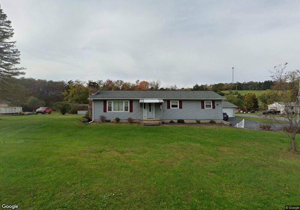
571 Derr Hill Rd Lock Haven, PA 17745
Estimated Value: $283,916 - $311,000
3
Beds
2
Baths
2,936
Sq Ft
$101/Sq Ft
Est. Value
About This Home
This home is located at 571 Derr Hill Rd, Lock Haven, PA 17745 and is currently estimated at $296,229, approximately $100 per square foot. 571 Derr Hill Rd is a home located in Clinton County with nearby schools including Jersey Shore Area Senior High School and Walnut Street Christian School.
Ownership History
Date
Name
Owned For
Owner Type
Purchase Details
Closed on
Mar 21, 2014
Sold by
Logue Sharon R and Logue Thomas C
Bought by
Logue Sharon R and Logue Thomas C
Current Estimated Value
Purchase Details
Closed on
Aug 20, 2008
Sold by
Logue Sharon R and Logue Thomas C
Bought by
Logue Sharon R and Logue Thomas C
Home Financials for this Owner
Home Financials are based on the most recent Mortgage that was taken out on this home.
Original Mortgage
$133,980
Interest Rate
6.13%
Mortgage Type
FHA
Purchase Details
Closed on
Jun 13, 2005
Sold by
Baker Sharon R and Prough Sharon R
Bought by
Prough Sharon R and Logue Thomas C
Home Financials for this Owner
Home Financials are based on the most recent Mortgage that was taken out on this home.
Original Mortgage
$80,000
Interest Rate
6.5%
Mortgage Type
Assumption
Create a Home Valuation Report for This Property
The Home Valuation Report is an in-depth analysis detailing your home's value as well as a comparison with similar homes in the area
Home Values in the Area
Average Home Value in this Area
Purchase History
| Date | Buyer | Sale Price | Title Company |
|---|---|---|---|
| Logue Sharon R | -- | None Available | |
| Logue Sharon R | -- | None Available | |
| Prough Sharon R | -- | None Available |
Source: Public Records
Mortgage History
| Date | Status | Borrower | Loan Amount |
|---|---|---|---|
| Closed | Logue Sharon R | $133,980 | |
| Closed | Prough Sharon R | $80,000 |
Source: Public Records
Tax History Compared to Growth
Tax History
| Year | Tax Paid | Tax Assessment Tax Assessment Total Assessment is a certain percentage of the fair market value that is determined by local assessors to be the total taxable value of land and additions on the property. | Land | Improvement |
|---|---|---|---|---|
| 2025 | $2,675 | $120,600 | $21,300 | $99,300 |
| 2024 | $2,623 | $120,600 | $21,300 | $99,300 |
| 2023 | $2,580 | $120,600 | $21,300 | $99,300 |
| 2022 | $2,543 | $120,600 | $21,300 | $99,300 |
| 2021 | $2,554 | $120,600 | $21,300 | $99,300 |
| 2020 | $2,537 | $120,600 | $0 | $0 |
| 2019 | $2,453 | $120,600 | $0 | $0 |
| 2018 | $2,349 | $120,600 | $0 | $0 |
| 2017 | $2,317 | $120,600 | $0 | $0 |
| 2016 | $2,036 | $120,600 | $0 | $0 |
| 2015 | $1,929 | $120,600 | $0 | $0 |
| 2014 | $2,080 | $118,500 | $0 | $0 |
Source: Public Records
Map
Nearby Homes
- 315 Clinton St
- 407 Fairview St
- Lot 7B Hemlock Ridge Rd
- 2660 Woodward Ave
- 15 W Sylvan Ave
- 109 W Central Ave
- 105 W Central Ave
- 133 Riverview Dr
- 2435 Woodward Ave
- 112 E Lincoln Ave
- 54 Avis Manor Cir
- 30 Woodcock Dr
- 8 Manor Village Ave
- 25 Woodcock Dr
- 6 Avis Ln
- 103A E Summit St
- 861 3rd St
- 320 E Central Ave
- 715 Park Ave
- 43 Drake Ln
- 557 Derr Hill Rd
- 570 Derr Hill Rd
- 535 Derr Hill Rd
- 17 Parrothead Ln
- 521 Derr Hill Rd
- 848 Gravel Hill Rd
- 516 Derr Hill Rd
- 18 Parrothead Ln
- 501 Derr Hill Rd
- 510 Derr Hill Rd
- 500 Derr Hill Rd
- 505 Derr Hill Rd
- 474 Spong Hollow Rd
- 783 Gravel Hill Rd
- 455 Spong Hollow Rd
- 17 Green Ln
- 86 Foxtrot Ln
- 73 Green Ln
- 467 Derr Hill Rd
- 457 Derr Hill Rd