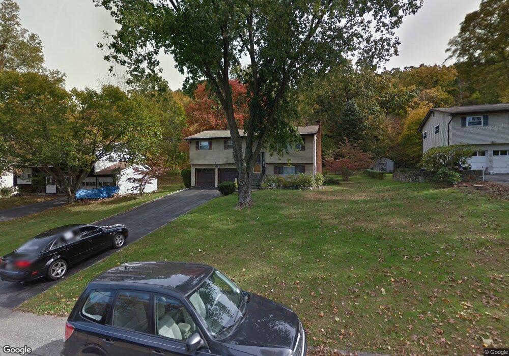
571 Westbrook Dr Cortlandt Manor, NY 10567
Estimated Value: $608,000 - $655,000
4
Beds
2
Baths
1,930
Sq Ft
$325/Sq Ft
Est. Value
About This Home
This home is located at 571 Westbrook Dr, Cortlandt Manor, NY 10567 and is currently estimated at $626,625, approximately $324 per square foot. 571 Westbrook Dr is a home located in Westchester County with nearby schools including George Washington Elementary School, Lakeland-Copper Beech Middle School, and Walter Panas High School.
Ownership History
Date
Name
Owned For
Owner Type
Purchase Details
Closed on
Jul 22, 2024
Sold by
Jennings David
Bought by
Tamayo Paula and Medina Hector
Current Estimated Value
Home Financials for this Owner
Home Financials are based on the most recent Mortgage that was taken out on this home.
Original Mortgage
$240,000
Outstanding Balance
$237,067
Interest Rate
6.87%
Mortgage Type
New Conventional
Estimated Equity
$389,558
Purchase Details
Closed on
Oct 6, 2011
Sold by
Cioffi Dorothy and Cioffi Joseph
Bought by
Jennings David
Home Financials for this Owner
Home Financials are based on the most recent Mortgage that was taken out on this home.
Original Mortgage
$306,716
Interest Rate
4.25%
Mortgage Type
FHA
Create a Home Valuation Report for This Property
The Home Valuation Report is an in-depth analysis detailing your home's value as well as a comparison with similar homes in the area
Home Values in the Area
Average Home Value in this Area
Purchase History
| Date | Buyer | Sale Price | Title Company |
|---|---|---|---|
| Tamayo Paula | $300,000 | Stewart Title | |
| Jennings David | $320,000 | The Judicial Title Insurance |
Source: Public Records
Mortgage History
| Date | Status | Borrower | Loan Amount |
|---|---|---|---|
| Open | Tamayo Paula | $240,000 | |
| Previous Owner | Jennings David | $306,716 |
Source: Public Records
Tax History Compared to Growth
Tax History
| Year | Tax Paid | Tax Assessment Tax Assessment Total Assessment is a certain percentage of the fair market value that is determined by local assessors to be the total taxable value of land and additions on the property. | Land | Improvement |
|---|---|---|---|---|
| 2024 | $12,316 | $6,150 | $725 | $5,425 |
| 2023 | $11,450 | $6,150 | $725 | $5,425 |
| 2022 | $11,139 | $6,150 | $725 | $5,425 |
| 2021 | $10,902 | $6,150 | $725 | $5,425 |
| 2020 | $10,918 | $6,150 | $725 | $5,425 |
| 2019 | $12,757 | $6,150 | $725 | $5,425 |
| 2018 | $10,361 | $6,150 | $725 | $5,425 |
| 2017 | $6,665 | $6,150 | $725 | $5,425 |
| 2016 | $12,224 | $6,150 | $725 | $5,425 |
| 2015 | -- | $6,150 | $725 | $5,425 |
| 2014 | -- | $6,150 | $725 | $5,425 |
| 2013 | -- | $6,150 | $725 | $5,425 |
Source: Public Records
Map
Nearby Homes
- 52 Winthrop Dr
- 33 Hollowbrook Ct N
- 63 Wild Birch Farms
- 53 Wild Birch Farms Unit 53
- 22 Richmond Place
- 1061 Oregon Rd
- 30 Trolley Rd
- 2 Merion Ct
- 55 Red Mill Rd
- 194 Frederick St
- 506 Westbrook Dr
- 34 Young St
- 101 Allan St
- 239 Millington Rd
- 0 Sherwood Rd Unit KEY936479
- 0 Sherwood Rd Unit KEY936474
- 27 Spruce St
- 14 Pine St
- 270 Locust Ave
- 5 Spruce St
- 569 Westbrook Dr
- 573 Westbrook Dr
- 575 Westbrook Dr
- 567 Westbrook Dr
- 570 Westbrook Dr
- 572 Westbrook Dr
- 565 Westbrook Dr
- 577 Westbrook Dr
- 568 Westbrook Dr
- 563 Westbrook Dr
- 574 Westbrook Dr
- 566 Westbrook Dr
- 579 Westbrook Dr
- 578 Westbrook Dr
- 576 Westbrook Dr
- 35 Fawn Ridge Dr
- 564 Westbrook Dr Unit A
- 564 Westbrook Dr
- 561 Westbrook Dr
- 37 Fawn Ridge Dr