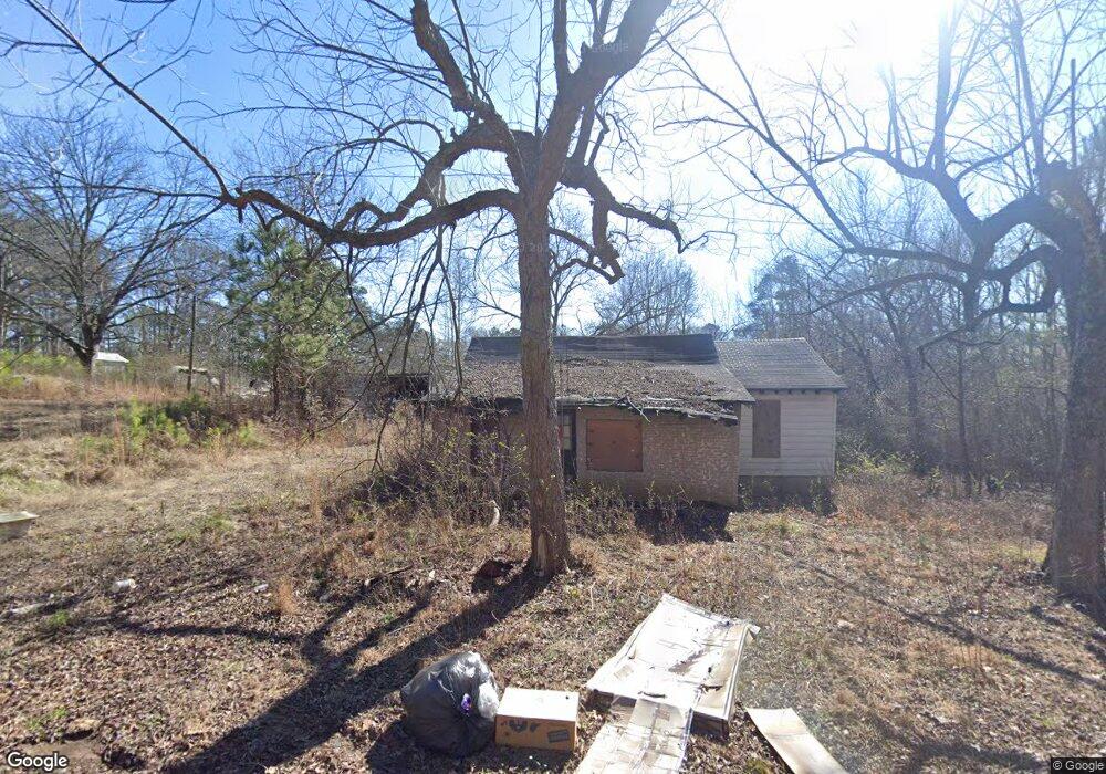
5719 Westbrook Rd Atlanta, GA 30349
Estimated Value: $85,915 - $271,000
4
Beds
2
Baths
1,867
Sq Ft
$82/Sq Ft
Est. Value
About This Home
This home is located at 5719 Westbrook Rd, Atlanta, GA 30349 and is currently estimated at $153,638, approximately $82 per square foot. 5719 Westbrook Rd is a home with nearby schools including C. H. Gullatt Elementary School, Camp Creek Middle School, and Creekside High School.
Ownership History
Date
Name
Owned For
Owner Type
Purchase Details
Closed on
Jun 16, 2020
Sold by
Daniels William Stanley
Bought by
Project 5719 Westbrook Llc
Current Estimated Value
Purchase Details
Closed on
Aug 27, 2013
Sold by
Black Jimmy Wakeley
Bought by
Black Jimmy Wakeley
Purchase Details
Closed on
Jan 17, 2012
Sold by
Clark Lamar
Bought by
Black Jimmy W and Black Ronald E
Create a Home Valuation Report for This Property
The Home Valuation Report is an in-depth analysis detailing your home's value as well as a comparison with similar homes in the area
Home Values in the Area
Average Home Value in this Area
Purchase History
| Date | Buyer | Sale Price | Title Company |
|---|---|---|---|
| Project 5719 Westbrook Llc | -- | -- | |
| Daniels William | $57,000 | -- | |
| Patriot Home Buyers Llc | $30,000 | -- | |
| Black Jimmy Wakeley | -- | -- | |
| Black Jimmy W | $70,000 | -- |
Source: Public Records
Tax History Compared to Growth
Tax History
| Year | Tax Paid | Tax Assessment Tax Assessment Total Assessment is a certain percentage of the fair market value that is determined by local assessors to be the total taxable value of land and additions on the property. | Land | Improvement |
|---|---|---|---|---|
| 2025 | $328 | $25,840 | $21,520 | $4,320 |
| 2023 | $328 | $30,880 | $3,600 | $27,280 |
| 2022 | $1,211 | $30,880 | $3,600 | $27,280 |
| 2021 | $1,140 | $28,480 | $2,600 | $25,880 |
| 2020 | $1,001 | $24,600 | $1,600 | $23,000 |
| 2019 | $956 | $24,200 | $1,600 | $22,600 |
| 2018 | $723 | $18,160 | $1,320 | $16,840 |
| 2017 | $556 | $13,640 | $1,120 | $12,520 |
| 2016 | $556 | $13,640 | $1,120 | $12,520 |
| 2015 | $558 | $13,640 | $1,120 | $12,520 |
| 2014 | $588 | $13,640 | $1,120 | $12,520 |
Source: Public Records
Map
Nearby Homes
- 5565 Mason Rd Unit REAR
- 4861 Wexford Trail
- 4830 Station Ln
- 4832 Station Ln Unit 12
- 4834 Station Ln
- 4834 Station Ln Unit 13
- 4836 Station Ln Unit 14
- 4418 Gladewood Run
- 4838 Station Ln Unit 15
- 4838 Station Ln
- 4840 Station Ln
- 4809 Dodson Rd
- 4759 Dodson Rd
- 4818 Station Ln
- 4822 Station Ln
- 4814 Station Ln
- 4817 Station Ln Unit 32
- 4813 Station Ln
- Cecil Plan at The Enclave at Stonewall Station
- Nelson Plan at The Enclave at Stonewall Station
- 4800 Westbrook Rd
- 4800 Westbrook Rd
- 0 Westbrook Dr Unit 7049608
- 4760 Westbrook Rd
- 4740 Westbrook Rd
- 5800 Westbrook Rd
- 4730 Westbrook Rd
- 4820 Westbrook Rd
- 0 Westbrook Rd
- 0 Westbrook Rd Unit 3206523
- 0 Westbrook Rd Unit 8566496
- 0 Westbrook Rd Unit 3160385
- 0 Westbrook Rd Unit 7073327
- 0 Westbrook Rd Unit 7073286
- 0 Westbrook Rd Unit 4302796
- 0 Westbrook Dr Rear Unit 40 7049678
- 4880 Westbrook Rd
- 5600 Mason Rd
- 4900 Westbrook Rd
- 5590 Mason Rd