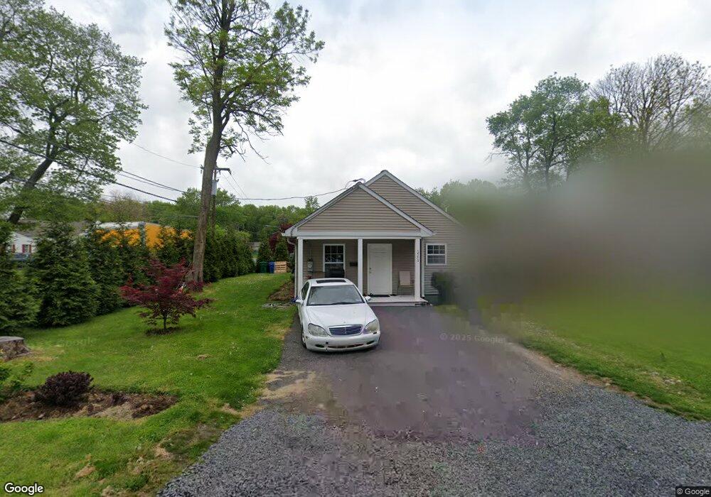
5755 Watson Ave Bristol, PA 19007
Estimated Value: $256,000 - $360,000
--
Bed
1
Bath
1,296
Sq Ft
$236/Sq Ft
Est. Value
About This Home
This home is located at 5755 Watson Ave, Bristol, PA 19007 and is currently estimated at $306,101, approximately $236 per square foot. 5755 Watson Ave is a home with nearby schools including Truman Senior High School, First Presbyterian Church School, and St. Mark Elementary School.
Ownership History
Date
Name
Owned For
Owner Type
Purchase Details
Closed on
Oct 30, 2013
Sold by
Bucks County Community Building Initiati
Bought by
Nduthu Muthoni
Current Estimated Value
Home Financials for this Owner
Home Financials are based on the most recent Mortgage that was taken out on this home.
Original Mortgage
$25,300
Outstanding Balance
$18,875
Interest Rate
4.24%
Mortgage Type
Unknown
Estimated Equity
$287,226
Purchase Details
Closed on
Feb 10, 2011
Sold by
Nelson Clifford N
Bought by
Habitat For Humanity Of Bucks County Inc
Purchase Details
Closed on
Jan 5, 2005
Sold by
Mariano Rocco Anthony
Bought by
Nelson Clifford N
Create a Home Valuation Report for This Property
The Home Valuation Report is an in-depth analysis detailing your home's value as well as a comparison with similar homes in the area
Home Values in the Area
Average Home Value in this Area
Purchase History
| Date | Buyer | Sale Price | Title Company |
|---|---|---|---|
| Nduthu Muthoni | $207,000 | None Available | |
| Bucks County Community Building Initiati | -- | None Available | |
| Habitat For Humanity Of Bucks County Inc | $70,000 | None Available | |
| Nelson Clifford N | $45,000 | Brokers Abstract & Search-Bi |
Source: Public Records
Mortgage History
| Date | Status | Borrower | Loan Amount |
|---|---|---|---|
| Open | Bucks County Community Building Initiati | $25,300 | |
| Open | Nduthu Muthoni | $116,700 | |
| Closed | Bucks County Community Building Initiati | $0 |
Source: Public Records
Tax History Compared to Growth
Tax History
| Year | Tax Paid | Tax Assessment Tax Assessment Total Assessment is a certain percentage of the fair market value that is determined by local assessors to be the total taxable value of land and additions on the property. | Land | Improvement |
|---|---|---|---|---|
| 2025 | $4,323 | $15,920 | $1,640 | $14,280 |
| 2024 | $4,323 | $15,920 | $1,640 | $14,280 |
| 2023 | $4,292 | $15,920 | $1,640 | $14,280 |
| 2022 | $4,292 | $15,920 | $1,640 | $14,280 |
| 2021 | $4,292 | $15,920 | $1,640 | $14,280 |
| 2020 | $4,292 | $15,920 | $1,640 | $14,280 |
| 2019 | $4,276 | $15,920 | $1,640 | $14,280 |
| 2018 | $4,207 | $15,920 | $1,640 | $14,280 |
| 2017 | $4,143 | $15,920 | $1,640 | $14,280 |
| 2016 | $4,143 | $15,920 | $1,640 | $14,280 |
| 2015 | $3,213 | $15,920 | $1,640 | $14,280 |
| 2014 | $3,213 | $1,320 | $1,320 | $0 |
Source: Public Records
Map
Nearby Homes
- 5617 Beaver Dam Rd
- 5605 Toga St
- 5517 Schumacher Dr
- 5 Green Ln
- 1201 Pacific Ave
- 1515 Lakeland Ave
- 5604 Fleetwing Dr
- 314 Railroad Ave
- 2205 Liberator St
- 5711 Mustang St
- 61 Green Ln
- 221 Cleveland St
- 6419 Radcliffe St
- 905 Garden St
- 243 Monroe St
- 2296 Seabird Dr Unit 1
- 2285 Seabird Dr Unit 14
- 16434 River View Cir
- 16442 River View Cir
- 16422 River View Cir
- 5753 Watson Ave
- 5704 Atkins Ave
- 5700 Plymouth Ave
- 5715 Watson Ave
- 5710 Atkins Ave
- 1220 Plymouth Ave
- 5714 Atkins Ave
- 1214 Plymouth Ave
- 1243 Plymouth Ave
- 5607 Truman St
- 5709 Atkins Ave
- 1245 Plymouth Ave
- 5604 Turner St
- 5604 Truman St
- 5715 Atkins Ave
- 5726 Atkins Ave
- 5713 Elwood Ave
- 1230 Norton Ave
- 5605 Truman St
- 5719 Atkins Ave