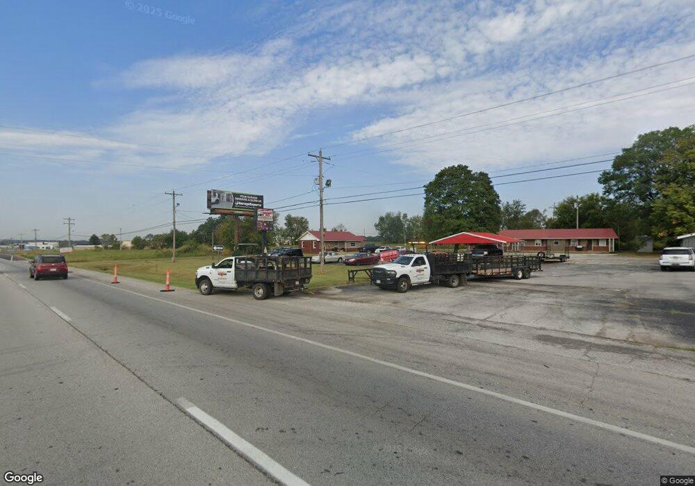
5759 W Us Highway 60 Brookline, MO 65619
--
Bed
--
Bath
5,837
Sq Ft
2
Acres
About This Home
This home is located at 5759 W Us Highway 60, Brookline, MO 65619. 5759 W Us Highway 60 is a home located in Greene County with nearby schools including Price Elementary School, Republic Middle School, and Republic High School.
Ownership History
Date
Name
Owned For
Owner Type
Purchase Details
Closed on
May 30, 2018
Sold by
Clydedale Farm Llc
Bought by
Gatley Christopher Eric
Purchase Details
Closed on
May 1, 2018
Sold by
Carson Richard L and Revocable Trust Agreement Of R
Bought by
Clydesdale Farm Llc
Purchase Details
Closed on
Jul 17, 2017
Sold by
Gatley Chris
Bought by
Clydesdale Ranch Llc
Purchase Details
Closed on
Dec 13, 2013
Sold by
Gatley Chris
Bought by
417 Rentals Llc
Home Financials for this Owner
Home Financials are based on the most recent Mortgage that was taken out on this home.
Original Mortgage
$460,000
Interest Rate
4.14%
Mortgage Type
Future Advance Clause Open End Mortgage
Purchase Details
Closed on
Jan 4, 2013
Sold by
Secretary Of Hud
Bought by
Gatley Chris
Purchase Details
Closed on
Sep 9, 2008
Sold by
Sun Security Bank
Bought by
417 Rentals Llc
Create a Home Valuation Report for This Property
The Home Valuation Report is an in-depth analysis detailing your home's value as well as a comparison with similar homes in the area
Home Values in the Area
Average Home Value in this Area
Purchase History
| Date | Buyer | Sale Price | Title Company |
|---|---|---|---|
| Gatley Christopher Eric | -- | None Available | |
| Clydesdale Farm Llc | -- | None Available | |
| Clydesdale Ranch Llc | -- | None Available | |
| 417 Rentals Llc | -- | None Available | |
| Gatley Chris | -- | None Available | |
| 417 Rentals Llc | -- | None Available |
Source: Public Records
Mortgage History
| Date | Status | Borrower | Loan Amount |
|---|---|---|---|
| Previous Owner | 417 Rentals Llc | $460,000 |
Source: Public Records
Tax History Compared to Growth
Tax History
| Year | Tax Paid | Tax Assessment Tax Assessment Total Assessment is a certain percentage of the fair market value that is determined by local assessors to be the total taxable value of land and additions on the property. | Land | Improvement |
|---|---|---|---|---|
| 2025 | $4,480 | $72,230 | $34,430 | $37,800 |
| 2024 | $4,480 | $68,810 | $28,930 | $39,880 |
| 2023 | $4,403 | $68,810 | $28,930 | $39,880 |
| 2022 | $4,437 | $68,790 | $28,930 | $39,860 |
| 2021 | $4,437 | $68,790 | $28,930 | $39,860 |
| 2020 | $4,168 | $69,100 | $28,930 | $40,170 |
| 2019 | $4,155 | $69,100 | $28,930 | $40,170 |
| 2018 | $3,900 | $62,850 | $28,930 | $33,920 |
| 2017 | $3,875 | $67,230 | $28,930 | $38,300 |
| 2016 | $4,188 | $67,230 | $28,930 | $38,300 |
| 2015 | $4,185 | $67,230 | $28,930 | $38,300 |
| 2014 | -- | $61,970 | $28,930 | $33,040 |
Source: Public Records
Map
Nearby Homes
- 4041 S Farm Road 107
- 4085 E Ashwood Ct
- 4082 E Ashwood Ct
- 4093 E Ashwood St
- 1755 N Boxwood Dr
- 4058 E Ashwood Ct
- 4090 E Ashwood Ct
- 4074 E Ashwood Ct
- 4098 E Ashwood Ct
- 3920 E Linden Ln
- The Charleston Plan at Wilson's Valley
- The Mesa W/Basement Plan at Wilson's Valley
- The Manhattan Plan at Wilson's Valley
- The Savannah Plan at Wilson's Valley
- The Aspen W/Basement Plan at Wilson's Valley
- The Dayton Plan at Wilson's Valley
- The Charleston W/Basement Plan at Wilson's Valley
- The Mesa Plan at Wilson's Valley
- The Tampa Plan at Wilson's Valley
- The Edgewood Plan at Wilson's Valley
- 5759 U S 60
- 5800 U S 60
- 5849 W Us Highway 60
- 5849 W Us Highway 60
- 5840 U S 60
- 5849 Us-60
- 5850 W Us Hwy 60
- 5850 W Hwy 60
- 5850 U S 60 Unit B
- 5850 U S 60
- 5850 U S 60 Unit G
- 5850 U S 60 Unit D
- 5850 U S 60 Unit E
- 5850 U S 60 Unit F
- 5850 U S 60 Unit A
- 5850 U S 60 Unit H
- 5850 U S 60 Unit C
- 5850 U S 60 Unit 1
- 3276 S Farm Road 107
- 5730 W Us Highway 60