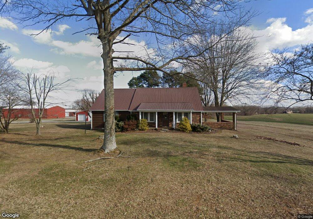
5767 Highland Rd Orlinda, TN 37141
Estimated Value: $536,000 - $1,474,018
--
Bed
1
Bath
2,435
Sq Ft
$413/Sq Ft
Est. Value
About This Home
This home is located at 5767 Highland Rd, Orlinda, TN 37141 and is currently estimated at $1,005,009, approximately $412 per square foot. 5767 Highland Rd is a home located in Robertson County with nearby schools including East Robertson Elementary School and East Robertson High School.
Ownership History
Date
Name
Owned For
Owner Type
Purchase Details
Closed on
Nov 2, 2023
Sold by
Stark Ronnie and Stark Valerie Dawn
Bought by
Stark Valerie Dawn and Stark Wade Dean
Current Estimated Value
Purchase Details
Closed on
Jul 8, 2011
Sold by
Stark Ronnie
Bought by
Stroud Christopher K
Purchase Details
Closed on
May 4, 2006
Sold by
Ronnie Stark
Bought by
Ronnie Stark and Dawn Valerie
Purchase Details
Closed on
Apr 26, 1996
Sold by
Cook E W
Bought by
Jerry Cook and Jerry Beatrice R
Purchase Details
Closed on
May 9, 1973
Bought by
Stark Ronnie
Create a Home Valuation Report for This Property
The Home Valuation Report is an in-depth analysis detailing your home's value as well as a comparison with similar homes in the area
Home Values in the Area
Average Home Value in this Area
Purchase History
| Date | Buyer | Sale Price | Title Company |
|---|---|---|---|
| Stark Valerie Dawn | -- | None Listed On Document | |
| Stroud Christopher K | $10,000 | -- | |
| Ronnie Stark | -- | -- | |
| Jerry Cook | $7,000 | -- | |
| Stark Ronnie | -- | -- |
Source: Public Records
Tax History Compared to Growth
Tax History
| Year | Tax Paid | Tax Assessment Tax Assessment Total Assessment is a certain percentage of the fair market value that is determined by local assessors to be the total taxable value of land and additions on the property. | Land | Improvement |
|---|---|---|---|---|
| 2024 | $2,079 | $115,475 | $66,175 | $49,300 |
| 2023 | $2,079 | $115,475 | $66,175 | $49,300 |
| 2022 | $2,343 | $90,950 | $50,375 | $40,575 |
| 2021 | $2,343 | $90,950 | $50,375 | $40,575 |
| 2020 | $2,343 | $90,950 | $50,375 | $40,575 |
| 2019 | $2,343 | $90,950 | $50,375 | $40,575 |
| 2018 | $2,343 | $90,950 | $50,375 | $40,575 |
| 2017 | $2,425 | $78,600 | $39,675 | $38,925 |
| 2016 | $2,425 | $78,600 | $39,675 | $38,925 |
| 2015 | $2,327 | $78,600 | $39,675 | $38,925 |
| 2014 | $2,108 | $71,200 | $39,675 | $31,525 |
Source: Public Records
Map
Nearby Homes
- 8283 Highway 52
- 6016 Highland Rd
- 0 Payne Rd Extension Unit RTC2898325
- 0 State Route 52
- 8637 Tennessee 52
- 0 Hulsey Rd
- 6485 Highland Rd
- 5444 E Robertson Rd
- 0 Jimson Rd
- 8044 Pleasant Hill Rd
- 8127 Pleasant Hill Rd
- 5373 E Robertson Rd
- 5127 Starks Rd
- 0 Bill Anderson Rd
- 0 Red River School Rd Unit RTC3003481
- 0 Red River School Rd Unit RTC2922826
- 5178 E Robertson Rd
- 3019 Friendship Rd
- 2671 Friendship Rd
- 4984 Somerville Rd
- 5776 Highland Rd
- 5750 Highland Rd
- 5742 Highland Rd
- 5728 Highland Rd
- 5805 Highland Rd
- 5706 Highland Rd
- 5707 Highland Rd
- 8314 Highway 52
- 3027 Highland
- 5970 Highland Rd
- 8318 Highway 52
- 8318 Highway 52
- 5661 Highland Rd
- 5665 Highland Rd
- 5810 Highland Rd
- 8386 Highway 52
- 8386 Tennessee 52
- 8272 Tennessee 52
- 8272 Highway 52
- 5882 Highland Rd