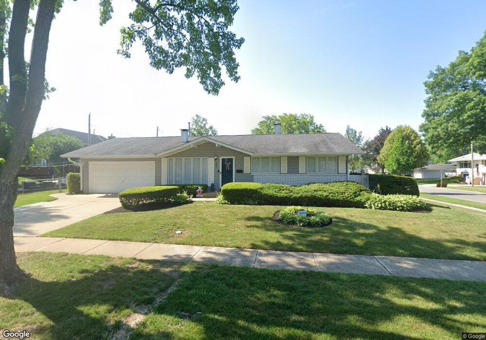
577 Hawthorne Rd Buffalo Grove, IL 60089
South Buffalo Grove NeighborhoodEstimated Value: $385,000 - $451,000
4
Beds
3
Baths
1,231
Sq Ft
$340/Sq Ft
Est. Value
About This Home
This home is located at 577 Hawthorne Rd, Buffalo Grove, IL 60089 and is currently estimated at $418,786, approximately $340 per square foot. 577 Hawthorne Rd is a home located in Cook County with nearby schools including Henry W Longfellow Elementary School, Cooper Middle School, and Buffalo Grove High School.
Ownership History
Date
Name
Owned For
Owner Type
Purchase Details
Closed on
Aug 9, 2018
Sold by
Reblin Patricia Lynn
Bought by
Baran Alicen D and Baran Vincent F
Current Estimated Value
Home Financials for this Owner
Home Financials are based on the most recent Mortgage that was taken out on this home.
Original Mortgage
$266,000
Outstanding Balance
$232,851
Interest Rate
4.87%
Mortgage Type
New Conventional
Estimated Equity
$185,935
Purchase Details
Closed on
Jan 28, 2003
Sold by
Schweinsberg Patricia L and Reblin Patricia Lynn
Bought by
Reblin Patricia Lynn
Home Financials for this Owner
Home Financials are based on the most recent Mortgage that was taken out on this home.
Original Mortgage
$61,600
Interest Rate
6.06%
Mortgage Type
Stand Alone First
Purchase Details
Closed on
May 19, 1998
Sold by
Schweinsberg Durwin A
Bought by
Schweinsberg Patricia L
Create a Home Valuation Report for This Property
The Home Valuation Report is an in-depth analysis detailing your home's value as well as a comparison with similar homes in the area
Home Values in the Area
Average Home Value in this Area
Purchase History
| Date | Buyer | Sale Price | Title Company |
|---|---|---|---|
| Baran Alicen D | $280,000 | Fidelity National Title | |
| Reblin Patricia Lynn | -- | Metropolitan Title Co | |
| Schweinsberg Patricia L | -- | -- |
Source: Public Records
Mortgage History
| Date | Status | Borrower | Loan Amount |
|---|---|---|---|
| Open | Baran Alicen D | $266,000 | |
| Previous Owner | Reblin Patricia Lynn | $61,600 |
Source: Public Records
Tax History Compared to Growth
Tax History
| Year | Tax Paid | Tax Assessment Tax Assessment Total Assessment is a certain percentage of the fair market value that is determined by local assessors to be the total taxable value of land and additions on the property. | Land | Improvement |
|---|---|---|---|---|
| 2024 | $8,407 | $29,584 | $10,080 | $19,504 |
| 2023 | $8,056 | $29,584 | $10,080 | $19,504 |
| 2022 | $8,056 | $29,584 | $10,080 | $19,504 |
| 2021 | $7,264 | $23,892 | $7,140 | $16,752 |
| 2020 | $7,148 | $23,892 | $7,140 | $16,752 |
| 2019 | $7,167 | $26,577 | $7,140 | $19,437 |
| 2018 | $8,274 | $24,024 | $6,300 | $17,724 |
| 2017 | $4,526 | $24,024 | $6,300 | $17,724 |
| 2016 | $5,117 | $24,024 | $6,300 | $17,724 |
| 2015 | $5,814 | $21,663 | $5,460 | $16,203 |
| 2014 | $5,599 | $21,663 | $5,460 | $16,203 |
| 2013 | $4,718 | $21,663 | $5,460 | $16,203 |
Source: Public Records
Map
Nearby Homes
- 665 Thornwood Dr
- 455 Mayfair Ln
- 535 Estate Dr
- 571 Estate Dr
- 310 Rosewood Ave
- 813 Stradford Cir Unit 21B2
- 859 Beechwood Rd
- 820 Weidner Rd Unit 4013
- 820 Weidner Rd Unit 409
- 234 Mohawk Trail
- 3451 N Carriageway Dr Unit 503
- 720 Weidner Rd Unit 302
- 921 Bernard Dr
- 443 Diane Dr
- 12 Oak Creek Dr Unit 2212
- 3300 N Carriageway Dr Unit 317
- 183 Saint Marys Pkwy
- 10 Old Oak Dr Unit 103
- 98 Glendale Rd
- 25 Crestview Terrace
- 555 Thornwood Dr
- 570 Vernon Ln
- 565 Thornwood Dr
- 570 Hawthorne Rd
- 584 Hawthorne Rd
- 552 Thornwood Dr
- 580 Vernon Ln
- 594 Hawthorne Rd
- 560 Hawthorne Rd
- 575 Thornwood Dr
- 568 Thornwood Dr
- 590 Vernon Ln
- 606 Hawthorne Rd
- 550 Hawthorne Rd
- 615 Hawthorne Rd
- 585 Thornwood Dr
- 578 Thornwood Dr
- 3 Red Oak Ct
- 614 Hawthorne Rd
- 600 Vernon Ln