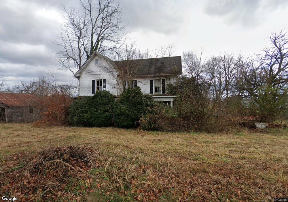
577 Holston Dr Blountville, TN 37617
Estimated Value: $316,086 - $619,000
--
Bed
1
Bath
2,927
Sq Ft
$145/Sq Ft
Est. Value
About This Home
This home is located at 577 Holston Dr, Blountville, TN 37617 and is currently estimated at $424,522, approximately $145 per square foot. 577 Holston Dr is a home located in Sullivan County with nearby schools including Holston Elementary School, Sullivan Central Middle School, and Tri-Cities Christian Academy.
Ownership History
Date
Name
Owned For
Owner Type
Purchase Details
Closed on
Nov 18, 2015
Sold by
Maple View Farms Inc
Bought by
Cate Communications Co Llc
Current Estimated Value
Purchase Details
Closed on
Aug 29, 2008
Sold by
Mapleview Farms
Bought by
Tri & Cities Airport Commission
Purchase Details
Closed on
Jul 31, 2006
Sold by
Mapleview Farms Inc
Bought by
Tri & Cities Airport Commission
Purchase Details
Closed on
Feb 18, 2005
Sold by
Grande Harbor Llc
Bought by
Wood Randy L
Purchase Details
Closed on
Jun 18, 2003
Sold by
Mapleview Farms Inc
Bought by
Valk and Valk Nellie Roberts
Create a Home Valuation Report for This Property
The Home Valuation Report is an in-depth analysis detailing your home's value as well as a comparison with similar homes in the area
Home Values in the Area
Average Home Value in this Area
Purchase History
| Date | Buyer | Sale Price | Title Company |
|---|---|---|---|
| Cate Communications Co Llc | $170,278 | -- | |
| Tri & Cities Airport Commission | $155,131 | -- | |
| Tri & Cities Airport Commission | $190,000 | -- | |
| Wood Randy L | $175,000 | -- | |
| Valk | $10,000 | -- |
Source: Public Records
Tax History Compared to Growth
Tax History
| Year | Tax Paid | Tax Assessment Tax Assessment Total Assessment is a certain percentage of the fair market value that is determined by local assessors to be the total taxable value of land and additions on the property. | Land | Improvement |
|---|---|---|---|---|
| 2024 | -- | $0 | $0 | $0 |
| 2023 | -- | $0 | $0 | $0 |
| 2022 | $0 | $0 | $0 | $0 |
| 2021 | $2,213 | $0 | $0 | $0 |
| 2020 | $2,213 | $0 | $0 | $0 |
| 2019 | $0 | $0 | $0 | $0 |
| 2018 | $0 | $0 | $0 | $0 |
| 2017 | $0 | $0 | $0 | $0 |
| 2016 | $2,213 | $85,920 | $49,620 | $36,300 |
| 2014 | -- | $0 | $0 | $0 |
Source: Public Records
Map
Nearby Homes
- 355 Holston Dr
- The Quinn Plan at Ashland Oaks
- The Audrey Plan at Ashland Oaks
- Phoenix Single Plan at Ashland Oaks
- 132 Sanders St
- 129 Forest Ln N
- 205 Grande Harbor Way
- 191 Grande Harbor Way
- 148 Forest Ln S
- 210 Centenary Rd
- 239 Brown Cir
- 205 Forest Ct
- 145 Grande Harbor Way
- 295 Brown Cir
- 156 Forest Ln N
- 164 Forest Ln N
- 2188 Tennessee 75
- 112 Cardinal Point
- 290 Candy Creek Private Dr
- 225 Forest Ln N
- 577 Holston Dr
- 595 Holston Private Dr
- 590 Holston Dr
- 341 Fain Dr
- 325 Fain Dr
- 313 Fain Dr
- 516 Holston Dr
- 305 Fain Dr
- 477 Holston Dr
- 479 Holston Dr
- 406 Holston Dr
- 429 Holston Dr
- 0 Holston Private Dr
- 412 Holston Dr
- 2133 Muddy Creek Rd
- 2025 Muddy Creek Rd
- 413 Holston Dr
- TBD Holston Private Dr
- 298 Cash Ave
- 387 Holston Dr