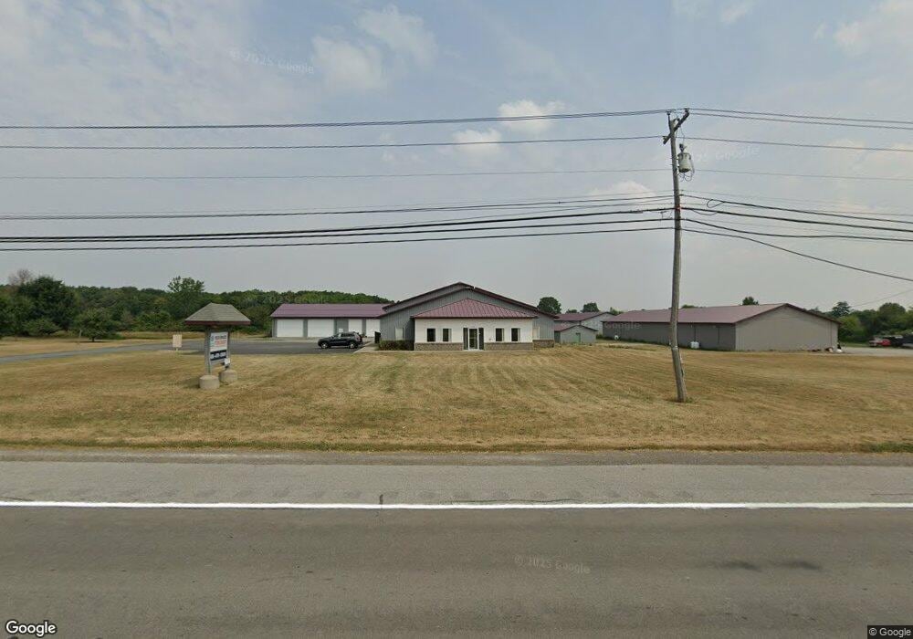
5773 Route 5 Batavia, NY 14020
Estimated Value: $2,447,179
--
Bed
--
Bath
12,228
Sq Ft
$200/Sq Ft
Est. Value
About This Home
This home is located at 5773 Route 5, Batavia, NY 14020 and is currently estimated at $2,447,179, approximately $200 per square foot. 5773 Route 5 is a home located in Genesee County with nearby schools including Jackson Primary School, John Kennedy Intermediate School, and Batavia Middle School.
Ownership History
Date
Name
Owned For
Owner Type
Purchase Details
Closed on
Mar 26, 2025
Sold by
Batavia Bus Storage Llc
Bought by
5773 Batavia Llc
Current Estimated Value
Purchase Details
Closed on
Apr 8, 2021
Sold by
Bengo S Propeties Llc
Bought by
Batavia Bus Storage Llc
Purchase Details
Closed on
Jul 6, 2017
Sold by
Partnership The Brisky Family Limited
Bought by
Bengo'S Properties Llc
Home Financials for this Owner
Home Financials are based on the most recent Mortgage that was taken out on this home.
Original Mortgage
$360,000
Interest Rate
3.89%
Mortgage Type
Commercial
Create a Home Valuation Report for This Property
The Home Valuation Report is an in-depth analysis detailing your home's value as well as a comparison with similar homes in the area
Home Values in the Area
Average Home Value in this Area
Purchase History
| Date | Buyer | Sale Price | Title Company |
|---|---|---|---|
| 5773 Batavia Llc | $2,325,000 | None Available | |
| Batavia Bus Storage Llc | -- | None Available | |
| Bengo'S Properties Llc | $450,000 | Benjamin Bonarigo | |
| Bengo'S Properties Llc | $450,000 | Benjamin Bonarigo |
Source: Public Records
Mortgage History
| Date | Status | Borrower | Loan Amount |
|---|---|---|---|
| Previous Owner | Bengo'S Properties Llc | $360,000 |
Source: Public Records
Tax History Compared to Growth
Tax History
| Year | Tax Paid | Tax Assessment Tax Assessment Total Assessment is a certain percentage of the fair market value that is determined by local assessors to be the total taxable value of land and additions on the property. | Land | Improvement |
|---|---|---|---|---|
| 2024 | $29,765 | $620,000 | $132,500 | $487,500 |
| 2023 | $17,746 | $620,000 | $132,500 | $487,500 |
| 2022 | $18,044 | $620,000 | $132,500 | $487,500 |
| 2021 | $17,112 | $520,000 | $58,000 | $462,000 |
| 2020 | $5,862 | $520,000 | $58,000 | $462,000 |
| 2019 | $14,789 | $520,000 | $58,000 | $462,000 |
| 2018 | $14,789 | $420,000 | $58,000 | $362,000 |
| 2017 | $14,773 | $420,000 | $58,000 | $362,000 |
| 2016 | $15,154 | $420,000 | $58,000 | $362,000 |
| 2015 | -- | $420,000 | $58,000 | $362,000 |
| 2014 | -- | $285,100 | $45,800 | $239,300 |
Source: Public Records
Map
Nearby Homes
- Lot #12 Westbrook Rd
- 9196 Transit Rd
- 8804 Haven Ln
- 0 Prole Rd
- 5163-5165 Laurel Oak Way
- 0 Sweetland Unit R1621821
- 5120 Laurel Oak Way
- 5121 Red Oak Ln
- 5111 Red Oak Ln
- 5107 Red Oak Ln
- 2 Forest Edge Dr
- 4 Forest Edge Dr
- 5 Collegeview Dr
- 21 Briarwood Terrace
- 4977 Ellicott Street Rd
- 8499 Stringham Dr
- 9151 Shepard Rd
- 0 Co Rd 5 Unit S1647808
- 1 Grandview Terrace
- 9208 Shepard Rd
- 5759 E Main Street Rd
- 5753 Main Rd
- 5803 E Main Street Rd
- 5811 Main Rd
- 5748 Main Rd
- 5762 Route 5
- 5815 Main Rd
- 5730 Main Rd
- 5711 E Main Street Rd
- 5843 E Main Street Rd
- 5703 E Main Street Rd
- 5687 E Main Street Rd
- 5681 E Main Rd
- 5671 E Main Street Rd
- 5671 E Main Street Rd
- 8849 Sanders Rd
- 8855 Sanders Rd
- 5645 E Main Street Rd
- 5643 E Main Street Rd
- 5643 E Main Street Rd