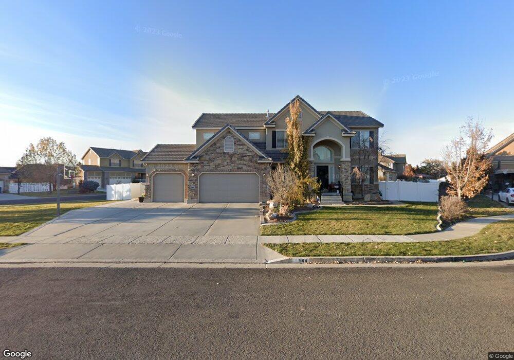
584 Harvest Field Cir Kaysville, UT 84037
West Kaysville NeighborhoodEstimated Value: $732,000 - $888,000
4
Beds
3
Baths
4,091
Sq Ft
$192/Sq Ft
Est. Value
About This Home
This home is located at 584 Harvest Field Cir, Kaysville, UT 84037 and is currently estimated at $786,476, approximately $192 per square foot. 584 Harvest Field Cir is a home located in Davis County with nearby schools including Columbia Elementary School, Farmington High, and Centennial Junior High School.
Ownership History
Date
Name
Owned For
Owner Type
Purchase Details
Closed on
Feb 21, 2020
Sold by
Deters Evangelina
Bought by
Erickson Daniel R and Erickson Darcie
Current Estimated Value
Home Financials for this Owner
Home Financials are based on the most recent Mortgage that was taken out on this home.
Original Mortgage
$330,000
Interest Rate
3.3%
Mortgage Type
New Conventional
Purchase Details
Closed on
Aug 6, 2008
Sold by
Richmond American Homes Of Utah Inc
Bought by
Deters Tyler and Deters Evangelina
Home Financials for this Owner
Home Financials are based on the most recent Mortgage that was taken out on this home.
Original Mortgage
$324,753
Interest Rate
6.32%
Mortgage Type
Purchase Money Mortgage
Create a Home Valuation Report for This Property
The Home Valuation Report is an in-depth analysis detailing your home's value as well as a comparison with similar homes in the area
Home Values in the Area
Average Home Value in this Area
Purchase History
| Date | Buyer | Sale Price | Title Company |
|---|---|---|---|
| Erickson Daniel R | -- | North American Title | |
| Deters Evangelina | -- | None Available | |
| Deters Tyler | -- | First American Title |
Source: Public Records
Mortgage History
| Date | Status | Borrower | Loan Amount |
|---|---|---|---|
| Previous Owner | Erickson Daniel R | $330,000 | |
| Previous Owner | Deters Tyler | $324,753 |
Source: Public Records
Tax History Compared to Growth
Tax History
| Year | Tax Paid | Tax Assessment Tax Assessment Total Assessment is a certain percentage of the fair market value that is determined by local assessors to be the total taxable value of land and additions on the property. | Land | Improvement |
|---|---|---|---|---|
| 2025 | $3,494 | $384,450 | $171,951 | $212,499 |
| 2024 | $3,494 | $368,499 | $146,537 | $221,962 |
| 2023 | $3,572 | $366,850 | $151,233 | $215,616 |
| 2022 | $3,654 | $696,000 | $274,674 | $421,326 |
| 2021 | $3,325 | $522,000 | $166,093 | $355,907 |
| 2020 | $2,995 | $458,000 | $139,650 | $318,350 |
| 2019 | $2,937 | $441,000 | $149,912 | $291,088 |
| 2018 | $2,719 | $407,000 | $122,745 | $284,255 |
| 2016 | $2,521 | $198,330 | $50,994 | $147,336 |
| 2015 | $2,508 | $187,385 | $50,994 | $136,391 |
| 2014 | $2,473 | $188,127 | $52,885 | $135,242 |
| 2013 | -- | $165,523 | $49,115 | $116,408 |
Source: Public Records
Map
Nearby Homes
- 453 Country Mill Dr
- 382 W Parkway Dr
- 447 W June Dr
- 52 S Grandison Ct E Unit 83-R
- 1346 W Blackbird Ln Unit 3
- 109 S Rock Loft Ridge Dr Unit 56-R
- 159 S Rock Loft Ridge Dr Unit 59-R
- 209 N Rock Loft Ridge E Unit 32-R
- 180 S Rock Loft Ridge Dr E Unit 7-R
- 246 N Rock Loft Ridge Dr Unit 36-R
- 22 S Rock Loft Ridge Dr Unit 16-R
- 34 S Rock Loft Ridge Dr Unit 85-R
- 190 N Rock Loft Ridge Dr Unit 40-R
- 75 S Grandison Ct E Unit 69-R
- 93 S Rock Loft Ridge Dr Unit 55-R
- 167 S Grandison E Unit 74-R
- 127 S Rock Loft Ridge Dr Unit 57-R
- 28 N Rock Loft Ridge Dr Unit 46-R
- 96 S Rock Loft Ridge Dr Unit 12-R
- 67 S Rock Loft Ridge Dr Unit 53-R
- 773 Wind Mill Ln
- 572 Harvest Field Cir
- 780 Wind Mill Ln
- 579 Harvest Field Cir
- 796 Wind Mill Ln
- 761 Wind Mill Ln
- 571 Harvest Field Cir
- 563 Harvest Field Cir
- 587 Harvest Field Cir
- 768 Wind Mill Ln
- 818 Wind Mill Ln
- 787 S Kays Dr
- 771 S Kays Dr
- 749 Wind Mill Ln
- 803 S Kays Dr
- 556 Threshing Way Ct
- 754 Wind Mill Ln
- 568 Threshing Way Ct
- 834 Wind Mill Ln
- 544 Threshing Way Ct