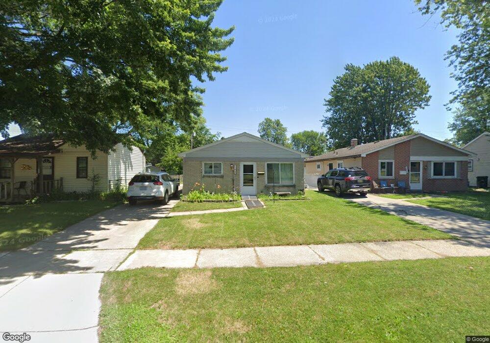
5847 Harold St Taylor, MI 48180
Estimated Value: $150,000 - $158,785
--
Bed
--
Bath
1,008
Sq Ft
$153/Sq Ft
Est. Value
About This Home
This home is located at 5847 Harold St, Taylor, MI 48180 and is currently estimated at $153,946, approximately $152 per square foot. 5847 Harold St is a home located in Wayne County with nearby schools including Clarence Randall Elementary School, Hoover Middle School, and Taylor High School.
Ownership History
Date
Name
Owned For
Owner Type
Purchase Details
Closed on
May 18, 2007
Sold by
King Marlene
Bought by
King Marlene
Current Estimated Value
Purchase Details
Closed on
Oct 15, 2002
Sold by
Citifinancial Mtg Co Inc
Bought by
King Marlene K
Purchase Details
Closed on
Jan 2, 2002
Sold by
Mcdonnell Terrence
Bought by
Associates Home Equity Services
Purchase Details
Closed on
Dec 1, 2000
Sold by
Rose Elinore I
Bought by
Mcdonnell Terrence
Purchase Details
Closed on
May 3, 1996
Sold by
Rose Terry S and Rose Elinore I
Bought by
Jenkins Gary A and Jenkins Tammy M
Create a Home Valuation Report for This Property
The Home Valuation Report is an in-depth analysis detailing your home's value as well as a comparison with similar homes in the area
Home Values in the Area
Average Home Value in this Area
Purchase History
| Date | Buyer | Sale Price | Title Company |
|---|---|---|---|
| King Marlene | -- | Michigan Title Insurance Age | |
| King Marlene K | $73,500 | -- | |
| Associates Home Equity Services | $59,600 | -- | |
| Mcdonnell Terrence | $77,900 | -- | |
| Jenkins Gary A | $41,400 | -- |
Source: Public Records
Tax History Compared to Growth
Tax History
| Year | Tax Paid | Tax Assessment Tax Assessment Total Assessment is a certain percentage of the fair market value that is determined by local assessors to be the total taxable value of land and additions on the property. | Land | Improvement |
|---|---|---|---|---|
| 2025 | $1,350 | $71,500 | $0 | $0 |
| 2024 | $1,350 | $66,300 | $0 | $0 |
| 2023 | $1,622 | $57,300 | $0 | $0 |
| 2022 | $1,288 | $54,300 | $0 | $0 |
| 2021 | $3,079 | $46,500 | $0 | $0 |
| 2020 | $2,906 | $40,200 | $0 | $0 |
| 2019 | $224,426 | $35,700 | $0 | $0 |
| 2018 | $1,106 | $27,400 | $0 | $0 |
| 2017 | $3,007 | $27,200 | $0 | $0 |
| 2016 | $2,160 | $26,400 | $0 | $0 |
| 2015 | $2,500 | $25,000 | $0 | $0 |
| 2013 | $2,650 | $27,500 | $0 | $0 |
| 2012 | $1,194 | $26,900 | $7,600 | $19,300 |
Source: Public Records
Map
Nearby Homes
- 5961 Marvin St
- 6075 Duncan St
- 5845 Beech Daly Rd
- 5961 Beech Daly Rd
- 25965 Currier St
- 6179 Fellrath St
- 5993 John Daly St
- 5842 Janet St
- 26106 Powers Ave
- 5904 Janet St
- 5970 John Daly St
- 6319 Duncan St
- 6338 Marvin St
- 25926 Powers Ave
- 6107 John Daly St
- 6363 Mcguire St
- 6349 Beech Daly Rd
- 26532 Powers Ave
- 25908 Beverly Rd
- 25628 Powers Ave
- 5855 Harold St
- 5839 Harold St
- 5833 Harold St
- 5859 Harold St
- 5860 Fellrath St
- 5868 Fellrath St
- 5846 Fellrath St Unit Bldg-Unit
- 5846 Fellrath St
- 5878 Fellrath St
- 5834 Fellrath St
- 5897 Harold St
- 5886 Fellrath St
- 5901 Harold St
- 5892 Fellrath St
- 5917 Harold St
- 5918 Fellrath St
- 5935 Harold St
- 5936 Fellrath St
- 5943 Harold St
- 5857 Fellrath St