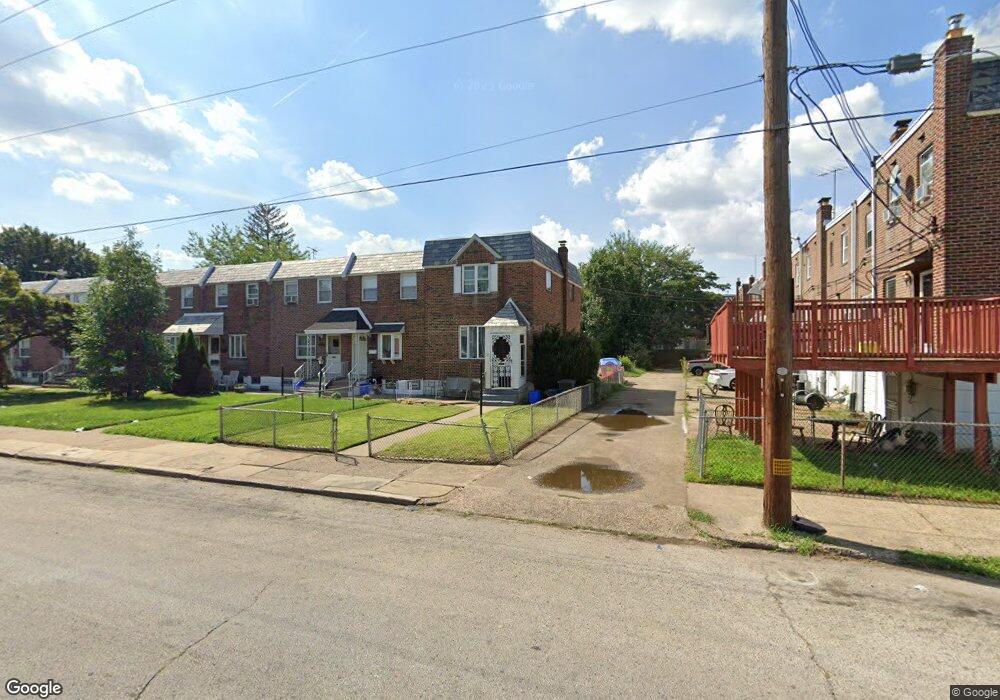
5854 Oakland St Philadelphia, PA 19149
Mayfair NeighborhoodEstimated Value: $188,000 - $211,000
3
Beds
1
Bath
1,078
Sq Ft
$187/Sq Ft
Est. Value
About This Home
This home is located at 5854 Oakland St, Philadelphia, PA 19149 and is currently estimated at $201,444, approximately $186 per square foot. 5854 Oakland St is a home located in Philadelphia County with nearby schools including Ziegler William H School, Frankford High School, and The Philadelphia Charter School for the Arts & Sciences.
Ownership History
Date
Name
Owned For
Owner Type
Purchase Details
Closed on
Jun 21, 2000
Sold by
Strobel Eugene W and Strobel Patricia S
Bought by
Taylor Eugene
Current Estimated Value
Home Financials for this Owner
Home Financials are based on the most recent Mortgage that was taken out on this home.
Original Mortgage
$55,000
Outstanding Balance
$19,466
Interest Rate
8.48%
Estimated Equity
$181,978
Create a Home Valuation Report for This Property
The Home Valuation Report is an in-depth analysis detailing your home's value as well as a comparison with similar homes in the area
Home Values in the Area
Average Home Value in this Area
Purchase History
| Date | Buyer | Sale Price | Title Company |
|---|---|---|---|
| Taylor Eugene | $57,900 | Lawyers Title Insurance Co |
Source: Public Records
Mortgage History
| Date | Status | Borrower | Loan Amount |
|---|---|---|---|
| Open | Taylor Eugene | $55,000 | |
| Closed | Taylor Eugene | $5,000 |
Source: Public Records
Tax History Compared to Growth
Tax History
| Year | Tax Paid | Tax Assessment Tax Assessment Total Assessment is a certain percentage of the fair market value that is determined by local assessors to be the total taxable value of land and additions on the property. | Land | Improvement |
|---|---|---|---|---|
| 2026 | $2,220 | $210,900 | $42,180 | $168,720 |
| 2025 | $2,220 | $210,900 | $42,180 | $168,720 |
| 2024 | $2,220 | $210,900 | $42,180 | $168,720 |
| 2023 | $2,220 | $158,600 | $31,720 | $126,880 |
| 2022 | $1,524 | $158,600 | $31,720 | $126,880 |
| 2021 | $1,524 | $0 | $0 | $0 |
| 2020 | $1,524 | $0 | $0 | $0 |
| 2019 | $1,463 | $0 | $0 | $0 |
| 2018 | $1,603 | $0 | $0 | $0 |
| 2017 | $1,603 | $0 | $0 | $0 |
| 2016 | $1,603 | $0 | $0 | $0 |
| 2015 | $1,534 | $0 | $0 | $0 |
| 2014 | -- | $114,500 | $75,619 | $38,881 |
| 2012 | -- | $12,384 | $2,153 | $10,231 |
Source: Public Records
Map
Nearby Homes
- 1530 Van Kirk St
- 1613 Van Kirk St
- 5828 Akron St
- 1622 E Howell St
- 5844 Saul St
- 5823 Akron St
- 5451 Oakland St
- 1431 Rosalie St
- 6005 Horrocks St
- 5431 Akron St
- 5422 Akron St
- 1606 Benner St
- 1244 E Sanger St
- 7753 E Roosevelt Blvd
- 5407 Saul St
- 6632 E Roosevelt Blvd
- 7040 E Roosevelt Blvd
- 6054 E Roosevelt Blvd
- 7536 E Roosevelt Blvd
- 6840 E Roosevelt Blvd
- 5852 Oakland St
- 5850 Oakland St
- 1540 Van Kirk St
- 5848 Oakland St
- 1542 Van Kirk St
- 1538 Van Kirk St
- 1536 Van Kirk St
- 1544 Van Kirk St
- 5846 Oakland St
- 1546 Van Kirk St
- 1548 Van Kirk St
- 1534 Van Kirk St
- 5844 Oakland St
- 1532 Van Kirk St
- 5842 Oakland St
- 5840 Oakland St
- 5838 Oakland St
- 5859 Sylvester St
- 5863 Sylvester St
- 5857 Sylvester St