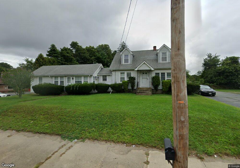
586 State Rd Unit 590 Westport, MA 02790
North Westport NeighborhoodEstimated Value: $453,000 - $647,000
--
Bed
--
Bath
--
Sq Ft
0.41
Acres
About This Home
This home is located at 586 State Rd Unit 590, Westport, MA 02790 and is currently estimated at $564,001. 586 State Rd Unit 590 is a home located in Bristol County with nearby schools including Alice A. Macomber Primary School, Westport Elementary School, and Westport Middle-High School.
Ownership History
Date
Name
Owned For
Owner Type
Purchase Details
Closed on
Aug 4, 2004
Sold by
Thibodeau Evelyn and Foley Gary
Bought by
Foley Gary and Foley Janice
Current Estimated Value
Purchase Details
Closed on
Sep 29, 1993
Sold by
Thibodeau Evelyn
Bought by
Foley Gary and Foley Janice
Create a Home Valuation Report for This Property
The Home Valuation Report is an in-depth analysis detailing your home's value as well as a comparison with similar homes in the area
Home Values in the Area
Average Home Value in this Area
Purchase History
| Date | Buyer | Sale Price | Title Company |
|---|---|---|---|
| Foley Gary | -- | -- | |
| Foley Gary | $123,256 | -- |
Source: Public Records
Mortgage History
| Date | Status | Borrower | Loan Amount |
|---|---|---|---|
| Open | Foley Gary | $20,000 | |
| Open | Foley Gary | $50,000 | |
| Closed | Foley Gary | $55,000 | |
| Previous Owner | Foley Gary | $25,000 |
Source: Public Records
Tax History Compared to Growth
Tax History
| Year | Tax Paid | Tax Assessment Tax Assessment Total Assessment is a certain percentage of the fair market value that is determined by local assessors to be the total taxable value of land and additions on the property. | Land | Improvement |
|---|---|---|---|---|
| 2025 | $3,197 | $429,100 | $132,900 | $296,200 |
| 2024 | $3,204 | $414,500 | $123,200 | $291,300 |
| 2023 | $3,000 | $367,600 | $104,900 | $262,700 |
| 2022 | $2,826 | $333,200 | $104,900 | $228,300 |
| 2021 | $2,679 | $310,800 | $95,400 | $215,400 |
| 2020 | $2,499 | $296,500 | $91,600 | $204,900 |
| 2019 | $2,430 | $293,800 | $97,000 | $196,800 |
| 2018 | $2,396 | $293,300 | $109,100 | $184,200 |
| 2017 | $2,332 | $292,600 | $105,600 | $187,000 |
| 2016 | $2,239 | $283,000 | $102,100 | $180,900 |
| 2015 | $2,224 | $280,400 | $104,400 | $176,000 |
Source: Public Records
Map
Nearby Homes
- 20 Faulkner St
- 116 Gifford Rd
- 3 Diane Way
- 9 Kyle Jacob Rd
- 100 D Dr
- 15 S Breault St
- 16 S Berryman St
- 9 Register Ave
- 1276 Old Fall River Rd
- 565 Highland Ave
- 92 Benoit St
- 33 William St
- 6 Beaulieu St
- 25 Beaulieu St
- 19 Charles Joseph Dr
- 2 Donna Marie Dr
- 128 Old Bedford Rd
- 771 Sanford Rd
- 27 Dias Ave
- 96 Forge Rd