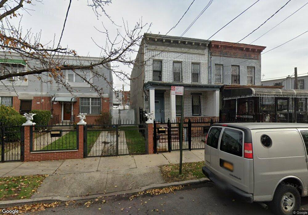
587 Hinsdale St Brooklyn, NY 11207
Brownsville NeighborhoodEstimated Value: $652,695 - $915,000
--
Bed
--
Bath
1,664
Sq Ft
$475/Sq Ft
Est. Value
About This Home
This home is located at 587 Hinsdale St, Brooklyn, NY 11207 and is currently estimated at $790,674, approximately $475 per square foot. 587 Hinsdale St is a home located in Kings County with nearby schools including P.S. 190 - Sheffield, Achievement First - East New York School, and Grace Christian Educational.
Ownership History
Date
Name
Owned For
Owner Type
Purchase Details
Closed on
Aug 22, 2002
Sold by
Salick Suzette
Bought by
Cleveland Development Co
Current Estimated Value
Purchase Details
Closed on
Nov 6, 2000
Sold by
Fountain Park Management Llc
Bought by
Salick Suzette
Home Financials for this Owner
Home Financials are based on the most recent Mortgage that was taken out on this home.
Original Mortgage
$225,000
Interest Rate
7.52%
Create a Home Valuation Report for This Property
The Home Valuation Report is an in-depth analysis detailing your home's value as well as a comparison with similar homes in the area
Home Values in the Area
Average Home Value in this Area
Purchase History
| Date | Buyer | Sale Price | Title Company |
|---|---|---|---|
| Cleveland Development Co | -- | -- | |
| Salick Suzette | $250,000 | -- | |
| Fountain Park Management Llc | $117,000 | -- |
Source: Public Records
Mortgage History
| Date | Status | Borrower | Loan Amount |
|---|---|---|---|
| Previous Owner | Fountain Park Management Llc | $225,000 |
Source: Public Records
Tax History Compared to Growth
Tax History
| Year | Tax Paid | Tax Assessment Tax Assessment Total Assessment is a certain percentage of the fair market value that is determined by local assessors to be the total taxable value of land and additions on the property. | Land | Improvement |
|---|---|---|---|---|
| 2025 | $2,447 | $46,740 | $16,500 | $30,240 |
| 2024 | $2,447 | $52,800 | $16,500 | $36,300 |
| 2023 | $2,336 | $46,680 | $16,500 | $30,180 |
| 2022 | $2,167 | $43,500 | $16,500 | $27,000 |
| 2021 | $2,156 | $37,080 | $16,500 | $20,580 |
| 2020 | $1,617 | $39,360 | $16,500 | $22,860 |
| 2019 | $2,124 | $39,360 | $16,500 | $22,860 |
| 2018 | $1,953 | $9,583 | $5,692 | $3,891 |
| 2017 | $1,844 | $9,045 | $4,916 | $4,129 |
| 2016 | $1,706 | $8,536 | $6,260 | $2,276 |
| 2015 | $1,029 | $8,533 | $4,664 | $3,869 |
| 2014 | $1,029 | $8,460 | $5,381 | $3,079 |
Source: Public Records
Map
Nearby Homes
- 650 Williams Ave
- 660 Williams Ave Unit 142
- 589 Hinsdale St
- 584 Hinsdale St
- 610 Alabama Ave
- 606 Alabama Ave
- 442 Newport St
- 1755 Linden Blvd
- 1753 Linden Blvd
- 582 Williams Ave
- 578 Williams Ave
- 576 Williams Ave
- 541 Hinsdale St
- 1825 Linden Blvd
- 679 Georgia Ave
- 533 Snediker Ave
- 90 Louisiana Ave
- 494 Hegeman Ave
- 661 Sheffield Ave
- 667 Sheffield Ave
- 585 Hinsdale St
- 583 Hinsdale St
- 581 Hinsdale St
- 231 New Lots Ave
- 233 New Lots Ave
- 229 New Lots Ave
- 579 Hinsdale St
- 235 New Lots Ave
- 239 New Lots Ave
- 237 New Lots Ave
- 227 New Lots Ave
- 241 New Lots Ave
- 577 Hinsdale St
- 616 Williams Ave
- 614 Williams Ave
- 243 New Lots Ave
- 612 Williams Ave
- 575 Hinsdale St
- 610 Williams Ave
- 245 New Lots Ave