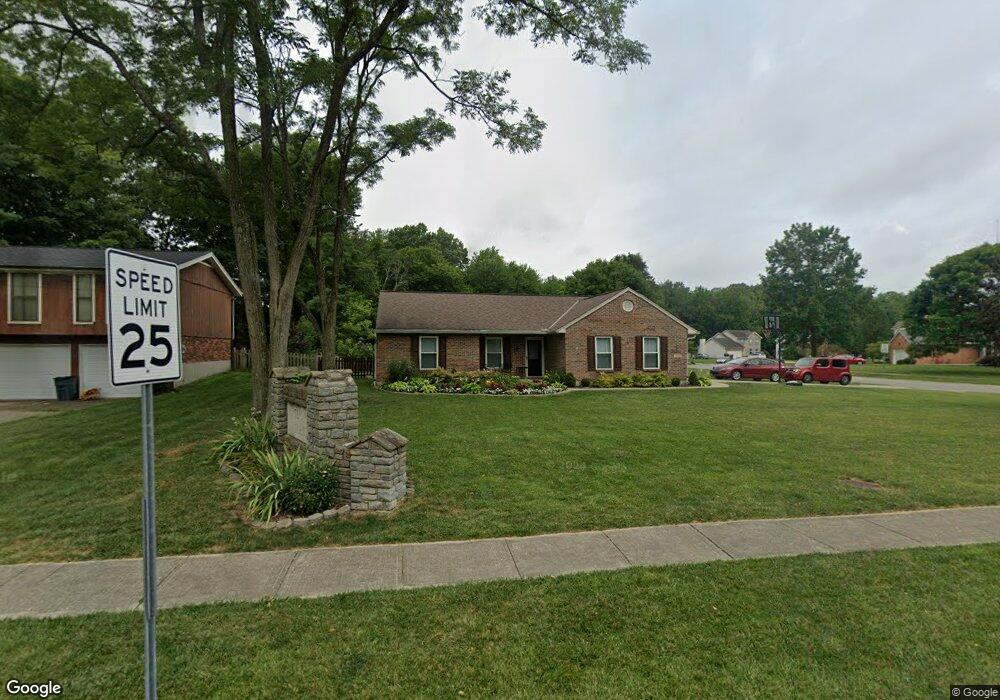
5880 Winchester Dr Milford, OH 45150
Estimated Value: $299,869 - $356,000
3
Beds
2
Baths
1,365
Sq Ft
$239/Sq Ft
Est. Value
About This Home
This home is located at 5880 Winchester Dr, Milford, OH 45150 and is currently estimated at $326,217, approximately $238 per square foot. 5880 Winchester Dr is a home located in Clermont County with nearby schools including Milford Senior High School, St. Mark's Lutheran School, and St. Andrew - St. Elizabeth Ann Seton School.
Ownership History
Date
Name
Owned For
Owner Type
Purchase Details
Closed on
Sep 1, 2004
Sold by
Dierig Mary Patricia and Scott Mary Patricia
Bought by
Vrbanac Michael and Vrbanac Miwa
Current Estimated Value
Home Financials for this Owner
Home Financials are based on the most recent Mortgage that was taken out on this home.
Original Mortgage
$108,000
Outstanding Balance
$54,218
Interest Rate
6.08%
Mortgage Type
Purchase Money Mortgage
Estimated Equity
$271,999
Purchase Details
Closed on
Jan 20, 1999
Sold by
Trst William A Decenso
Bought by
T E H Inc
Create a Home Valuation Report for This Property
The Home Valuation Report is an in-depth analysis detailing your home's value as well as a comparison with similar homes in the area
Home Values in the Area
Average Home Value in this Area
Purchase History
| Date | Buyer | Sale Price | Title Company |
|---|---|---|---|
| Vrbanac Michael | $162,900 | Prodigy Title Agency Llc | |
| T E H Inc | $22,000 | -- |
Source: Public Records
Mortgage History
| Date | Status | Borrower | Loan Amount |
|---|---|---|---|
| Open | Vrbanac Michael | $108,000 |
Source: Public Records
Tax History Compared to Growth
Tax History
| Year | Tax Paid | Tax Assessment Tax Assessment Total Assessment is a certain percentage of the fair market value that is determined by local assessors to be the total taxable value of land and additions on the property. | Land | Improvement |
|---|---|---|---|---|
| 2024 | $3,443 | $84,920 | $14,810 | $70,110 |
| 2023 | $530 | $84,920 | $14,810 | $70,110 |
| 2022 | $3,664 | $60,270 | $10,500 | $49,770 |
| 2021 | $3,668 | $60,270 | $10,500 | $49,770 |
| 2020 | $3,516 | $60,270 | $10,500 | $49,770 |
| 2019 | $2,786 | $45,260 | $10,400 | $34,860 |
| 2018 | $2,787 | $45,260 | $10,400 | $34,860 |
| 2017 | $2,744 | $45,260 | $10,400 | $34,860 |
| 2016 | $2,784 | $41,130 | $9,450 | $31,680 |
| 2015 | $2,579 | $41,130 | $9,450 | $31,680 |
| 2014 | $2,579 | $41,130 | $9,450 | $31,680 |
| 2013 | $2,537 | $39,240 | $9,800 | $29,440 |
Source: Public Records
Map
Nearby Homes
- 1382 Lela Ln
- 6049 Delfair Ln
- 6034 Delfair Ln
- 1485 Foxtale Ct
- .6438 ac Buckwheat Rd
- .0288 ac Buckwheat Rd
- 5614 Water Mills Dr
- 5613 Water Mills Dr
- 5852 Monassas Run Rd
- 5065 Cross Creek Ln
- 5818 Jeb Stuart Dr
- 1399 Wade Rd
- 5975 Buckwheat Rd
- 5778 Tall Oaks Dr
- 5811 Monassas Run Dr
- 1281 Piedmont Dr
- 1289 Woodville Pike
- 1290 Michael Ln
- 5942 Pinto Place
- 1554 Deerwoods Dr
- 5878 Winchester Dr
- 1479 Corbin Dr
- 5876 Winchester Dr
- 1474 Corbin Dr
- 1478 Corbin Dr
- 1473 Corbin Dr
- 1374 Cottonwood Dr
- 1481 Corbin Dr
- 1470 Corbin Dr
- 1378 Cottonwood Dr
- 1483 Corbin Dr
- 1372 Cottonwood Dr
- 1476 Corbin Dr
- 1471 Corbin Dr
- 1380 Cottonwood Dr
- 1485 Corbin Dr
- 1370 Cottonwood Dr
- 5874 Winchester Dr
- 5982 Katey Way
- 5980 Katey Way