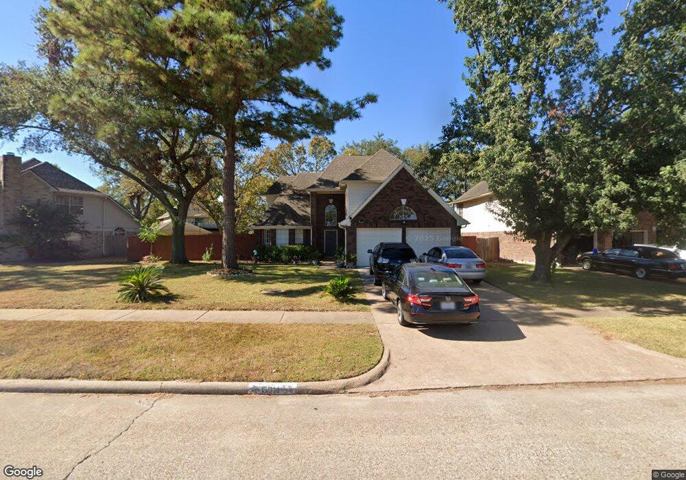
5911 Georgetown Colony Dr Houston, TX 77084
Eldridge North NeighborhoodEstimated Value: $304,312 - $332,000
4
Beds
3
Baths
2,396
Sq Ft
$133/Sq Ft
Est. Value
About This Home
This home is located at 5911 Georgetown Colony Dr, Houston, TX 77084 and is currently estimated at $317,828, approximately $132 per square foot. 5911 Georgetown Colony Dr is a home located in Harris County with nearby schools including Horne Elementary School, Truitt Middle School, and Cypress Falls High School.
Ownership History
Date
Name
Owned For
Owner Type
Purchase Details
Closed on
Aug 13, 2019
Sold by
Albadwi Gheyath
Bought by
Albadawi Ghazwan and Altikriti Afaaf
Current Estimated Value
Purchase Details
Closed on
Oct 30, 2014
Sold by
Tucker Heather F and Tucker David M
Bought by
Albadwi Gheyath
Purchase Details
Closed on
May 27, 2009
Sold by
Roberts Frank D and Roberts Vicki
Bought by
Stults Heather F
Home Financials for this Owner
Home Financials are based on the most recent Mortgage that was taken out on this home.
Original Mortgage
$131,572
Interest Rate
4.76%
Mortgage Type
FHA
Purchase Details
Closed on
May 18, 1995
Sold by
Sumrall Ricky L and Sumrall Kela
Bought by
Roberts Frank D and Roberts Vicki
Home Financials for this Owner
Home Financials are based on the most recent Mortgage that was taken out on this home.
Original Mortgage
$83,700
Interest Rate
8.36%
Create a Home Valuation Report for This Property
The Home Valuation Report is an in-depth analysis detailing your home's value as well as a comparison with similar homes in the area
Home Values in the Area
Average Home Value in this Area
Purchase History
| Date | Buyer | Sale Price | Title Company |
|---|---|---|---|
| Albadawi Ghazwan | -- | None Available | |
| Albadwi Gheyath | -- | Stewart Title | |
| Stults Heather F | -- | Alamo Title | |
| Roberts Frank D | -- | American Title |
Source: Public Records
Mortgage History
| Date | Status | Borrower | Loan Amount |
|---|---|---|---|
| Previous Owner | Stults Heather F | $131,572 | |
| Previous Owner | Roberts Frank D | $83,700 |
Source: Public Records
Tax History Compared to Growth
Tax History
| Year | Tax Paid | Tax Assessment Tax Assessment Total Assessment is a certain percentage of the fair market value that is determined by local assessors to be the total taxable value of land and additions on the property. | Land | Improvement |
|---|---|---|---|---|
| 2025 | $830 | $276,718 | $57,371 | $219,347 |
| 2024 | $830 | $301,079 | $54,682 | $246,397 |
| 2023 | $830 | $293,451 | $54,682 | $238,769 |
| 2022 | $5,656 | $268,117 | $42,132 | $225,985 |
| 2021 | $5,431 | $215,120 | $42,132 | $172,988 |
| 2020 | $5,210 | $190,541 | $24,801 | $165,740 |
| 2019 | $5,308 | $185,890 | $20,301 | $165,589 |
| 2018 | $1,753 | $183,393 | $20,301 | $163,092 |
| 2017 | $5,275 | $183,393 | $20,301 | $163,092 |
| 2016 | $5,049 | $177,614 | $20,301 | $157,313 |
| 2015 | $4,216 | $159,570 | $20,301 | $139,269 |
| 2014 | $4,216 | $143,190 | $20,301 | $122,889 |
Source: Public Records
Map
Nearby Homes
- 5822 Painted Trail Dr
- 5811 N Magazine Cir
- 5810 N Magazine Cir
- 14710 James River Ln
- 5723 Painted Trail Dr
- 5602 Society Ln
- 5518 Society Ln
- 14310 N Towerglen Loop
- 5718 Charlestown Colony Dr
- 14307 N Towerglen Loop
- 6307 Cherry Run
- 14602 Bradford Colony Dr
- 15034 Margeson St
- 15014 Tinker St
- 14514 Briton Cove Dr
- 5330 Pine Cliff Dr
- 15642 Pagehurst Dr
- 6219 Summerville Ln
- 15722 Fox Springs Dr
- 14602 Liscomb Dr
- 5915 Georgetown Colony Dr
- 5907 Georgetown Colony Dr
- 5919 Georgetown Colony Dr
- 14747 Tilley St
- 14510 Telfair Ct
- 5914 Rolff Ln
- 5918 Rolff Ln
- 5919 Fort Sumter Ln
- 14743 Tilley St
- 5910 Rolff Ln
- 5923 Georgetown Colony Dr
- 14751 Tilley St
- 5915 Fort Sumter Ln
- 14506 Telfair Ct
- 14739 Tilley St
- 14507 Telfair Ct
- 6003 Georgetown Colony Dr
- 5911 Fort Sumter Ln
- 14502 Telfair Ct
- 14503 Telfair Ct