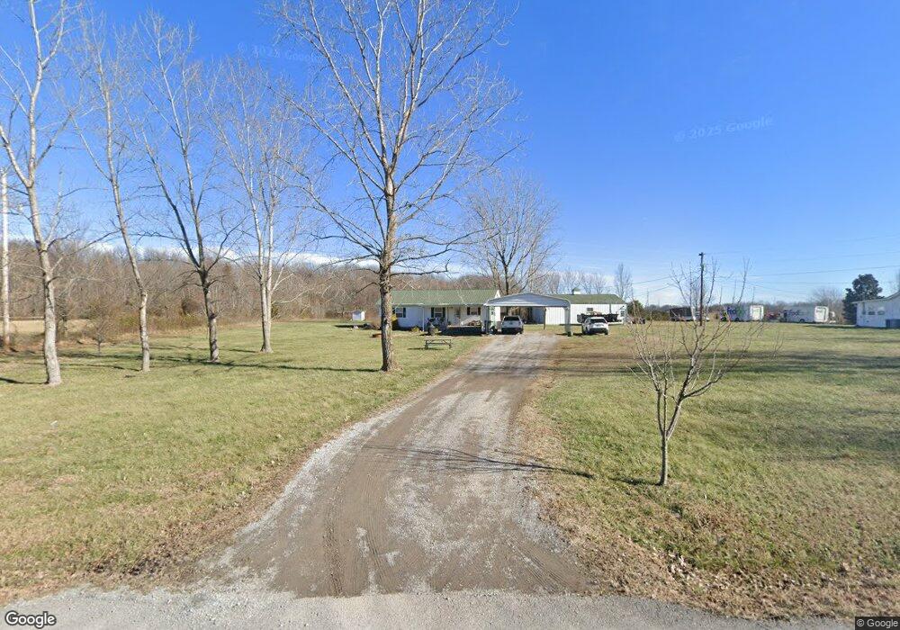
5919 Payne Rd Portland, TN 37148
Estimated Value: $109,000 - $258,000
--
Bed
1
Bath
968
Sq Ft
$185/Sq Ft
Est. Value
About This Home
This home is located at 5919 Payne Rd, Portland, TN 37148 and is currently estimated at $178,984, approximately $184 per square foot. 5919 Payne Rd is a home located in Robertson County with nearby schools including East Robertson Elementary School and East Robertson High School.
Ownership History
Date
Name
Owned For
Owner Type
Purchase Details
Closed on
Sep 19, 2008
Sold by
Tidwell Glen
Bought by
Stone Christopher R
Current Estimated Value
Purchase Details
Closed on
Oct 18, 2004
Sold by
Provident Bank
Bought by
Tidwell Beauna and Tidwell Glen
Purchase Details
Closed on
Apr 14, 1999
Bought by
Hackney Mary Jo and Bray John L
Purchase Details
Closed on
Feb 12, 1999
Bought by
The Farmers Bank
Purchase Details
Closed on
Apr 4, 1992
Bought by
Long Howard
Purchase Details
Closed on
Sep 20, 1991
Bought by
Huff Tressia June
Purchase Details
Closed on
Mar 14, 1987
Bought by
Hackney Steve R
Create a Home Valuation Report for This Property
The Home Valuation Report is an in-depth analysis detailing your home's value as well as a comparison with similar homes in the area
Home Values in the Area
Average Home Value in this Area
Purchase History
| Date | Buyer | Sale Price | Title Company |
|---|---|---|---|
| Stone Christopher R | $27,000 | -- | |
| Tidwell Beauna | $21,900 | -- | |
| Hackney Mary Jo | $40,000 | -- | |
| The Farmers Bank | $39,800 | -- | |
| Long Howard | -- | -- | |
| Huff Tressia June | -- | -- | |
| Hackney Steve R | -- | -- |
Source: Public Records
Tax History Compared to Growth
Tax History
| Year | Tax Paid | Tax Assessment Tax Assessment Total Assessment is a certain percentage of the fair market value that is determined by local assessors to be the total taxable value of land and additions on the property. | Land | Improvement |
|---|---|---|---|---|
| 2024 | $524 | $29,100 | $7,500 | $21,600 |
| 2023 | $524 | $29,100 | $7,500 | $21,600 |
| 2022 | $383 | $14,875 | $4,000 | $10,875 |
| 2021 | $383 | $14,875 | $4,000 | $10,875 |
| 2020 | $383 | $14,875 | $4,000 | $10,875 |
| 2019 | $383 | $14,875 | $4,000 | $10,875 |
| 2018 | $383 | $14,875 | $4,000 | $10,875 |
| 2017 | $419 | $13,575 | $3,450 | $10,125 |
| 2016 | $419 | $13,575 | $3,450 | $10,125 |
| 2015 | $402 | $13,575 | $3,450 | $10,125 |
| 2014 | $290 | $9,800 | $3,450 | $6,350 |
Source: Public Records
Map
Nearby Homes
- 0 Bill Anderson Rd
- 6485 Highland Rd
- 0 Payne Rd Extension Unit RTC2898325
- 9416 Shady Park Rd
- 8637 Tennessee 52
- 7197 Highland Rd
- 5881 Highway 31 W
- 135 Old Highway 52 W
- 5300 Highway 31 W
- 1202 Tennessee 52
- 648 Scattersville Rd
- 6016 Highland Rd
- 8283 Highway 52
- 5988 Highway 31 W
- 0 Jimson Rd
- 432 Crafton Rd
- 113 Megann Dr
- 909 College St
- 0 Shaub Rd
- 146 Groves Ln
- 5911 Payne Rd
- 5939 Payne Rd
- 5901 Payne Rd
- 5840 Payne Rd
- 5822 Payne Rd
- 9006 Groves Cemetery Rd
- 5827 Payne Rd
- 0 Bill Anderson Road Tract 4 Unit RTC2445287
- 0 Bill Anderson Road Tract 4 Unit RTC2431689
- 0 Bill Anderson Road Tract 3 Unit RTC2431685
- 0 Bill Anderson Road Tract 2 Unit RTC2378552
- 0 Bill Anderson Road Tract 4 Unit RTC2374730
- 0 Bill Anderson Road Tract 3 Unit RTC2374723
- 5711 Bill Anderson Rd
- 0 Groves Cemetery Rd Tract 4
- 5695 Bill Anderson Rd
- 5811 Payne Rd
- 0 Groves Cemetery Rd Tract 3
- 8985 Groves Cemetery Rd
- 5802 Payne Rd