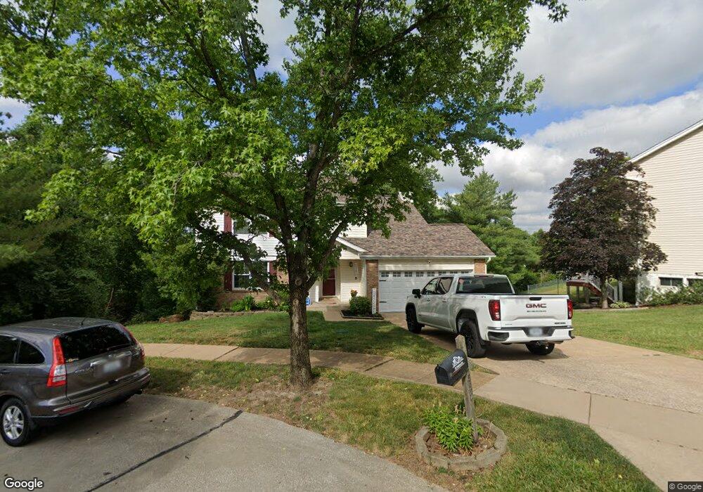
5925 Woodbrook Dr Saint Louis, MO 63129
Estimated Value: $358,910 - $379,000
3
Beds
3
Baths
1,946
Sq Ft
$189/Sq Ft
Est. Value
About This Home
This home is located at 5925 Woodbrook Dr, Saint Louis, MO 63129 and is currently estimated at $366,978, approximately $188 per square foot. 5925 Woodbrook Dr is a home located in St. Louis County with nearby schools including Blades Elementary School, Bernard Middle School, and Oakville Senior High School.
Ownership History
Date
Name
Owned For
Owner Type
Purchase Details
Closed on
Dec 20, 2021
Sold by
Townsend David L and Townsend Kerrie L
Bought by
Townsend Family Trust
Current Estimated Value
Purchase Details
Closed on
Mar 17, 2004
Sold by
Townsend David and Townsend Kerrie L
Bought by
Townsend David and Townsend Kerrie L
Home Financials for this Owner
Home Financials are based on the most recent Mortgage that was taken out on this home.
Original Mortgage
$104,000
Interest Rate
5.64%
Mortgage Type
Purchase Money Mortgage
Purchase Details
Closed on
Feb 22, 2000
Sold by
Townsend David
Bought by
Townsend Frederick and Townsend Joyce
Purchase Details
Closed on
Jan 26, 1999
Sold by
Davidson Larry E
Bought by
Davidson Cathy J
Create a Home Valuation Report for This Property
The Home Valuation Report is an in-depth analysis detailing your home's value as well as a comparison with similar homes in the area
Home Values in the Area
Average Home Value in this Area
Purchase History
| Date | Buyer | Sale Price | Title Company |
|---|---|---|---|
| Townsend Family Trust | -- | Investors Title | |
| Townsend David | $109,000 | Capital Title Co Inc | |
| Townsend Frederick | -- | Capital Title | |
| Townsend David | $130,000 | Capital Title | |
| Davidson Cathy J | -- | -- |
Source: Public Records
Mortgage History
| Date | Status | Borrower | Loan Amount |
|---|---|---|---|
| Previous Owner | Townsend David | $104,000 |
Source: Public Records
Tax History Compared to Growth
Tax History
| Year | Tax Paid | Tax Assessment Tax Assessment Total Assessment is a certain percentage of the fair market value that is determined by local assessors to be the total taxable value of land and additions on the property. | Land | Improvement |
|---|---|---|---|---|
| 2025 | $3,617 | $59,910 | $22,480 | $37,430 |
| 2024 | $3,617 | $53,830 | $14,440 | $39,390 |
| 2023 | $3,571 | $53,830 | $14,440 | $39,390 |
| 2022 | $2,866 | $43,360 | $11,530 | $31,830 |
| 2021 | $2,774 | $43,360 | $11,530 | $31,830 |
| 2020 | $2,526 | $37,510 | $9,750 | $27,760 |
| 2019 | $2,518 | $37,510 | $9,750 | $27,760 |
| 2018 | $2,497 | $33,590 | $8,870 | $24,720 |
| 2017 | $2,494 | $33,590 | $8,870 | $24,720 |
| 2016 | $2,270 | $29,300 | $8,870 | $20,430 |
| 2015 | $2,084 | $29,300 | $8,870 | $20,430 |
| 2014 | $1,851 | $25,710 | $6,060 | $19,650 |
Source: Public Records
Map
Nearby Homes
- 5824 Bridleford Ln
- 5827 Bridleford Ln
- 5896 Rockland Ln
- 3652 Lemay Woods Dr
- 5735 White Pine Dr
- 5600 Wickershire Ln
- 4251 Green Grove Ct
- 5942 Hawkins Fuchs Rd
- 5524 Providence Place Dr
- 6055 Bayou Bend Ct
- 4357 Bristol View Ct
- 4374 Bristol View Ct
- 5327 Crowndun Dr
- 4121 Old Baumgartner Rd
- 5735 Dove Meadow Ln
- 5714 Shining Day Place
- 5417 Morningdale Place
- 4523 Beaver Brook Ct
- 5227 Patterson Rd
- 6401 Brookfield Court Dr
- 5921 Woodbrook Dr
- 5917 Woodbrook Dr
- 5929 Woodbrook Dr
- 5913 Woodbrook Dr
- 5933 Woodbrook Dr
- 5924 Woodbrook Dr
- 5932 Woodbrook Dr
- 5928 Woodbrook Dr
- 5918 Woodbrook Dr
- 5991 Pennbrooke Dr
- 5909 Woodbrook Dr
- 5995 Pennbrooke Dr
- 5914 Woodbrook Dr
- 5910 Woodbrook Dr
- 3724 Woodbrook Ct
- 5987 Pennbrooke Dr
- 5905 Woodbrook Dr
- 3721 Woodbrook Ct
- 5906 Woodbrook Dr
- 5994 Pennbrooke Dr