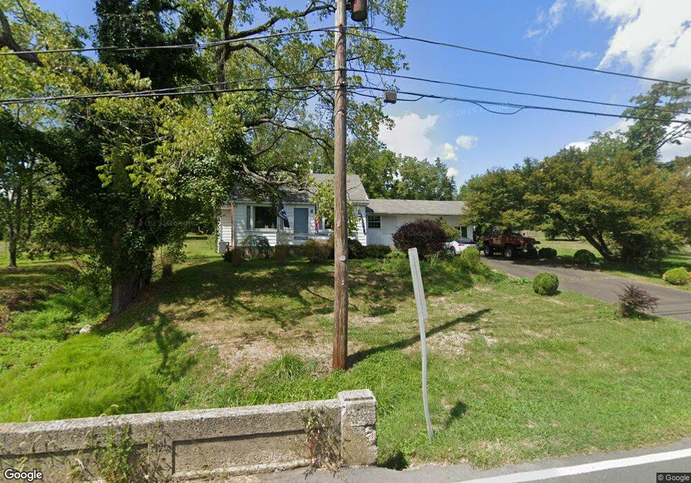
593 Penns Park Rd Newtown, PA 18940
Estimated Value: $472,000 - $487,000
2
Beds
1
Bath
896
Sq Ft
$534/Sq Ft
Est. Value
About This Home
This home is located at 593 Penns Park Rd, Newtown, PA 18940 and is currently estimated at $478,779, approximately $534 per square foot. 593 Penns Park Rd is a home located in Bucks County with nearby schools including Wrightstown Elementary School, Newtown Middle School, and Council Rock High School North.
Ownership History
Date
Name
Owned For
Owner Type
Purchase Details
Closed on
Jun 12, 2009
Sold by
Estate Of Ruth Porpora and Pisel Walter J
Bought by
Monaghan James F
Current Estimated Value
Home Financials for this Owner
Home Financials are based on the most recent Mortgage that was taken out on this home.
Original Mortgage
$198,158
Outstanding Balance
$126,141
Interest Rate
4.91%
Mortgage Type
FHA
Estimated Equity
$352,638
Purchase Details
Closed on
Oct 6, 1964
Bought by
Porpora Matthew and Porpora Ruth
Create a Home Valuation Report for This Property
The Home Valuation Report is an in-depth analysis detailing your home's value as well as a comparison with similar homes in the area
Home Values in the Area
Average Home Value in this Area
Purchase History
| Date | Buyer | Sale Price | Title Company |
|---|---|---|---|
| Monaghan James F | $205,000 | Lawyers Title Insurance Corp | |
| Porpora Matthew | -- | -- |
Source: Public Records
Mortgage History
| Date | Status | Borrower | Loan Amount |
|---|---|---|---|
| Open | Monaghan James F | $198,158 |
Source: Public Records
Tax History Compared to Growth
Tax History
| Year | Tax Paid | Tax Assessment Tax Assessment Total Assessment is a certain percentage of the fair market value that is determined by local assessors to be the total taxable value of land and additions on the property. | Land | Improvement |
|---|---|---|---|---|
| 2025 | $4,380 | $24,800 | $8,960 | $15,840 |
| 2024 | $4,380 | $24,800 | $8,960 | $15,840 |
| 2023 | $4,195 | $24,800 | $8,960 | $15,840 |
| 2022 | $4,154 | $24,800 | $8,960 | $15,840 |
| 2021 | $4,089 | $24,800 | $8,960 | $15,840 |
| 2020 | $3,992 | $24,800 | $8,960 | $15,840 |
| 2019 | $3,901 | $24,800 | $8,960 | $15,840 |
| 2018 | $3,829 | $24,800 | $8,960 | $15,840 |
| 2017 | $3,678 | $24,800 | $8,960 | $15,840 |
| 2016 | $3,678 | $24,800 | $8,960 | $15,840 |
| 2015 | -- | $24,800 | $8,960 | $15,840 |
| 2014 | -- | $24,800 | $8,960 | $15,840 |
Source: Public Records
Map
Nearby Homes
- 40 Hallowell Dr
- 887 Worthington Mill Rd
- 309 Matthews Ln
- 288 Jane Chapman Dr E Unit E
- 2145 2nd St
- 0 Augusta Dr Unit KINGSWOOD
- 0 Augusta Dr Unit MAYWEATHER
- 0 Augusta Dr Unit RAINTREE
- 0 Augusta Dr Unit CLOVERFIELD
- 0 Augusta Dr Unit ROLLINS
- 0 Augusta Dr Unit LANEY
- Raintree Plan at Lyondale Meadows
- Kingswood Plan at Lyondale Meadows
- Cloverfield Plan at Lyondale Meadows
- Laney Plan at Lyondale Meadows
- Mayweather Plan at Lyondale Meadows
- Rollins Plan at Lyondale Meadows
- 702 Society Place Unit A2
- 401 Society Place Unit A1
- 101 Laurel Cir
- 583 Penns Park Rd
- 591 Durham Rd Unit BARN
- 591 Durham Rd Unit FRMHSE
- 554 Penns Park Rd
- 631 Penns Park Rd
- 545 Penns Park Rd
- 529 Penns Park Rd
- 561 Durham Rd Unit UPPER
- 178 Wrenwood Way
- 557 Durham Rd Unit C
- 557 Durham Rd
- 206 Wrenwood Way
- 162 Wrenwood Way
- 145 Wrenwood Way
- 130 Wrenwood Way
- 593 Mud Rd
- 205 Pheasant Ln
- 183 Robin Rd
- 214 Pheasant Ln
- 186 Robin Rd