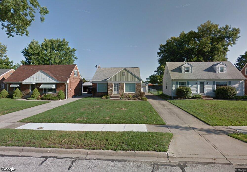
5945 Mayland Ave Cleveland, OH 44124
Estimated Value: $205,507 - $237,000
3
Beds
1
Bath
1,519
Sq Ft
$145/Sq Ft
Est. Value
About This Home
This home is located at 5945 Mayland Ave, Cleveland, OH 44124 and is currently estimated at $220,377, approximately $145 per square foot. 5945 Mayland Ave is a home located in Cuyahoga County with nearby schools including Mayfield High School, Corpus Christi Academy, and Gilmour Academy.
Ownership History
Date
Name
Owned For
Owner Type
Purchase Details
Closed on
Aug 19, 2021
Sold by
Farinacci Michael A
Bought by
Forsythe Beth
Current Estimated Value
Home Financials for this Owner
Home Financials are based on the most recent Mortgage that was taken out on this home.
Original Mortgage
$153,987
Outstanding Balance
$140,022
Interest Rate
2.9%
Mortgage Type
FHA
Estimated Equity
$80,355
Purchase Details
Closed on
Oct 20, 1976
Sold by
Farinacci Michael A and Farinacci L
Bought by
Farinacci Michael A
Purchase Details
Closed on
Jan 1, 1975
Bought by
Farinacci Michael A and Farinacci L
Create a Home Valuation Report for This Property
The Home Valuation Report is an in-depth analysis detailing your home's value as well as a comparison with similar homes in the area
Home Values in the Area
Average Home Value in this Area
Purchase History
| Date | Buyer | Sale Price | Title Company |
|---|---|---|---|
| Forsythe Beth | $157,000 | Everest Land Title | |
| Farinacci Michael A | -- | -- | |
| Farinacci Michael A | -- | -- |
Source: Public Records
Mortgage History
| Date | Status | Borrower | Loan Amount |
|---|---|---|---|
| Open | Forsythe Beth | $153,987 |
Source: Public Records
Tax History Compared to Growth
Tax History
| Year | Tax Paid | Tax Assessment Tax Assessment Total Assessment is a certain percentage of the fair market value that is determined by local assessors to be the total taxable value of land and additions on the property. | Land | Improvement |
|---|---|---|---|---|
| 2024 | $3,570 | $54,250 | $12,775 | $41,475 |
| 2023 | $3,621 | $50,930 | $11,620 | $39,310 |
| 2022 | $3,723 | $50,925 | $11,620 | $39,305 |
| 2021 | $3,073 | $50,930 | $11,620 | $39,310 |
| 2020 | $2,773 | $43,540 | $9,940 | $33,600 |
| 2019 | $2,688 | $124,400 | $28,400 | $96,000 |
| 2018 | $2,512 | $43,540 | $9,940 | $33,600 |
| 2017 | $2,580 | $40,110 | $9,520 | $30,590 |
| 2016 | $2,560 | $40,110 | $9,520 | $30,590 |
| 2015 | $2,314 | $40,110 | $9,520 | $30,590 |
| 2014 | $2,314 | $39,350 | $9,350 | $30,000 |
Source: Public Records
Map
Nearby Homes
- 5931 Mayberry Ave
- 1575 Lander Rd
- 1572 Crestwood Rd
- 1574 Hawthorne Dr
- 1430 Belrose Rd
- 1590 Longwood Dr
- 1379 Lander Rd
- 1363 Ranchland Dr
- 1337 Elmwood Rd
- 1737 Mayfair Blvd
- 1328 Elmwood Rd
- 1391 Iroquois Ave
- 5833 Ashcroft Dr
- 1763 Temple Ave
- 1542 Woodhurst Ave
- 6132 Westerham Rd
- 5688 Shawnee Dr
- 1593 Woodhurst Ave
- 1520 Fruitland Ave
- 1604 Fruitland Ave
- 5951 Mayland Ave
- 5941 Mayland Ave
- 5935 Mayland Ave
- 5955 Mayland Ave
- 5961 Mayland Ave
- 5965 Mayland Ave
- 5971 Mayland Ave
- 5944 Mayland Ave
- 5950 Mayland Ave
- 5940 Mayland Ave
- 5934 Mayland Ave
- 5954 Mayland Ave
- 5960 Mayland Ave
- 5975 Mayland Ave
- 5964 Mayland Ave
- 5935 Mayberry Ave
- 5970 Mayland Ave
- 5974 Mayland Ave
- 5938 Mayberry Ave
- 1560 Lander Rd