Estimated Value: $364,000 - $489,389
3
Beds
3
Baths
1,912
Sq Ft
$211/Sq Ft
Est. Value
About This Home
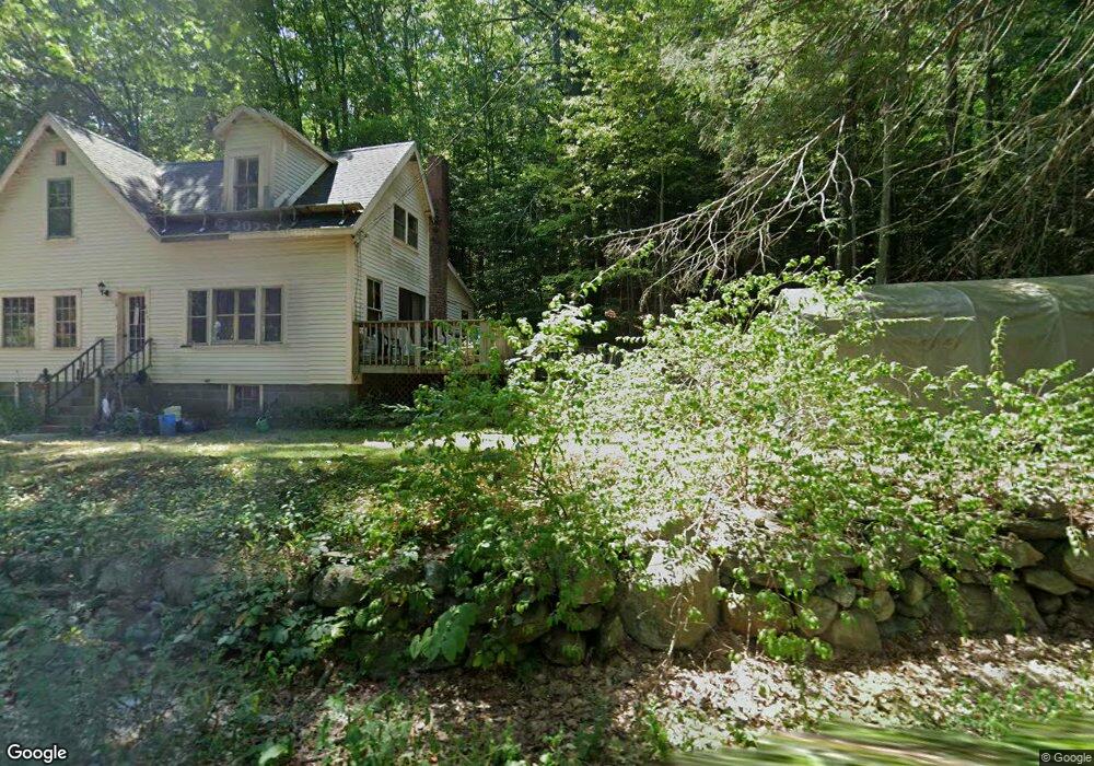
This home is located at 596 N Orange Rd, Athol, MA 01331 and is currently estimated at $403,597, approximately $211 per square foot. 596 N Orange Rd is a home located in Worcester County with nearby schools including Athol High School.
Create a Home Valuation Report for This Property
The Home Valuation Report is an in-depth analysis detailing your home's value as well as a comparison with similar homes in the area
Home Values in the Area
Average Home Value in this Area
Tax History
| Year | Tax Paid | Tax Assessment Tax Assessment Total Assessment is a certain percentage of the fair market value that is determined by local assessors to be the total taxable value of land and additions on the property. | Land | Improvement |
|---|---|---|---|---|
| 2025 | $5,280 | $415,400 | $127,500 | $287,900 |
| 2024 | $5,094 | $397,000 | $127,500 | $269,500 |
| 2023 | $5,139 | $366,000 | $111,800 | $254,200 |
| 2022 | $5,142 | $320,400 | $109,800 | $210,600 |
| 2021 | $4,713 | $266,900 | $100,100 | $166,800 |
| 2020 | $4,481 | $260,800 | $96,900 | $163,900 |
| 2019 | $70 | $248,000 | $91,900 | $156,100 |
| 2018 | $5,630 | $217,500 | $79,900 | $137,600 |
| 2017 | $4,319 | $211,700 | $79,900 | $131,800 |
| 2016 | $3,859 | $194,600 | $79,900 | $114,700 |
| 2015 | $3,703 | $194,600 | $79,900 | $114,700 |
| 2014 | $3,586 | $194,600 | $79,900 | $114,700 |
Source: Public Records
Map
Nearby Homes
- 568 N Orange Rd
- 620 N Orange Rd
- 536 N Orange Rd
- 642 N Orange Rd
- 935 N Orange Rd
- 553 N Orange Rd
- 603 N Orange Rd
- 523 N Orange Rd
- 485 N Orange Rd
- 0 Brooks Rd Unit 71063768
- 0 Brooks Rd
- 0 Brooks Rd Unit 70620110
- Lot 2 Brooks Rd
- 452 N Orange Rd
- 424 N Orange Rd
- 425 N Orange Rd
- 405 N Orange Rd
- 388 N Orange Rd
- 785 N Orange Rd
- 0 Lenox St Unit 70413794
Your Personal Tour Guide
Ask me questions while you tour the home.