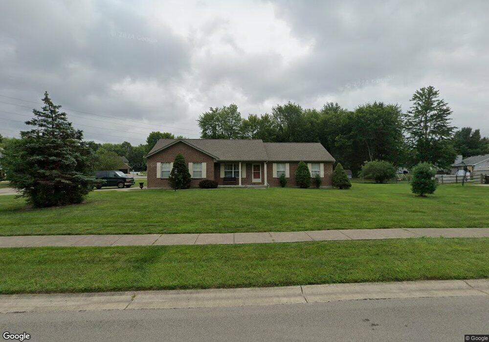
5978 Katey Way Milford, OH 45150
Estimated Value: $321,157 - $353,000
3
Beds
2
Baths
1,400
Sq Ft
$242/Sq Ft
Est. Value
About This Home
This home is located at 5978 Katey Way, Milford, OH 45150 and is currently estimated at $338,289, approximately $241 per square foot. 5978 Katey Way is a home located in Clermont County with nearby schools including Milford Senior High School, St. Mark's Lutheran School, and St. Andrew - St. Elizabeth Ann Seton School.
Ownership History
Date
Name
Owned For
Owner Type
Purchase Details
Closed on
Mar 22, 1999
Sold by
C L S K Inc
Bought by
First Baptist Church Of Milford
Current Estimated Value
Home Financials for this Owner
Home Financials are based on the most recent Mortgage that was taken out on this home.
Original Mortgage
$106,000
Interest Rate
6.42%
Mortgage Type
New Conventional
Purchase Details
Closed on
Nov 16, 1998
Sold by
Wynne Investments Inc
Bought by
Weber Mark F
Create a Home Valuation Report for This Property
The Home Valuation Report is an in-depth analysis detailing your home's value as well as a comparison with similar homes in the area
Home Values in the Area
Average Home Value in this Area
Purchase History
| Date | Buyer | Sale Price | Title Company |
|---|---|---|---|
| First Baptist Church Of Milford | $26,600 | -- | |
| Weber Mark F | $26,400 | -- |
Source: Public Records
Mortgage History
| Date | Status | Borrower | Loan Amount |
|---|---|---|---|
| Closed | First Baptist Church Of Milford | $106,000 |
Source: Public Records
Tax History Compared to Growth
Tax History
| Year | Tax Paid | Tax Assessment Tax Assessment Total Assessment is a certain percentage of the fair market value that is determined by local assessors to be the total taxable value of land and additions on the property. | Land | Improvement |
|---|---|---|---|---|
| 2024 | $4,615 | $98,390 | $14,810 | $83,580 |
| 2023 | $4,663 | $98,390 | $14,810 | $83,580 |
| 2022 | $4,348 | $69,830 | $10,500 | $59,330 |
| 2021 | $4,353 | $69,830 | $10,500 | $59,330 |
| 2020 | $4,177 | $69,830 | $10,500 | $59,330 |
| 2019 | $3,433 | $54,430 | $10,400 | $44,030 |
| 2018 | $3,434 | $54,430 | $10,400 | $44,030 |
| 2017 | $3,414 | $54,430 | $10,400 | $44,030 |
| 2016 | $3,434 | $49,490 | $9,450 | $40,040 |
| 2015 | $3,191 | $49,490 | $9,450 | $40,040 |
| 2014 | $3,191 | $49,490 | $9,450 | $40,040 |
| 2013 | $3,121 | $46,940 | $9,800 | $37,140 |
Source: Public Records
Map
Nearby Homes
- 6049 Delfair Ln
- 1382 Lela Ln
- 6034 Delfair Ln
- 1485 Foxtale Ct
- .6438 ac Buckwheat Rd
- .0288 ac Buckwheat Rd
- 5614 Water Mills Dr
- 5613 Water Mills Dr
- 5065 Cross Creek Ln
- 5852 Monassas Run Rd
- 5975 Buckwheat Rd
- 5818 Jeb Stuart Dr
- 1289 Woodville Pike
- 1399 Wade Rd
- 5942 Pinto Place
- 5778 Tall Oaks Dr
- 1430 Woodville Pike
- 1201 Sorrel Ln
- 6074 Deerfield Rd Unit 28
- 6074 Deerfield Rd Unit 317