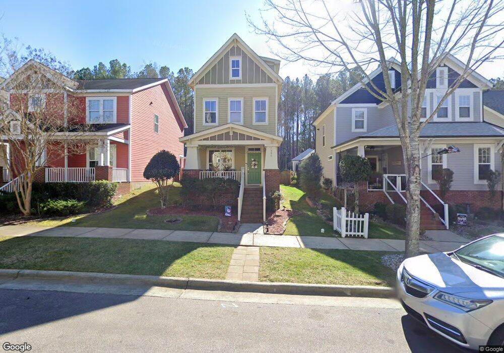
599 Millbrook Dr Pittsboro, NC 27312
Estimated Value: $394,105 - $449,000
3
Beds
3
Baths
2,015
Sq Ft
$210/Sq Ft
Est. Value
About This Home
This home is located at 599 Millbrook Dr, Pittsboro, NC 27312 and is currently estimated at $423,526, approximately $210 per square foot. 599 Millbrook Dr is a home located in Chatham County with nearby schools including Pittsboro Elementary School, George Moses Horton Middle School, and Northwood High.
Ownership History
Date
Name
Owned For
Owner Type
Purchase Details
Closed on
Jul 12, 2022
Sold by
Ansarijaberi Amirmansour A and Ansarijaberi Christine A
Bought by
Hall Kim Marie
Current Estimated Value
Home Financials for this Owner
Home Financials are based on the most recent Mortgage that was taken out on this home.
Original Mortgage
$350,000
Outstanding Balance
$329,540
Interest Rate
4.15%
Mortgage Type
New Conventional
Estimated Equity
$93,986
Purchase Details
Closed on
Apr 30, 2021
Sold by
Ansarijaberi Christine A and Ansarijaberi Amir M
Bought by
Ansarijaberi Christine Annette and Ansarijaberi Amirmansour
Home Financials for this Owner
Home Financials are based on the most recent Mortgage that was taken out on this home.
Original Mortgage
$183,000
Interest Rate
2.4%
Mortgage Type
New Conventional
Purchase Details
Closed on
Mar 21, 2019
Sold by
Isaacs Max Justin and Kirkpatrick Sarah Bennett
Bought by
Ansarijaberi Christine A and Ansarijaberi Amir M
Home Financials for this Owner
Home Financials are based on the most recent Mortgage that was taken out on this home.
Original Mortgage
$185,250
Interest Rate
4.4%
Mortgage Type
New Conventional
Purchase Details
Closed on
Jul 29, 2015
Sold by
Mulholland Steven Edward and Fay Susan Ivy
Bought by
Isaacs Max Justine and Kirkpatrick Sarah Bennett
Home Financials for this Owner
Home Financials are based on the most recent Mortgage that was taken out on this home.
Original Mortgage
$210,614
Interest Rate
3.62%
Mortgage Type
FHA
Purchase Details
Closed on
Aug 24, 2007
Sold by
Mid Atlantic Homes Llc
Bought by
Mulholland Steven and Fay Susan
Home Financials for this Owner
Home Financials are based on the most recent Mortgage that was taken out on this home.
Original Mortgage
$206,812
Interest Rate
6.65%
Mortgage Type
Purchase Money Mortgage
Create a Home Valuation Report for This Property
The Home Valuation Report is an in-depth analysis detailing your home's value as well as a comparison with similar homes in the area
Home Values in the Area
Average Home Value in this Area
Purchase History
| Date | Buyer | Sale Price | Title Company |
|---|---|---|---|
| Hall Kim Marie | $350,000 | Riggsbee Chad Wesley | |
| Hall Kim Marie | $350,000 | Riggsbee Chad Wesley | |
| Ansarijaberi Christine Annette | -- | None Available | |
| Ansarijaberi Christine Annette | -- | None Listed On Document | |
| Ansarijaberi Christine A | $247,000 | None Available | |
| Isaacs Max Justine | $214,500 | Attorney | |
| Mulholland Steven | $218,000 | None Available |
Source: Public Records
Mortgage History
| Date | Status | Borrower | Loan Amount |
|---|---|---|---|
| Open | Hall Kim Marie | $350,000 | |
| Closed | Hall Kim Marie | $350,000 | |
| Previous Owner | Ansarijaberi Christine Annette | $183,000 | |
| Previous Owner | Ansarijaberi Christine A | $185,250 | |
| Previous Owner | Isaacs Max Justine | $210,614 | |
| Previous Owner | Mulholland Steven | $206,812 |
Source: Public Records
Tax History Compared to Growth
Tax History
| Year | Tax Paid | Tax Assessment Tax Assessment Total Assessment is a certain percentage of the fair market value that is determined by local assessors to be the total taxable value of land and additions on the property. | Land | Improvement |
|---|---|---|---|---|
| 2025 | $4,191 | $379,450 | $63,250 | $316,200 |
| 2024 | $4,191 | $246,461 | $55,000 | $191,461 |
| 2023 | $3,106 | $246,461 | $55,000 | $191,461 |
| 2022 | $2,933 | $246,461 | $55,000 | $191,461 |
| 2021 | $2,907 | $246,461 | $55,000 | $191,461 |
| 2020 | $2,912 | $246,293 | $42,800 | $203,493 |
| 2019 | $2,902 | $246,293 | $42,800 | $203,493 |
| 2018 | $2,779 | $246,293 | $42,800 | $203,493 |
| 2017 | $2,779 | $246,293 | $42,800 | $203,493 |
| 2016 | $2,648 | $232,710 | $40,000 | $192,710 |
| 2015 | $2,621 | $232,710 | $40,000 | $192,710 |
| 2014 | -- | $232,710 | $40,000 | $192,710 |
| 2013 | -- | $232,710 | $40,000 | $192,710 |
Source: Public Records
Map
Nearby Homes
- 73 Freeman Dr
- 26 Danbury Ct
- 115 Circle City Way
- 7839 U S Highway 64
- 7837 U S Highway 64
- 7841 U S Highway 64
- 1157 Hillsboro St
- 57 Merriville Rd
- CHANLEY Plan at Corbett Landing
- CHAMPLAIN Plan at Corbett Landing
- ELMSDALE Plan at Corbett Landing
- SEBASTIAN Plan at Corbett Landing
- DRESDEN Plan at Corbett Landing
- BALLENTINE Plan at Corbett Landing
- PARKETTE Plan at Corbett Landing
- MARABELLE Plan at Corbett Landing
- KENDALL Plan at Corbett Landing
- THEODORE Plan at Corbett Landing
- BRANFORD Plan at Corbett Landing
- KAITLYN Plan at Corbett Landing
- 603 Millbrook Dr
- 595 Millbrook Dr
- 611 Millbrook Dr
- 587 Millbrook Dr
- 615 Millbrook Dr
- 583 Millbrook Dr
- 619 Millbrook Dr
- 577 Millbrook Dr
- 573 Millbrook Dr
- 569 Millbrook Dr
- 565 Millbrook Dr
- 561 Millbrook Dr
- 559 Millbrook Dr
- 644 Millbrook Dr
- 551 Millbrook Dr
- 26 Cobble Ridge Dr
- 549 Millbrook Dr
- 541 Millbrook Dr
- 34 Cobble Ridge Dr
- 708 Millbrook Dr