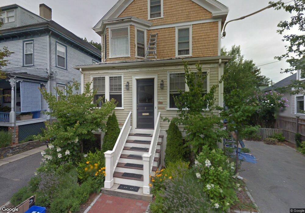
6 Brooks Ave Newport, RI 02840
Estimated Value: $864,000 - $1,141,000
4
Beds
2
Baths
1,940
Sq Ft
$489/Sq Ft
Est. Value
About This Home
This home is located at 6 Brooks Ave, Newport, RI 02840 and is currently estimated at $948,820, approximately $489 per square foot. 6 Brooks Ave is a home located in Newport County with nearby schools including Rogers High School, St Michael's Country Day School, and All Saints STEAM Academy.
Ownership History
Date
Name
Owned For
Owner Type
Purchase Details
Closed on
Sep 28, 2007
Sold by
Koconis Richard J
Bought by
Antone George and Antone Allen
Current Estimated Value
Purchase Details
Closed on
Sep 6, 2001
Sold by
Holmes James S and Holmes Gail S
Bought by
Koconis Richard J
Purchase Details
Closed on
Aug 8, 1997
Sold by
Rogers Martha Mary Est
Bought by
Holmes James S and Holmes Gail
Create a Home Valuation Report for This Property
The Home Valuation Report is an in-depth analysis detailing your home's value as well as a comparison with similar homes in the area
Home Values in the Area
Average Home Value in this Area
Purchase History
| Date | Buyer | Sale Price | Title Company |
|---|---|---|---|
| Antone George | $400,000 | -- | |
| Koconis Richard J | $200,000 | -- | |
| Holmes James S | $87,500 | -- |
Source: Public Records
Mortgage History
| Date | Status | Borrower | Loan Amount |
|---|---|---|---|
| Open | Holmes James S | $275,000 | |
| Closed | Holmes James S | $293,000 | |
| Closed | Holmes James S | $22,000 |
Source: Public Records
Tax History Compared to Growth
Tax History
| Year | Tax Paid | Tax Assessment Tax Assessment Total Assessment is a certain percentage of the fair market value that is determined by local assessors to be the total taxable value of land and additions on the property. | Land | Improvement |
|---|---|---|---|---|
| 2025 | $5,384 | $749,900 | $230,400 | $519,500 |
| 2024 | $5,175 | $742,400 | $230,400 | $512,000 |
| 2023 | $4,995 | $503,500 | $162,800 | $340,700 |
| 2022 | $4,839 | $503,500 | $162,800 | $340,700 |
| 2021 | $4,698 | $503,500 | $162,800 | $340,700 |
| 2020 | $4,013 | $390,400 | $135,300 | $255,100 |
| 2019 | $4,013 | $390,400 | $135,300 | $255,100 |
| 2018 | $3,717 | $372,100 | $135,300 | $236,800 |
| 2017 | $3,625 | $323,400 | $104,100 | $219,300 |
| 2016 | $3,535 | $323,400 | $104,100 | $219,300 |
| 2015 | $3,451 | $323,400 | $104,100 | $219,300 |
| 2014 | $3,793 | $314,500 | $104,100 | $210,400 |
Source: Public Records
Map
Nearby Homes
- 1 Arnold Ave
- 19 Princeton St Unit 21
- 5 Elliot Place
- 155 Evarts St
- 4 Newport Ave Unit B2
- 125 Van Zandt Ave Unit 307
- 17 Lincoln St
- 7 Sheffield Ave
- 1 Shangri-La Ln
- 198 Gibbs Ave
- 103 Champlin Place N
- 36 Kay Blvd
- 53 Warner St
- 3 Vicksburg Place
- 78 Rhode Island Ave Unit 6
- 78 Rhode Island Ave Unit 8
- 5 Bowser Ct
- 44 Warner St
- 26 Prescott Hall Rd
- 8 Champlin St
- 8 Brooks Ave
- 4 Brooks Ave
- 10 Brooks Ave
- 3 Ledyard St
- 5 1/2 Ledyard St
- 401 Broadway
- 401 Broadway Unit 2
- 401 Broadway Unit 1
- 11A Brooks Ave
- 5 Ledyard St
- 12 Brooks Ave
- 5 Brooks Ave
- 7 Brooks Ave
- 7 Ledyard St
- 409 Broadway
- 3 Brooks Ave
- 9 Brooks Ave
- 419 Broadway Unit 5
- 419 Broadway Unit 2
- 419 Broadway Unit 1