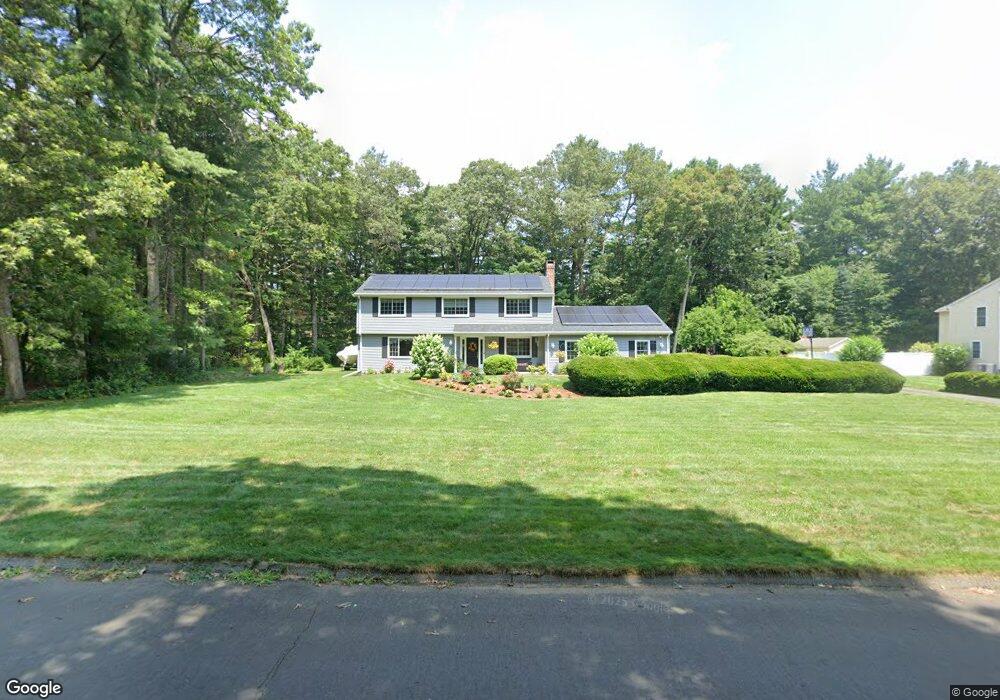
6 Fawn Dr Granby, CT 06035
Estimated Value: $575,000 - $640,000
4
Beds
3
Baths
2,924
Sq Ft
$210/Sq Ft
Est. Value
About This Home
This home is located at 6 Fawn Dr, Granby, CT 06035 and is currently estimated at $614,937, approximately $210 per square foot. 6 Fawn Dr is a home located in Hartford County with nearby schools including Kelly Lane Primary School, Granby Memorial Middle School, and Granby Memorial High School.
Ownership History
Date
Name
Owned For
Owner Type
Purchase Details
Closed on
May 22, 2018
Sold by
Noyes William A
Bought by
Noyes Natalie A
Current Estimated Value
Purchase Details
Closed on
Dec 3, 1993
Sold by
Manro James and Manro Sherry
Bought by
Noyes William and Noyes Natalie
Purchase Details
Closed on
Sep 2, 1992
Sold by
Padfield Nicholas and Padfield Diana
Bought by
Munro James and Munro Sherry
Purchase Details
Closed on
Sep 1, 1989
Sold by
Dilisio Ralph
Bought by
Padfield Nicholas
Create a Home Valuation Report for This Property
The Home Valuation Report is an in-depth analysis detailing your home's value as well as a comparison with similar homes in the area
Home Values in the Area
Average Home Value in this Area
Purchase History
| Date | Buyer | Sale Price | Title Company |
|---|---|---|---|
| Noyes Natalie A | -- | -- | |
| Noyes Natalie A | -- | -- | |
| Noyes William | $195,000 | -- | |
| Noyes William | $195,000 | -- | |
| Munro James | $182,000 | -- | |
| Munro James | $182,000 | -- | |
| Padfield Nicholas | $253,000 | -- |
Source: Public Records
Mortgage History
| Date | Status | Borrower | Loan Amount |
|---|---|---|---|
| Previous Owner | Padfield Nicholas | $250,000 | |
| Previous Owner | Padfield Nicholas | $116,500 | |
| Previous Owner | Padfield Nicholas | $20,000 |
Source: Public Records
Tax History Compared to Growth
Tax History
| Year | Tax Paid | Tax Assessment Tax Assessment Total Assessment is a certain percentage of the fair market value that is determined by local assessors to be the total taxable value of land and additions on the property. | Land | Improvement |
|---|---|---|---|---|
| 2025 | $10,800 | $315,700 | $59,570 | $256,130 |
| 2024 | $10,459 | $315,700 | $59,570 | $256,130 |
| 2023 | $10,068 | $315,700 | $59,570 | $256,130 |
| 2022 | $9,345 | $233,730 | $51,450 | $182,280 |
| 2021 | $9,258 | $233,730 | $51,450 | $182,280 |
| 2020 | $9,258 | $233,730 | $51,450 | $182,280 |
| 2019 | $9,258 | $233,730 | $51,450 | $182,280 |
| 2018 | $9,043 | $233,730 | $51,450 | $182,280 |
| 2017 | $8,849 | $233,240 | $51,450 | $181,790 |
| 2016 | $8,616 | $233,240 | $51,450 | $181,790 |
| 2015 | $8,448 | $233,240 | $51,450 | $181,790 |
| 2014 | $8,285 | $233,240 | $51,450 | $181,790 |
Source: Public Records
Map
Nearby Homes
- 27 Brettonwood Dr Unit 27
- 14 Brettonwood Dr
- 7 Knollwood Cir
- 16 Berkshire Way
- 14 Gordon St
- 21 Berkshire Way
- 51 Canton Rd
- 16 Whytewood Ln
- 31 Hunt Glen Dr
- 12 Gretel Ln
- 77 Hunt Glen Dr
- 45 Hoskins Rd
- 324 Firetown Rd
- 11 Mallard Cir
- 2 Quail Dr Unit 2
- 14 Teal Cir Unit 14
- 19 Simsbury Landing
- 5 Anja Dr
- 26 Winterset Ln
- 7R Stonewall Dr