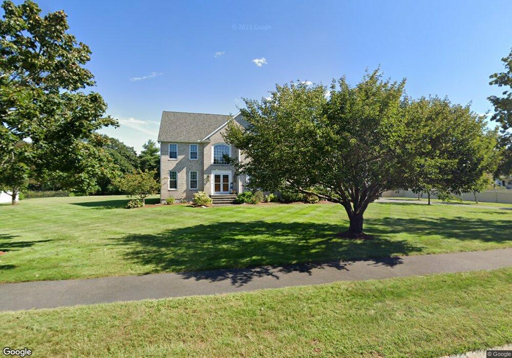
6 Russet Hill Rd Franklin, MA 02038
Estimated Value: $1,204,074 - $1,356,000
4
Beds
3
Baths
3,640
Sq Ft
$358/Sq Ft
Est. Value
About This Home
This home is located at 6 Russet Hill Rd, Franklin, MA 02038 and is currently estimated at $1,302,019, approximately $357 per square foot. 6 Russet Hill Rd is a home located in Norfolk County with nearby schools including Remington Middle School, Franklin High School, and Benjamin Franklin Classical Charter Public School.
Ownership History
Date
Name
Owned For
Owner Type
Purchase Details
Closed on
Nov 9, 2011
Sold by
Kinner Douglas R and Kinner Diane M
Bought by
Moreau Robert J and Moreau Susan M
Current Estimated Value
Home Financials for this Owner
Home Financials are based on the most recent Mortgage that was taken out on this home.
Original Mortgage
$465,750
Outstanding Balance
$317,443
Interest Rate
4.01%
Mortgage Type
Purchase Money Mortgage
Estimated Equity
$984,576
Purchase Details
Closed on
Dec 29, 1998
Sold by
Del Mar Dev Corp
Bought by
Kinner Douglas R and Kinner Diane M
Home Financials for this Owner
Home Financials are based on the most recent Mortgage that was taken out on this home.
Original Mortgage
$225,000
Interest Rate
6.89%
Mortgage Type
Purchase Money Mortgage
Create a Home Valuation Report for This Property
The Home Valuation Report is an in-depth analysis detailing your home's value as well as a comparison with similar homes in the area
Home Values in the Area
Average Home Value in this Area
Purchase History
| Date | Buyer | Sale Price | Title Company |
|---|---|---|---|
| Moreau Robert J | $630,000 | -- | |
| Kinner Douglas R | $450,000 | -- |
Source: Public Records
Mortgage History
| Date | Status | Borrower | Loan Amount |
|---|---|---|---|
| Open | Moreau Robert J | $465,750 | |
| Closed | Kinner Douglas R | $38,250 | |
| Closed | Kinner Douglas R | $96,300 | |
| Previous Owner | Kinner Douglas R | $225,000 |
Source: Public Records
Tax History Compared to Growth
Tax History
| Year | Tax Paid | Tax Assessment Tax Assessment Total Assessment is a certain percentage of the fair market value that is determined by local assessors to be the total taxable value of land and additions on the property. | Land | Improvement |
|---|---|---|---|---|
| 2025 | $11,002 | $946,800 | $382,600 | $564,200 |
| 2024 | $11,341 | $961,900 | $382,600 | $579,300 |
| 2023 | $10,428 | $828,900 | $325,000 | $503,900 |
| 2022 | $10,792 | $768,100 | $338,600 | $429,500 |
| 2021 | $10,009 | $683,200 | $284,000 | $399,200 |
| 2020 | $9,622 | $663,100 | $284,000 | $379,100 |
| 2019 | $9,674 | $659,900 | $281,100 | $378,800 |
| 2018 | $9,165 | $625,600 | $287,000 | $338,600 |
| 2017 | $9,251 | $634,500 | $295,900 | $338,600 |
| 2016 | $8,746 | $603,200 | $271,400 | $331,800 |
| 2015 | $8,211 | $553,300 | $221,500 | $331,800 |
| 2014 | $8,235 | $569,900 | $238,100 | $331,800 |
Source: Public Records
Map
Nearby Homes
- 70 Uncas Ave
- 64 Uncas Ave
- 1 Uncas Ave
- 82 Uncas Ave Unit 1
- 159 E Central St
- 55 Lawrence Dr Unit 55
- 29 Lawrence Dr
- 67 Milliken Ave Unit 22
- 40 Cross St
- 99 Summer St
- 90 E Central St Unit 103
- 90 E Central St Unit 106
- 90 E Central St Unit 304
- 90 E Central St Unit 202
- 90 E Central St Unit 105
- 90 E Central St Unit 301
- 32 Dale St
- 0 Fall Ln
- 6 Woodchester Rd
- 76 Dean Ave
- 10 Russet Hill Rd
- 2 Russet Hill Rd
- 10 Northern Spy Rd
- 11 Russet Hill Rd
- 14 Russet Hill Rd
- 14 Northern Spy Rd
- 6 Northern Spy Rd
- 7 Northern Spy Rd
- 15 Russet Hill Rd
- 18 Russet Hill Rd
- 15 Northern Spy Rd
- 18 Northern Spy Rd
- 26 Northern Spy Rd
- 18 Red Gate Ln
- 19 Russet Hill Rd
- 19 Northern Spy Rd
- 14 Red Gate Ln
- 10 Red Gate Ln
- 22 Russet Hill Rd
- 76 Eighteenth Dr Unit 53