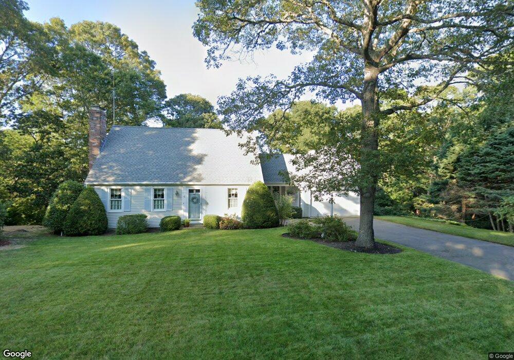
6 Sheltered Hollow Ln Yarmouth Port, MA 02675
Yarmouth Port NeighborhoodEstimated Value: $715,695 - $885,000
3
Beds
3
Baths
1,497
Sq Ft
$529/Sq Ft
Est. Value
About This Home
This home is located at 6 Sheltered Hollow Ln, Yarmouth Port, MA 02675 and is currently estimated at $792,174, approximately $529 per square foot. 6 Sheltered Hollow Ln is a home located in Barnstable County with nearby schools including Dennis-Yarmouth Regional High School.
Ownership History
Date
Name
Owned For
Owner Type
Purchase Details
Closed on
Oct 27, 2016
Sold by
Rideout Ft
Bought by
Rideout Robert O and Rideout Stephany R
Current Estimated Value
Purchase Details
Closed on
Jul 21, 2014
Sold by
Rideout Robert O and Rideout Stephany R
Bought by
Rideout Ft and Rideout Robert O
Purchase Details
Closed on
Jul 17, 1986
Bought by
Rideout Robert O
Create a Home Valuation Report for This Property
The Home Valuation Report is an in-depth analysis detailing your home's value as well as a comparison with similar homes in the area
Home Values in the Area
Average Home Value in this Area
Purchase History
| Date | Buyer | Sale Price | Title Company |
|---|---|---|---|
| Rideout Robert O | -- | -- | |
| Rideout Ft | -- | -- | |
| Rideout Robert O | -- | -- |
Source: Public Records
Mortgage History
| Date | Status | Borrower | Loan Amount |
|---|---|---|---|
| Previous Owner | Rideout Robert O | $160,000 | |
| Previous Owner | Rideout Robert O | $163,000 | |
| Previous Owner | Rideout Robert O | $81,000 | |
| Previous Owner | Rideout Robert O | $68,000 |
Source: Public Records
Tax History Compared to Growth
Tax History
| Year | Tax Paid | Tax Assessment Tax Assessment Total Assessment is a certain percentage of the fair market value that is determined by local assessors to be the total taxable value of land and additions on the property. | Land | Improvement |
|---|---|---|---|---|
| 2025 | $5,073 | $716,500 | $241,400 | $475,100 |
| 2024 | $4,694 | $636,100 | $209,900 | $426,200 |
| 2023 | $4,592 | $566,200 | $177,200 | $389,000 |
| 2022 | $4,150 | $452,100 | $158,600 | $293,500 |
| 2021 | $4,084 | $427,200 | $158,600 | $268,600 |
| 2020 | $3,922 | $392,200 | $156,100 | $236,100 |
| 2019 | $3,672 | $363,600 | $156,100 | $207,500 |
| 2018 | $3,647 | $354,400 | $146,900 | $207,500 |
| 2017 | $3,551 | $354,400 | $146,900 | $207,500 |
| 2016 | $3,537 | $354,400 | $146,900 | $207,500 |
| 2015 | $3,409 | $339,500 | $146,900 | $192,600 |
Source: Public Records
Map
Nearby Homes
- 64 Kates Path
- 42 John Hall Cartway Unit 42
- 50 John Hall Cartway
- 50 John Hall Cartway Unit 50
- 228 Kates Path
- 34 Kates Path
- 34 Kates Path Unit 34
- 17 Kates Path Unit A
- 51 Bray Farm Rd N
- 44 Stratford Ln
- 43 Canterbury Rd
- 7 Forest Gate Unit 7
- 30 W Woods
- 30 W Woods Cir Unit 30
- 59 Main St Unit 19-2
- 59 Route 6a Unit 29-4
- 25 Oak Glen Village Unit 25
- 25 Oak Glen
- 6 Nimble Hill Dr
- 2 Pine Grove
- 217 Sheltered Hollow Ln
- 15 Willie Bray Rd
- 77 Collingwood Dr
- 12 Sheltered Hollow Ln
- 42 Liverpool Dr
- 27 Sheltered Hollow128
- 67 Collingwood Dr
- 73 Bray Farm Rd S
- 85 Collingwood Dr
- 85 Collingwood Dr
- 17 Sheltered Hollow Ln
- 3 Willie Bray Rd
- 84 Collingwood Dr
- 72 Collingwood Dr
- 34 Liverpool Dr
- 61 Collingwood Dr
- 10 Willie Bray Rd
- 37 Liverpool Dr
- 27 Sheltered Hollow Ln
- 51 Bray Farm Rd S