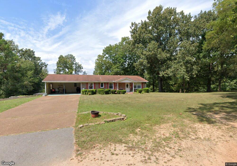
601 Reid Cir Lawrenceburg, TN 38464
Estimated Value: $191,705 - $257,000
--
Bed
1
Bath
1,344
Sq Ft
$166/Sq Ft
Est. Value
About This Home
This home is located at 601 Reid Cir, Lawrenceburg, TN 38464 and is currently estimated at $223,676, approximately $166 per square foot. 601 Reid Cir is a home with nearby schools including David Crockett Elementary School, Ingram Sowell Elementary School, and Lawrenceburg Public Elementary School.
Ownership History
Date
Name
Owned For
Owner Type
Purchase Details
Closed on
Sep 24, 2021
Sold by
Wilson Charlotte and Wilson Charlotte Rochelle
Bought by
Morton Jones Teeisha and Wilson Fami Charlotte Rochelle
Current Estimated Value
Purchase Details
Closed on
Nov 23, 2010
Sold by
Morton Jeffery D
Bought by
Morton Charlotte
Purchase Details
Closed on
Feb 27, 1990
Bought by
Morton Jeffery and Wife Charlotte
Purchase Details
Closed on
Nov 4, 1986
Bought by
Morton Jeffery and Wife Charlotte
Purchase Details
Closed on
Jan 1, 1981
Create a Home Valuation Report for This Property
The Home Valuation Report is an in-depth analysis detailing your home's value as well as a comparison with similar homes in the area
Home Values in the Area
Average Home Value in this Area
Purchase History
| Date | Buyer | Sale Price | Title Company |
|---|---|---|---|
| Morton Jones Teeisha | $52,523 | None Available | |
| Morton Charlotte | -- | -- | |
| Morton Jeffery | -- | -- | |
| Morton Jeffery | $54,000 | -- | |
| -- | -- | -- |
Source: Public Records
Tax History Compared to Growth
Tax History
| Year | Tax Paid | Tax Assessment Tax Assessment Total Assessment is a certain percentage of the fair market value that is determined by local assessors to be the total taxable value of land and additions on the property. | Land | Improvement |
|---|---|---|---|---|
| 2025 | -- | $37,150 | $0 | $0 |
| 2024 | -- | $37,150 | $6,250 | $30,900 |
| 2023 | $1,155 | $37,150 | $6,250 | $30,900 |
| 2022 | $1,155 | $37,150 | $6,250 | $30,900 |
| 2021 | $1,163 | $26,450 | $6,250 | $20,200 |
| 2020 | $1,163 | $26,450 | $6,250 | $20,200 |
| 2019 | $1,163 | $26,450 | $6,250 | $20,200 |
| 2018 | $1,163 | $26,450 | $6,250 | $20,200 |
| 2017 | $1,163 | $26,450 | $6,250 | $20,200 |
| 2016 | $1,163 | $26,450 | $6,250 | $20,200 |
| 2015 | $1,101 | $26,450 | $6,250 | $20,200 |
| 2014 | $1,109 | $26,650 | $6,250 | $20,400 |
Source: Public Records
Map
Nearby Homes
- 845 Gaither Ave
- 108 Buffalo Rd
- 234 Glenn Springs Rd
- 330 Cocke St
- 219 Waterloo St
- 113 W Taylor St
- 0 W Point Rd Unit RTC2942707
- 316 S Military Ave
- 426 Frank St
- 222 Groh St
- 213 Pulaski St
- 0 Stewart St
- 209 Frank St
- 109 Fairway Dr
- 310 May St
- 409 N Military Ave
- 511 S Locust Ave
- 411 Bumpas Rd
- 415 Bumpas Rd
- 0 Presnell Dr
- 1215 Marion Dr
- 1207 Marion Dr
- 1260 Marion Dr
- 1220 Marion Dr
- 1270 Marion Dr
- 1210 Marion Dr
- 594 Skyline Dr
- 1205 Marion Dr
- 585 Skyline Dr
- 603 Skyline Dr
- 1213 W Gaines St Unit A
- 1213 W Gaines St Unit B
- 1209 W Gaines St
- 1211 W Gaines St
- 1225 W Gaines St
- 1219 W Gaines St
- 50401 Old Waynesboro Hwy
- 1005 W Gaines St
- 604 Waterloo St
- 1003 W Gaines St