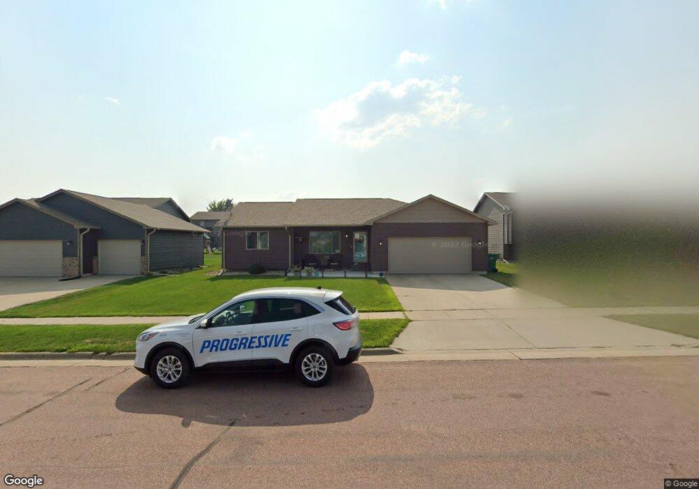
601 S Clearbrook Ave Sioux Falls, SD 57106
Northwest Sioux Falls NeighborhoodEstimated Value: $332,281 - $375,000
3
Beds
1
Bath
1,122
Sq Ft
$323/Sq Ft
Est. Value
About This Home
This home is located at 601 S Clearbrook Ave, Sioux Falls, SD 57106 and is currently estimated at $362,820, approximately $323 per square foot. 601 S Clearbrook Ave is a home located in Minnehaha County with nearby schools including Discovery Elementary School, Memorial Middle School, and Jefferson High School - 67.
Ownership History
Date
Name
Owned For
Owner Type
Purchase Details
Closed on
May 9, 2014
Bought by
Brunner Neil J and Brunner Samantha K
Current Estimated Value
Home Financials for this Owner
Home Financials are based on the most recent Mortgage that was taken out on this home.
Original Mortgage
$165,950
Outstanding Balance
$126,521
Interest Rate
4.34%
Mortgage Type
New Conventional
Estimated Equity
$236,299
Create a Home Valuation Report for This Property
The Home Valuation Report is an in-depth analysis detailing your home's value as well as a comparison with similar homes in the area
Home Values in the Area
Average Home Value in this Area
Purchase History
| Date | Buyer | Sale Price | Title Company |
|---|---|---|---|
| Brunner Neil J | $174,700 | Getty Abstract & Title Comp |
Source: Public Records
Mortgage History
| Date | Status | Borrower | Loan Amount |
|---|---|---|---|
| Open | Brunner Neil J | $165,950 |
Source: Public Records
Tax History Compared to Growth
Tax History
| Year | Tax Paid | Tax Assessment Tax Assessment Total Assessment is a certain percentage of the fair market value that is determined by local assessors to be the total taxable value of land and additions on the property. | Land | Improvement |
|---|---|---|---|---|
| 2024 | $4,195 | $309,800 | $30,300 | $279,500 |
| 2023 | $4,089 | $290,600 | $30,300 | $260,300 |
| 2022 | $4,034 | $270,600 | $30,300 | $240,300 |
| 2021 | $3,187 | $238,900 | $0 | $0 |
| 2020 | $3,187 | $203,900 | $0 | $0 |
| 2019 | $3,124 | $196,368 | $0 | $0 |
| 2018 | $2,880 | $192,172 | $0 | $0 |
| 2017 | $2,755 | $181,704 | $28,512 | $153,192 |
| 2016 | $2,755 | $173,711 | $28,512 | $145,199 |
| 2015 | $2,598 | $157,130 | $26,928 | $130,202 |
| 2014 | $938 | $157,130 | $26,928 | $130,202 |
Source: Public Records
Map
Nearby Homes
- 7805 W Noah Cir
- 7809 W Stoney Creek St
- 8008 W Browning St
- 604 S Mary Gene Ave
- 501 S Mary Gene Ave
- 1200 S Monticello Ave
- 7524 W Boysenberry St
- 8709 W Rathburn St
- 521 S Big Stone Ave
- 7517 W 15th St
- 1301 Hyannis Port Ln
- 7512 W Stoney Creek St
- 1209 S Discovery Ave
- 8605 W Bryggen Ct
- 1315 S President Ct
- 1501 S Wheatland Ave
- 8905 W 18th St
- 100 N Bryggen Place
- 102 N Bryggen Place
- 104 N Bryggen Place
- 533 S Clearbrook Ave
- 605 S Clearbrook Ave
- 529 S Clearbrook Ave
- 604 S Whitewood Ave
- 600 S Whitewood Ave
- 609 S Clearbrook Ave
- 608 S Whitewood Ave
- 532 S Whitewood Ave
- 604 S Clearbrook Ave
- 525 S Clearbrook Ave
- 612 S Whitewood Ave
- 600 S Clearbrook Ave
- 528 S Whitewood Ave
- 608 S Clearbrook Ave
- 521 S Clearbrook Ave
- 524 S Clearbrook Ave
- 524 S Whitewood Ave
- 601 S Whitewood Ave
- 7901 W Kelsey St
- 537 S Whitewood Ave